Cruising Tips & Notes
Manaus Brazil
Lake Canacari
Santarém Brazil |
|
Santarém is a city in the state of Pará, Brazil, located at the confluence of the Tapajós and Amazon rivers. It's known for its biodiversity, with nearby areas offering opportunities for ecotourism and wildlife observation. The city is also a transportation hub for riverboats traveling along the Amazon River.
Santarém, Brazil, has a rich history dating back to indigenous settlements long before Portuguese colonization. The Tapajós indigenous people were among the earliest inhabitants of the region. In the 17th century, Portuguese explorers arrived in the area, establishing settlements along the Amazon River.
Santarém was officially founded in 1661 by the Portuguese as a strategic outpost for trade and defense. Over the centuries, it grew into an important commercial center due to its location at the confluence of the Tapajós and Amazon rivers, facilitating trade between the interior of Brazil and the Atlantic coast.
During the rubber boom in the late 19th and early 20th centuries, Santarém experienced significant economic growth as rubber traders established operations in the region. However, when the rubber industry declined, the city's economy suffered.
Today, Santarém remains an important regional hub for trade, transportation, and tourism. Its cultural heritage, blend of indigenous and Portuguese influences, and proximity to the Amazon rainforest continue to attract visitors from around the world.
The things to see:
In Santarém, Brazil, there are several attractions worth visiting:
1. **Meeting of the Waters (Encontro das Águas)**: Witness the spectacular natural phenomenon where the clear blue waters of the Tapajós River meet the muddy waters of the Amazon River.
2. **São Francisco Xavier Church**: This 18th-century church is known for its stunning architecture and intricate Baroque interior decorations.
3. **Mercado Modelo**: Explore this lively market where you can find fresh fruits, vegetables, fish, handicrafts, and local delicacies.
4. **Port of Santarém**: Take a stroll along the waterfront and watch the bustling activity of boats coming and going along the Amazon River.
5. **Municipal Museum**: Learn about the history, culture, and biodiversity of the region through exhibits on indigenous peoples, rubber extraction, and local flora and fauna.
6. **Alter do Chão Beach**: Just a short boat ride from Santarém, Alter do Chão offers pristine white sand beaches and crystal-clear waters, perfect for swimming, sunbathing, and relaxation.
7. **Floresta Nacional do Tapajós**: Explore the Tapajós National Forest, a vast area of protected rainforest with hiking trails, wildlife viewing opportunities, and the chance to learn about sustainable forestry practices.
8. **Lago Verde**: Visit this picturesque lake surrounded by lush vegetation, ideal for kayaking, canoeing, and birdwatching.
The Amazon River
The Amazon River is the largest river by discharge volume of water in the world and the second longest river in length, after the Nile. It flows through South America, primarily through Brazil, Peru, and Colombia, and drains into the Atlantic Ocean. The Amazon Basin, which the river traverses, is home to the Amazon Rainforest, the largest tropical rainforest in the world.
The Amazon River has a length of approximately 6,575 kilometers (4,086 miles), although its exact length is debated due to various tributaries and changing water levels. It is a vital source of life for the diverse ecosystems within the Amazon Rainforest, providing water, nutrients, and transportation routes for countless plant and animal species
The Amazon Rainforest, often referred to as the "Lungs of the Earth," is the largest tropical rainforest in the world, spanning approximately 6.7 million square kilometers (2.7 million square miles) across nine countries in South America: Brazil, Peru, Colombia, Venezuela, Ecuador, Bolivia, Guyana, Suriname, and French Guiana.
The Amazon plays a crucial role in regulating the Earth's climate by absorbing carbon dioxide and releasing oxygen through photosynthesis. It also helps maintain global weather patterns and acts as a carbon sink, storing vast amounts of carbon that would otherwise contribute to climate change if released into the atmosphere
The river basin is also home to numerous indigenous communities who depend on the river for their livelihoods, transportation, and cultural practices. The indigenous peoples of the Amazon are diverse and comprise numerous ethnic groups, each with their own languages, cultures, and traditions. They have inhabited the Amazon rainforest for thousands of years, living off the land and maintaining a deep connection to nature. These communities rely on traditional hunting, fishing, gathering, and agriculture practices for sustenance.
These communities play a crucial role in advocating for the conservation of the Amazon rainforest, as they understand its ecological significance better than anyone else. Their knowledge of medicinal plants, sustainable resource management, and biodiversity conservation is invaluable for efforts to protect the Amazon and its inhabitants.
The Amazon Rainforest is renowned for its incredibly diverse and abundant animal life. It is estimated to be home to around 10% of the world's known species. Some of the iconic animals found in the Amazon include jaguars, anacondas, capybaras, sloths, poison dart frogs, macaws, toucans, and pink river dolphins
The rainforest's rich biodiversity extends to its rivers, where numerous species of fish, including the piranha, inhabit the murky waters. Additionally, the Amazon is a hotspot for bird species, with hundreds of colorful and unique birds flying among the treetops.
The interconnected ecosystem of the Amazon supports this incredible array of wildlife, with each species playing a vital role in maintaining the balance of the rainforest. However, like the indigenous communities, the animal life of the Amazon faces threats from deforestation, habitat loss, climate change, and illegal wildlife trafficking. Conservation efforts are crucial to protecting the Amazon's unique and irreplaceable biodiversity for future generations.
Natal Brazil
Natal is the capital city of the state of Rio Grande do Norte in northeastern Brazil. It’s known for its beautiful beaches, including Ponta Negra and Genipabu. The city is also famous for its massive sand dunes, which offer opportunities for dune buggy rides and sandboarding.
Natal has a rich cultural heritage, with influences from its indigenous, Portuguese, and African cultures. It’s also home to Forte dos Reis Magos, a historic fortress built in the 16th century.
Tourism is a major industry in Natal, attracting visitors from around the world to enjoy its natural beauty and vibrant culture.
Forte dos Reis Magos: The Forte dos Reis Magos, or the "Fortress of the Three Wise Men," is a historic military fortification located in Natal, Brazil. Built in the 16th century by the Portuguese, it is one of the oldest European fortresses in Brazil. The fort was strategically constructed at the mouth of the Potengi River to defend the city and its harbor from invasions.
The Forte dos Reis Magos features a unique star-shaped design, typical of Portuguese military architecture of the time. It has thick walls, cannons, and a central tower, which offers panoramic views of the surrounding area.
Today, the fortress is open to visitors as a museum and cultural site. Visitors can explore the interior of the fort, learn about its history through exhibits and displays, and enjoy the scenic views from the top of the tower. The Forte dos Reis Magos is not only a historical landmark but also a symbol of Natal's rich heritage and cultural significance.
The star-shaped fortress is the oldest and most important historical construction of Natal. It was built in 1598 to protect the coast against French pirates, and during the colonial period it was perhaps the most important of Brazil's defense barriers. It is located in the water, accessible using a pedestrian path from Praia do Forte. For about 300 years, it worked as military quarters, an administration office and prison, and for some time it was under Dutch control. The name of the fortress is due to the statues of the Biblical Magi in the entrance.
Pirangi Cashew Tree: At first glance, it seems as if you're looking at a forest- but this massive network of branches is actually just one cashew tree whose circumference measures 500 yards, producing over 60,000 nuts per year. It holds the Guinness Book of World Records spot for the biggest cashew tree in the world. Covering an area of nearly 8,000 square meters and roughly the size of 70 normal-sized cashew trees, it can be difficult to distinguish between the original tree trunk and the rest of the tree. Its exact origins are unknown, it is believed to have grown due to a genetic abnormality and is over 1,000 years old. If accompanied by a tour guide, visitors are allowed to pick cashews right from the tree. There is also a large observation deck 10 meters high that allows for a panoramic view of the tree.
Dunas Park is the second largest urban park in all of Brazil, offering a retreat into nature from the hustle and bustle of city life for both locals and visitors. Its scenic mixture of lush rainforest and tall, golden sand dunes creates a unique landscape to experience. It's a chance to see some of the region's natural environment.
Established in the late 1980s, the Museum of Sacred Art is to be found at the Igreja Santo Antonio (Church of St. Anthony), which was built in the 1760s and stands on the Rua Santa Antonio. Many valuable pieces are displayed here and relate to the Christian Catholic religion, such as 18th-century paintings.
Genipabu: Famous for its stunning sand dunes and freshwater lagoons, offering dune buggy rides, camel tours, and sandboarding.
Morro do Careca: Morro do Careca, or "Bald Hill" in English, is one of the most iconic landmarks in Natal, Brazil. It's a large sand dune located at the southern end of Ponta Negra Beach. Morro do Careca is known for its distinctive shape, resembling a bald head, hence its name.
Visitors to Natal often go to Morro do Careca to admire its beauty and take in the panoramic views of Ponta Negra Beach and the surrounding coastline. While it was once possible to climb the dune, access to the top has been restricted to protect the fragile ecosystem and prevent erosion. However, it remains a popular spot for photos and enjoying the beach below.
Morro do Careca is not only a natural attraction but also a symbol of Natal's beauty and uniqueness, drawing tourists from around the world to experience its splendor.
Praia da Pipa: Located about an hour's drive from Natal, this beach is known for its natural beauty, cliffs, and surfing spots.
Natal Dunes State Park: The Natal Dunes State Park (Parque Estadual das Dunas de Natal “Jornalista Luiz Maria Alves”) is a protected area located in the city of Natal, Rio Grande do Norte, Brazil. It’s the second-largest urban forest in Brazil and covers an area of approximately 1,172 hectares. The park is known for its vast sand dunes, diverse flora and fauna, and unique ecosystem, including mangroves, lagoons, and Atlantic Forest remnants.
The park is an important conservation area, preserving the natural habitat of several endangered species such as the red-necked rhea, the golden lion tamarin, and various species of birds, reptiles, and mammals. It also serves as a recreational area for locals and tourists, offering activities such as hiking, birdwatching, and ecological tours.
The Natal Dunes State Park plays a crucial role in the preservation of biodiversity in the region and provides opportunities for environmental education and sustainable tourism.
Alberto Maranhão Theatre: The Alberto Maranhão Theatre, located in Natal, Brazil, is a historic and cultural landmark. Built in the late 19th century, it is one of the oldest theaters in Brazil. The theater is known for its beautiful neoclassical architecture, with ornate details and a grand facade.
Inside, the theater features a majestic auditorium with balconies adorned with intricate decorations. The stage has hosted a variety of performances over the years, including plays, concerts, ballets, and operas.
The Alberto Maranhão Theatre is not only a venue for entertainment but also an important cultural institution in Natal, hosting events that celebrate the city's artistic heritage and showcasing local talent.
Visitors to Natal often include a visit to the Alberto Maranhão Theatre to admire its architecture, attend performances, or simply soak in the cultural atmosphere of this historic venue.
Recife Brazil
Recife is the capital city of the northeastern state of Pernambuco, Brazil. Known as the "Venice of Brazil" due to its numerous rivers, bridges, and canals, Recife is a vibrant and culturally rich city with a diverse mix of influences. Here are some key points about Recife:
Recife, the capital city of the state of Pernambuco in northeastern Brazil, has a rich and varied history.
The area where Recife now stands was originally inhabited by indigenous peoples. The Portuguese arrived in the early 16th century and established a settlement named "Pernambuco," which later became known as Recife. The city quickly grew into an important port and trading center due to its strategic location.
In the 17th century, Recife was occupied by the Dutch for a period of about 24 years (1630-1654) during the Dutch colonization of Brazil. This period left a significant cultural and architectural influence on the city, with many buildings and traditions reflecting Dutch heritage.
Recife played a vital role in the sugar industry during the colonial era, with vast plantations surrounding the city. The wealth generated from sugar production contributed to the development of Recife and attracted immigrants from Europe and Africa.
Like much of Brazil, Recife has a history of slavery, with thousands of Africans forcibly brought to the region to work on sugar plantations. This history is reflected in the city's culture, music, and traditions. Recife was also a center of resistance against slavery, with various revolts and uprisings occurring throughout its history.
In the 20th century, Recife has experienced rapid industrialization and urbanization, becoming one of Brazil's major economic centers. However, like many cities in Brazil, Recife also faces challenges such as poverty, inequality, and urban violence.
Places of interest:
Recife Antigo (Old Recife): Explore the historic heart of the city, which features colonial-era buildings, charming streets, and vibrant markets. Don't miss attractions like the Kahal Zur Israel Synagogue, the first synagogue in the Americas, and the Paço do Frevo cultural center, dedicated to the frevo dance and music.
Marco Zero Square: Located in Recife Antigo, Marco Zero Square is a bustling plaza and popular gathering spot. It's known for its large compass rose mosaic and serves as a cultural hub with frequent events, art installations, and performances.
Rua do Bom Jesus: This cobblestone street in Recife Antigo is lined with colorful colonial buildings, art galleries, cafes, and restaurants. It's a great place to stroll, shop for souvenirs, and experience the local culture.
Francisco Brennand Ceramic Workshop: Visit this fascinating art studio and museum, housed in a former ceramic tile factory. Explore the intricate ceramic sculptures and installations created by renowned Brazilian artist Francisco Brennand.
Recife's Bridges: Marvel at the unique architecture of Recife's bridges, including the iconic Maurício de Nassau Bridge and the historic Duarte Coelho Bridge, which connects Recife to the island of Recife Antigo.
Boa Viagem Beach: Relax on the sandy shores of Boa Viagem Beach, one of the most famous urban beaches in Brazil. Enjoy swimming, sunbathing, water sports, and beachfront dining along the lively boardwalk.
Instituto Ricardo Brennand: Discover the impressive art collection and medieval-style castle at the Instituto Ricardo Brennand. The museum showcases European and Brazilian art, weapons, armor, and decorative arts in a beautiful setting.
Casa da Cultura: Explore this former prison turned cultural center, which features shops selling handicrafts, art, and souvenirs. Admire the building's Moorish architecture and learn about its fascinating history.
Olinda: Take a short trip to the nearby colonial town of Olinda, a UNESCO World Heritage site known for its well-preserved historic center, colorful buildings, and lively carnival celebrations.
Parque das Esculturas Francisco Brennand: Located on the shores of the Capibaribe River, this sculpture park showcases the work of Brazilian artist Francisco Brennand in a beautiful outdoor setting.
These are just a few of the many attractions that Recife has to offer.
Buzios Brazil
Búzios is a thriving tourist destination that beautifully balances its rich history and cultural heritage with modern luxury and amenities.
The origins of Búzios can be traced back thousands of years to the indigenous Tamoio people who inhabited the Brazilian coastline.
The Tamoio is a name that holds historical significance in Brazil, particularly in the region surrounding Búzios. The Tamoio were an indigenous people who inhabited the coastal areas of present-day Rio de Janeiro and São Paulo states before the arrival of the Portuguese in the 16th century.
The Tamoio were known for their resistance against Portuguese colonization, engaging in conflicts and battles to defend their territory and way of life. They were skilled warriors and navigators, and their resistance posed significant challenges to Portuguese expansion efforts in Brazil.
These early inhabitants lived in harmony with the environment, fishing and cultivating the land. The Tamoio people were skilled sailors, using their vast knowledge of the ocean currents and winds to navigate the seas in their canoes.
The arrival of the Portuguese in the 16th century marked a significant turning point in Búzios' history. The town, then known as Armação dos Búzios, became a strategic location for the Portuguese due to its natural harbor, which facilitated trade and communication between their colonies in the Americas and Africa. The area was also abundant in resources such as whale oil, which was in high demand in Europe, and this led to the establishment of a prosperous whaling industry in Búzios.
Throughout the 17th and 18th centuries, Búzios played a significant role in the African slave trade. The town's deep-water port made it an ideal stopover point for slave ships, which would bring captured Africans to be sold in Brazil or transported to other colonies in the Americas. The legacy of the slave trade can still be seen in Búzios' Afro-Brazilian culture, including its music, dance, and cuisine.
By the 19th century, the whaling industry began to decline, and Búzios' economy shifted towards fishing and agriculture. The town's idyllic setting and peaceful atmosphere made it a popular escape for artists and intellectuals, who would visit to find inspiration and solitude.
Búzios' modern history began in the 1960s when French actress Brigitte Bardot arrived in the town while fleeing paparazzi in Rio de Janeiro. Her visit put Búzios on the map as a glamorous and exclusive destination, drawing attention from the international jet-set crowd. In the decades that followed, Búzios experienced rapid growth and development, with new hotels, restaurants, and other tourist infrastructure being built to accommodate the growing number of visitors.
The town's unique charm and allure continue to captivate visitors from around the world, making it one of Brazil's most sought-after coastal getaways.
Buzios offers over 20 stunning beaches, each with its own unique characteristics, ranging from secluded coves to lively stretches of sand. Water sports such as surfing, snorkeling, and scuba diving are popular activities in the area. The town itself boasts a vibrant dining scene, with numerous restaurants serving fresh seafood and international cuisine, as well as a bustling nightlife with bars, clubs, and live music venues.
In addition to its natural beauty and recreational opportunities, Buzios also has a rich cultural heritage, with historical sites, art galleries, and boutique shops to explore. It's a popular destination for both domestic and international travelers looking to experience the beauty and charm of the Brazilian coast.
In Búzios, Brazil, there are several notable places to see and attractions to visit. Here are some must-see places in Búzios:
1. Rua das Pedras: This bustling cobblestone street is the heart of downtown Búzios, lined with shops, boutiques, restaurants, bars, and art galleries. It's a vibrant hub of activity day and night.
2. Orla Bardot: Orla Bardot is a picturesque waterfront promenade located in Búzios, Brazil, named after the famous French actress Brigitte Bardot. Bardot visited Búzios in the 1960s, which helped bring international attention to the town and its beautiful beaches.
The Orla Bardot stretches along the coastline of the Armação Beach and features stunning views of the bay, rocky cliffs, and turquoise waters. The promenade is adorned with palm trees, benches, and landscaped gardens, creating a pleasant and inviting atmosphere for visitors.
One of the highlights of Orla Bardot is the bronze statue of Brigitte Bardot, which was erected in her honor in 1999. The statue depicts Bardot sitting on a suitcase, gazing out at the sea, and serves as a symbol of her connection to Búzios.
Orla Bardot is a popular destination for tourists and locals alike, offering a scenic spot for leisurely strolls, jogging, cycling, and enjoying sunsets. It's also lined with restaurants, cafes, bars, and shops, where visitors can dine, relax, and shop while taking in the beautiful views.
3. Beaches: Búzios is known for its beautiful beaches, each with its own unique character. Some popular beaches to visit include João Fernandes, Ferradura, Geribá, Praia da Tartaruga, and Praia da Azeda.
4. Church of Sant'Ana: The Church of Sant'Ana, also known as the Church of Saint Anne, is a historic Catholic church located in the neighborhood of Sant'Ana in Búzios, Brazil. The church is dedicated to Saint Anne, the mother of the Virgin Mary, and is an important religious and cultural landmark in the area.
The Church of Sant'Ana features charming colonial architecture with simple yet elegant design elements. Its whitewashed walls, wooden doors, and bell tower add to its quaint and picturesque appearance. Inside, visitors can admire religious artwork, statues, and ornate decorations that reflect the church's significance to the local community.
The church serves as a place of worship for parishioners and visitors alike, hosting regular religious services, ceremonies, and events throughout the year. It also attracts tourists interested in exploring Búzios' historical and cultural heritage.
Located in the scenic neighborhood of Sant'Ana, the Church of Sant'Ana offers visitors a glimpse into Búzios' colonial past and its rich religious traditions. It is a peaceful and serene sanctuary amidst the bustling activity of the surrounding town, providing a place for contemplation, prayer, and spiritual reflection.
5 Mirantes (Viewpoints): Mirante do Forno and Mirante do Pontal are two scenic viewpoints located in Búzios, Brazil, offering breathtaking panoramic views of the coastline and surrounding landscapes.
**Mirante do Forno:** Situated atop a hill overlooking Forno Beach (Praia do Forno), Mirante do Forno provides visitors with stunning vistas of the bay, the crystal-clear waters of the beach, and the lush greenery of the surrounding hillsides. It's an ideal spot for photography, especially during sunrise or sunset, when the sky is painted with vibrant colors. Accessible by a short hike or by car, Mirante do Forno offers a peaceful and serene setting away from the crowds, allowing visitors to relax and soak in the natural beauty of Búzios.
**Mirante do Pontal:** Located near the Pontal do Atalaia, Mirante do Pontal offers panoramic views of the coastline, the ocean, and the town of Búzios. From this viewpoint, visitors can admire the picturesque beaches, rocky cliffs, and turquoise waters that define the landscape of Búzios. Mirante do Pontal is a popular spot for sightseeing, photography, and enjoying the beauty of the Brazilian coast. It's accessible by car or by hiking along scenic trails, providing visitors with an opportunity to immerse themselves in nature and explore the area's natural beauty.
6. Ferradura Beach Lookout: The Ferradura Beach Lookout, known as Mirante da Ferradura in Portuguese, is a scenic viewpoint located in Búzios, Brazil. Situated atop a hill overlooking Ferradura Beach, this lookout offers breathtaking panoramic views of the bay, the surrounding coastline, and the lush greenery of the landscape.
You can access the Ferradura Beach Lookout by hiking or driving up the hill, where you will be rewarded with stunning vistas of the crystal-clear waters and golden sands of Ferradura Beach below. It’s an ideal spot for photography, enjoying sunsets, or simply taking in the natural beauty of Búzios.
The Ferradura Beach Lookout provides a peaceful and serene setting away from the crowds, allowing visitors to relax and immerse themselves in the tranquil atmosphere while admiring the beauty of the Brazilian coast. It’s a must-visit destination for nature lovers and anyone seeking a memorable experience in Búzios.
7. Rua das Pedras: Rua das Pedras, which translates to "Street of Stones," is the main thoroughfare and cultural hub of Búzios, Brazil. This charming cobblestone street stretches through downtown Búzios and is lined with a diverse array of shops, boutiques, restaurants, bars, and art galleries.
During the day, Rua das Pedras is a bustling hub of activity, with visitors and locals alike exploring the shops, browsing for souvenirs, and enjoying a leisurely meal at one of the many cafes or restaurants. You can find everything from local handicrafts and beachwear to designer clothing and jewelry.
In the evening, Rua das Pedras comes alive with a vibrant nightlife scene. The street is dotted with bars, clubs, and live music venues, where you can enjoy cocktails, dance to Brazilian rhythms, and socialize with friends against the backdrop of the lively atmosphere.
Rua das Pedras is not only a shopping and dining destination but also a cultural center, hosting events, festivals, and art exhibitions throughout the year. It's a must-visit destination for anyone exploring Búzios, offering a taste of the town's unique charm, vibrant energy, and rich cultural heritage.
8. Tucuns Trail: The Tucuns Trail is a scenic hiking trail located in Búzios, Brazil. This trail offers nature enthusiasts and outdoor adventurers the opportunity to explore the natural beauty of Búzios' coastline and surrounding landscapes on foot.
The Tucuns Trail winds through lush vegetation, rocky terrain, and coastal cliffs, providing hikers with stunning panoramic views of the Atlantic Ocean and the rugged coastline below. Along the way, hikers may encounter native flora and fauna, including tropical plants, birds, and small mammals.
The trail is moderately difficult, with some steep sections and uneven terrain, so it is recommended for hikers with a moderate level of fitness and proper hiking gear. It typically takes around 2-3 hours to complete the entire trail, depending on hiking speed and stops along the way.
The Tucuns Trail is a popular destination for nature lovers and outdoor enthusiasts seeking to escape the hustle and bustle of the town and immerse themselves in the tranquility of Búzios' natural landscapes. It offers a peaceful and scenic retreat for hikers looking to connect with nature and enjoy breathtaking views of the Brazilian coast.
9 Geribá Beach: One of Búzios' most popular beaches, Geribá Beach is known for its clear waters, golden sands, and excellent conditions for surfing and other water sports.
Rio de Janeiro Brazil
Rio de Janeiro, often called Rio, is a captivating city on Brazil's southeastern coast. The city is known for its dramatic geography, lush mountains, golden beaches, picturesque coastline, stunning landscape, diverse culture, and iconic Carnival. Rio's carnival, with its energetic samba dancers jiggling their hips, attracts thousands of tourists from around the world.
The city also boasts famous beaches, the Christ the Redeemer statue, and a rich music scene. It is a city of contrasts, where natural splendor, cultural richness, and societal challenges coexist.
Its allure lies in its unique combination of these elements, making it a destination that continues to captivate and inspire visitors from all corners of the globe.
Rio de Janeiro offers a wealth of attractions. Here are some must-see spots:
=
1. Christ the Redeemer: Christ the Redeemer is a colossal statue of Jesus Christ located in Rio de Janeiro, Brazil. It stands atop the Corcovado mountain and overlooks the city with outstretched arms. Designed by Brazilian engineer Heitor da Silva Costa and created by French sculptor Paul Landowski, the statue was completed in 1931. It's one of the New Seven Wonders of the World and is an iconic symbol of Christianity and Brazilian culture.
2. Sugarloaf Mountain is an iconic peak rising 396 meters above Rio de Janeiro, providing panoramic views of the city's stunning landscape. Accessible by a cable car journey, the summit offers breathtaking vistas of famous landmarks like Christ the Redeemer, Copacabana Beach, and the city skyline. Sugarloaf Mountain is a must-visit for those seeking a bird's eye perspective of Rio de Janeiro.
3. Copacabana Beach:Copacabana Beach is one of the most famous beaches in the world, located in Rio de Janeiro, Brazil. Stretching for about 4 kilometers along the Atlantic coast, it is known for its golden sand, vibrant atmosphere, and iconic boardwalk. Copacabana Beach attracts millions of visitors each year, offering a range of activities including swimming, sunbathing, beach sports, and people-watching. It's also a hub for nightlife with numerous bars, restaurants, and clubs nearby. The annual New Year's Eve celebration at Copacabana Beach, known as Réveillon, is one of the largest in the world, drawing millions of revelers to watch fireworks and enjoy live music.
4. Ipanema Beach: made famous by the song “The Girl from Ipanema” (Garota de Ipanema), a bossa nova jazz song written in 1962. It was composed by Antônio Carlos Jobim, with Portuguese lyrics by Vinícius de Moraes and English lyrics by Norman Gimbel. The song became internationally famous and has been recorded by numerous artists. It captures the essence of the neighborhood of Ipanema in Rio de Janeiro and has become an iconic representation of Brazilian music.
5. Jardim Botânico (Botanical Garden): Jardim Botânico, or the Rio de Janeiro Botanical Garden, is a renowned botanical garden located in the southern zone of Rio de Janeiro, Brazil. Founded in 1808 by King John VI of Portugal, it covers an area of about 140 hectares and features a diverse collection of flora from Brazil and around the world. The garden is home to over 6,500 species of plants, including rare and endangered species, as well as a variety of birds and other wildlife. You 1st can explore the garden's lush pathways, themed gardens, and iconic glasshouse, as well as learn about its scientific research and conservation efforts. Jardim Botânico is not only a popular tourist attraction but also serves as an important center for botanical study and education.
6. Tijuca National Park: Largest urban rainforest in the world, offering hiking trails, waterfalls, and diverse flora and fauna.
7. Maracanã Stadium: This historic football stadium, was home to legendary soccer matches.
8. Santa Teresa: Santa Teresa is a historic neighborhood located on a hill overlooking downtown Rio de Janeiro, Brazil. Known for its bohemian atmosphere, charming cobblestone streets, and colonial-era architecture, Santa Teresa has long been a haven for artists, musicians, and intellectuals. The neighborhood is famous for its colorful street art, lively cultural scene, and panoramic views of the city below. Visitors can explore Santa Teresa's art studios, boutique shops, and eclectic restaurants, as well as visit attractions like the Parque das Ruínas, a cultural center housed in the ruins of a mansion, and the iconic yellow tram, which traverses the neighborhood's steep streets. Santa Teresa offers a unique blend of history, creativity, and local charm that makes it a must-visit destination in Rio de Janeiro.
9. Lapa: Lapa is a vibrant neighborhood in the city of Rio de Janeiro, Brazil, known for its lively nightlife, historic architecture, and cultural attractions. The neighborhood is famous for the Arcos da Lapa, a set of impressive aqueduct arches that were originally constructed in the 18th century. Today, the Arcos da Lapa serves as a landmark and is often illuminated at night, adding to the area's charm.
Lapa is also renowned for its eclectic mix of bars, restaurants, and live music venues, making it a popular destination for locals and tourists alike. The neighborhood comes alive at night, with samba music filling the air and revelers spilling out onto the streets. Visitors can explore the bustling nightlife scene, sample traditional Brazilian cuisine, and dance the night away in one of Lapa's many clubs and bars.
During the day, Lapa offers a glimpse into Rio's history and culture, with attractions such as the Selarón Steps, a colorful mosaic staircase created by artist Jorge Selarón, and the Santa Teresa neighborhood, known for its bohemian atmosphere and artistic community.
10. Escadaria Selarón (Selaron Steps): Colorful mosaic staircase created by artist Jorge Selarón, featuring over 2000 tiles from around the world. by artist Jorge Selarón, the steps are adorned with over 2000 brightly colored tiles from more than 60 countries, creating a visually striking mosaic. As you ascend or descend the steps, each tile tells a unique story, making it a fascinating and Instagram-worthy spot. The staircase serves as both a piece of public art and a cultural attraction, reflecting the diversity and creativity of Rio de Janeiro.
These are just a few highlights, but Rio de Janeiro has much more to offer, including cultural institutions, culinary delights, and natural wonders
ILHABELA, SÃO SEBÃSTIAO, BRAZIL
Ilhabela, meaning Beautiful Island, is in the state of São Paulo. Ilhabela is famous for its gorgeous beaches, dense tropical forests and hundreds of waterfalls.
Ilhabela was discovered in 1502 by Américo Vespúcio, Ilhabela is located 210 miles south of Rio de Janeiro and 138 miles north of São Paulo.
Before Portugal colonized Brazil in 1500, an indigenous tribe called the Tupinambas, inhabited the island. They called the island 'Ciribai', which means tranquil place.
Set on a hill, Nossa Senhora D'Ajuda e Bom Sucesso Church is sometimes used as a gathering point for community activities, and the area in front of the church is frequently decorated with lots of little flags. It provides a nice viewpoint for looking at the town at the foot of the hill. At the bottom of the stairs leading to the church, there is an artwork of Christ on the cross.
You can enjoy a beautiful view of the North of the Island and the Ilhabela Yacht Club. Recently, a stylized Ilhabela sign was created to make travel photos even more fun.
Other things worth a visit,
1. Praia do Curral: A popular beach known for its clear waters, white sands, and lively atmosphere with beach bars and restaurants.
2. Parque Estadual de Ilhabela: This state park offers hiking trails through lush Atlantic rainforest, leading to beautiful viewpoints and waterfalls.
3. Vila (Centro Histórico): The historic center of Ilhabela is filled with charming colonial architecture, cobblestone streets, shops, and restaurants.
4. Praia de Castelhanos: Accessible by boat or a rugged road through the jungle, this secluded beach is surrounded by mountains and is great for surfing or simply relaxing.
5. Cachoeira da Toca: A stunning waterfall nestled in the forest, offering a refreshing swimming spot after a hike.
6. Museu Náutico: This maritime museum showcases the history of sailing in the region, with exhibits on indigenous canoes, shipwrecks, and the island’s connection to piracy.
7. Ilhabela Marina: A modern marina where visitors can admire luxurious yachts, dine at waterfront restaurants, or take boat tours around the island.
Punta Del Este Uruguay
Punta del Este is a city and resort on the Atlantic Coast in the Maldonado Department of southeastern Uruguay. Although the city has a year-round population of about 9200, the summer tourist boom adds to this a very large number of non-residents.
Punta del Este is also the name of the municipality to which the city belongs. The city is referred to as "the Monaco of the South", "The Pearl of the Atlantic", "the Hamptons of South America", and "the St. Tropez of South America", being also compared to Miami and Cannes.
Punta del Este is well known for organizing worldwide summits. Music and cinema festivals, whale sightseeing, international education, real estate, and haute cuisine are among the main attractions of the increasingly globalized city
Some points of interest in Punta del Este include:
1. La Mano (The Hand): A famous sculpture emerging from the sand on Brava Beach.
2. Casapueblo: A unique building and art gallery created by Uruguayan artist Carlos Páez Vilaró.
3. Gorriti Island: A picturesque island accessible by ferry, offering beaches, hiking trails, and a historic lighthouse.
4. Punta del Este Lighthouse: Located on the southern tip of the peninsula, offering panoramic views of the city and coastline.
5. Playa Brava and Playa Mansa: Two of the most popular beaches in Punta del Este, known for their golden sands and clear waters.
6. Puerto de Punta del Este: The city's marina, where visitors can admire luxury yachts and enjoy waterfront dining.
7. Sculpture Park: An outdoor art gallery featuring works by various renowned artists from around the world.
8. Casa Pueblo Museum: A museum inside the iconic Casapueblo building, showcasing the artwork of Carlos Páez Vilaró.
9. Shopping and Dining: Punta del Este offers numerous upscale shops, boutiques, and restaurants, particularly along Avenida Gorlero.
10. Enjoyment of the Nightlife: The city is famous for its lively nightlife scene, with numerous bars, clubs, and casinos to explore.
Buenos Aires
Buenos Aires is the capital and largest city of Argentina, known for its rich cultural heritage, vibrant nightlife, and European-inspired architecture. It's often called the "Paris of South America" due to its elegant boulevards, cafe culture, and cosmopolitan atmosphere. The city is home to iconic landmarks like the Obelisco, Plaza de Mayo, and La Recoleta Cemetery, where Eva Perón is buried. Tango, the passionate dance, originated in Buenos Aires and remains an integral part of its cultural identity.
Buenos Aires is full of interesting places to explore. Some key attractions include:
1. La Boca: Famous for its colorful Caminito street, tango performances, and Boca Juniors football stadium.
2. Recoleta: Known for its upscale neighborhoods, elegant architecture, and the Recoleta Cemetery, where Eva Perón is buried.
3. Palermo: A trendy district with parks, gardens, boutiques, cafes, and vibrant nightlife.
4. Plaza de Mayo: The city's main square surrounded by important buildings like the Casa Rosada (the Presidential Palace) and the Metropolitan Cathedral.
5. Puerto Madero: A waterfront area filled with restaurants, bars, and modern architecture.
6. Teatro Colón: One of the world's top opera houses, renowned for its acoustics and opulent design.
7. San Telmo: Known for its historic cobblestone streets, antique shops, and Sunday market at Plaza Dorrego.
8. Museo Nacional de Bellas Artes: Argentina's premier fine arts museum, featuring works by renowned artists like Goya, Rembrandt, and Van Gogh.
9. El Tigre: A river delta town located just outside Buenos Aires, offering boat tours, recreational activities, and a peaceful escape from the city.
10. Casa Rosada: The iconic pink-hued Presidential Palace, which houses the offices of the President of Argentina and is open for guided tours.
These are just a few highlights, but Buenos Aires has much more to offer, including cultural events, gastronomic experiences, and hidden gems waiting to be discovered.
Montevideo Uruguay
The nation's capital and home to nearly half of Uruguay's population is Montevideo. It is a vibrant, eclectic place with a rich cultural life. Stretching about twelve and a half miles from east to west, the city wears many faces, from its industrial port to the exclusive beachside suburb of Carrasco near the airport.
In the historic downtown business district, art deco and neoclassical buildings jostle for space alongside grimy, worn-out skyscrapers that appear airlifted from Havana or Ceauşescu's Romania, while to the southeast the shopping malls and modern high-rises of beach communities such as Punta Carretas and Pocitos bear more resemblance to those of Miami or Copacabana.
Music, theater and the arts are alive and well here, from elegant older theaters and cozy little tango bars to modern beachfront discos, and there's a strong international flavor, thanks to the many foreign cultural centers.
The pier has a clear green line on the floor which you can follow to the main gate of the port, located about six hundred feet away. Across the street from the port gate is the Mercado del Puerto, offering a large variety of souvenirs, handicrafts, ATMs, restaurants and a tourist information office. Right next to it there is a pedestrian street that leads through the Old City and reaches Independence Square. Additionally there is a taxi stop inside the port and another one at the main gate.
All in all it is a great visit
The Falklands
Stanley is the capital of the archipelago that is located off the coast of South America. Home to more than 740 islands, the Falkland Islands are one of the last untouched wildlife wonders of the world. Unspoiled beaches, islands and cliffs provide a natural safe-haven for hundreds of species that have made the Falklands their home.
Stanley, the capital of the Falkland's is characterized by its bright rooftops, red telephone boxes, shops, pubs, hotels and restaurants.
When you visit the museum, you step back in time at Cartmell Cottage, explore further afield into the surrounding hills and along the coastline or simply soak up the atmosphere of the town. A walk through the town will give you an idea of the traditional British charm that is preserved in this overseas territory of the United Kingdom.
Stanley also has a historic dockyard museum with galleries devoted to America natural history, the 1890, 1982 Falkland war and then and its Antarctica heritage.
By the waterfront the whale bone arch stands near the entrance of Christ Catholic Church, which was built in the late 1800s.
New Island is ruggedly beautiful and remote. New Island is located at the extreme west of the Falklands' archipelago. Since 1996 the island has been owned and run by The New Island Conservation Trust
Dramatic cliffs contrast with sheltered sandy bays and natural harbors. New Island has a large concentration and great diversity of wildlife. It is also one of the driest places with an annual rainfall of less than 16". Long used as a base for whaling, as a sheep farm and for occasional attempts to collect guano, New Island is considered by some to be one of the most beautiful islands in the Falklands archipelago. Over forty species of birds breed on New Island including four species of penguin. Thin-billed prions are a highlight along with Skuas, striated caracara and peregrine falcons. Marine mammals are also plentiful. Peale's dolphins breed in inshore waters, sea lions are often observed and fur seal colonies are found around the island. The highlight is a large colony of Rockhopper penguins and black-browed albatrosses on the cliffs opposite the settlement are on the western side of the island
The South Georgia Islands should be on your bucket list. They are a wildlife and photographer’s paradise.
A few of the pictures below are thanks to Seabourn..
A few of the pictures below are thanks to Seabourn..
South Georgia Islands
A23a The World’s Largest Iceberg
Unexpectedly, we sailed past the worlds largest iceberg, A23a, today.
A23a broke off from Antarctica in 1986 and almost immediately got stuck after a deep section of it grounded on the seafloor. Prior to it breaking off the area housed a Russian research base. Recently, it became dislodged and started drifting again.
The iceberg is about 1,312 feet thick, and almost 1,544 square miles in area, about three times the size of New York City.
The enormous iceberg has reached the tip of the Antarctic Peninsula, where a number of different currents converge. It's expected to drift through an area known as "iceberg alley," and its track will affect whichever part of the ocean and ocean floor it travels over.
Cuverville Island
We are in Cuverville island today. It is 32 degrees without the wind.
Operations were canceled at 12:00 pm because of the winds and swells.
We are now doing some cruising in 50kt (58 MPH) winds. The chairs are flying across the 7th Deck so the crew is tying everything down.
The Quest navigated, aided by radar in made the passage around Anvers Island so we could call upon the U.S. Palmer Research Station. The idea was to transport some vital spare parts to the station along with an unexpectedly early mail delivery and a gift of fresh fruits and vegetables that would otherwise be unseen by station personnel for another month. That was not to be as the rising tempest and approaching hurricane-like wind speeds, made the rendezvous impossible.
Yankee Harbor & Greenwich Island, South Shetland Islands.
Yankee Harbor is situated on the south coast of Greenwich Island in the South Shetland Islands, a region teeming with incredible biodiversity. With towering glaciers and majestic snow-covered peaks as a backdrop. For those who have never been to Antarctica, the scene is set for an unforgettable adventure.
Drakes Passage
- The Drake Passage is the body of water between South America's Cape Horn, Chile, Argentina and the South Shetland Islands of Antarctica. It connects the southwestern part of the Atlantic Ocean (Scotia Sea) with the southeastern part of the Pacific Ocean and extends into the Southern Ocean. The passage is named after the 16th-century English explorer and privateer Sir Francis Drake.
The Drake Passage is considered one of the most treacherous voyages for ships to make. Currents at its latitude meet no resistance from any landmass, and waves top 40 feet, giving it a reputation for being "the most powerful convergence of seas".
As the Drake Passage is the narrowest passage (choke point) around Antarctica, its existence and shape strongly influence the circulation of water around Antarctica and the global oceanic circulation, as well as the global climate. The bathymetry of the Drake Passage plays an important role in the global mixing of oceanic water.
The Chilean Fjords
Chile’s expansive fjords stretch all the way to the country’s southernmost tip, a scarcely explored region that really is the end of the line.
The earliest known inhabitants of the fjords and channels were, from north to south, the Chono, Alacalufe and Yaghan, all of whom shared a life style as canoe-faring hunter-gatherers. In the opinion of Robert FitzRoy who saw the Chono people in the 1830s, they were more muscular and with a more beautiful appearance when compared to canoe-farers further south.
They also shared physical traits such as being of low stature, long-headed and having a "low face" Despite physical similarities their languages were completely different.
It is often assumed that Chonos were the people who left behind most of the abundant Pre-Historic shell middens.A midden is an old dump for domestic waste which may consist of animal bone, human excrement, botanical material, mollusc shells, potsherds, lithics, and other artifacts and ecofacts associated with past human occupation.
Guaitecas Archipelago made up the southern limit of Pre-Hispanic agriculture as noted by the mention of the cultivation of potatoes by a Spanish expedition in 1557.
Both Chonos and Alacalufes used an indigenous evergreen, as firewood as well as wood for rows, boats and houses.
After entering Peel Fjord from the Sarmiento Channel, the eastern side offers entry to three other fjords. Two of these, Amalia Fjord and Asia Fjord, end in massive walls of ice slowly flowing down from the immense Southern Patagonian Ice Field. At the heart of Bernardo O'Higgings National Park, the largest protected area in Chile, we saw the El Brujo Glacier. Located at the end of the Asia Fjord, this huge wall of ice sculpted by the wind is fascinating and impressive. This magical, natural and grandiose décor that changes as the light plays upon it will be an unforgettable sight.
To the south of the glacier is a narrow channel which provides a unique geography, is unfortunately the home of a wrecked passenger ship. The good news is that all aboard were saved.
Castro Chile
Castro is the capital of Chiloé Island in Chile. The city is located on Estero de Castro on the eastern coast of central Chiloé Island. Castro is Chile's third oldest city in continuous existence.
Castro is famous for its palafitos, traditional wooden stilt houses which were common in many places in Chiloé. Some of them are preserved in the town district Gamboa in the west of the town in a bay called Fiordo de Castro.
Boats are built in a traditional way in a wharf between the town center and Gamboa. In Gamboa there is an interesting wooden chapel as well. is easy to recognize due to its colorful "palafitos" (houses built on stilts) and these days very popular for their arts and crafts shops and seafood restaurants.
The island is the extension of Chile's coastal mountain range, from which it is separated by the Chacao Strait. The nearest of the myriad islands and archipelagoes to its south are the Guaitecas Islands, which lie across the Guafo Gulf. To the east, 30 miles across the Corcovado Gulf, is the mainland; to the west is the Pacific Ocean.
During colonial times, Castro was the site of a small fort system made up of Fuerte de Castro, Batería marítima de Castro and Fortín de Tauco. The last fortification is not located in Castro proper but a few kilometers south along Estero de Castro. Only the remnants of Fortín de Tauco can be found at present, there are no known vestiges of the two fortifications that were located in what is now the city of Castro.
Situated in an area of heavy rainfall, the densely forested island is little developed. Spaniards captured it from Indians in 1567 and controlled it until 1826, making it the last foothold in Chile of royalist resistance during the struggle for Chilean independence. Most of the island's inhabitants (Chilotes) live in one of Chiloé's port cities,
Ancud or Castro the island's oldest city, was founded 1567. Both cities are connected by road. Chilotes are engaged in agriculture (potatoes, grains), livestock raising (sheep, cattle), fishing, and lumbering. Historically, a large number of Chilotes have migrated to the mainland or to Southern Argentina.
Castro also has a salmon and shell fish industry that serves the world. These can be seen cruising out to the Pacific Ocean.
Puerto Montt Chile
Puerto Montt is a port city and commune in southern Chile, located at the northern end of the Reloncaví Sound in the Llanquihue Province, Los Lagos Region,656 miles to the south of the capital, Santiago.
Founded as late as 1853 during the German colonization of southern Chile, Puerto Montt soon outgrew older neighboring cities due to its strategic position at the southern end of the Chilean Central Valley being a gateway city into Chiloé Archipelago, Llanquihue and Nahuel Huapi lakes and Western Patagonia.
Puerto Montt has gained renown and grown significantly due to the rise of Chile as the second largest salmon producer of the world during the 1990s and 2000s.
The city is configured as the hub of one of the largest salmon aquaculture industries in the world. Hatcheries, fisheries and packing plants are mostly located south of Puerto Montt. Fresh salmon is flown daily to world markets and frozen salmon is shipped by ocean to all destinations. The tremendous growth of the region, mainly due to the salmon industry, but also due to rapid expansion of forestry, cattle, and tourism, has proven the massive economic potential of Puerto Montt and its surrounding area.
The city's cultural heritage mixes elements of Chiloé culture with German heritage. The chiloe culture is a mixing of Huilliche, Spanish and Chono influences in centuries of isolation without much contact with the rest of Chile or the Western World.
The Solis Restaurant
As you already know, the contract with Thomas Keller ended and Seabourn replaced it with the introduction of Solis.
When reading these comments keep in mind neither Dee nor I are foodies.
We really liked the Grill so we looked at the Solis concept with a bit of skepticism, after all a Mediterranean theme just didn’t hit our fancy.
Boy were we wrong. The food and service were 15 on a scale of 10.
They have a speciality cocktail menu that fills a page, and the menu itself is quite large and it changes daily.
Food that didn’t sound good to us was great. They brought breadsticks with two dips that really didn’t sound that good. Well that was wrong assumption, they were great. Then they brought a croissant made into a roll. It was really really good,
Dee had a salad whose dressing just didn’t sound that great but worth a try. They made it at the table. It was phenomenal. It was so good, much to her chagrin, I helped her eat it.
My calamari was excellent as well, beautifully cooked and presented as well.
The waiter suggested the streak for two. The darn thing is brought to your table when cooked for you to view and approve. It was huge as the picture above shows. Then back it went to the carving station. When it returned it looked more manageable. It really wasn’t as neither of us finished our plates. Then there was the scalloped potatoes, so good.
For desert, which we didn’t need, fell on both sides of the scale. I had the Tiramisu which was made at the table as well. In my opinion it was OK. Dee on the other hand had some ice cream desert the was huge and beautifully presented. Being a supportive partner I helped her with that as well.
All in all these two non foodies loved every bite of our dinner. We have two more reservations in the next three weeks and we will let you know how we make it through.
Santiago Chile
Santiago de Chile, is the capital and largest city of Chile and one of the largest cities in the Americas. It is located in the country's central valley and is the center of the Santiago Metropolitan Region, which has a population of 7 million, representing 40% of Chile's total population.
Founded in 1541 by the Spanish conquistador Pedro de Valdivia, Santiago has served as the capital city of Chile since colonial times. The city has a downtown core of 19th-century neoclassical architecture and winding side-streets featuring a mix of art deco, neo-gothic, and other styles. Santiago's cityscape is defined by several stand-alone hills and the fast-flowing Mapocho River, which is lined by parks such as Parque Forestal and Balmaceda Park. The Andes Mountains can be seen from most parts of the city and unforeseen contribute to a smog problem, particularly during winter, due to the lack of rain.
The outskirts of the city are surrounded by vineyards, and Santiago is within an hour's drive of both the mountains and the Pacific Ocean.
As fate would have it we were leave Santiago at about 5:00 PM. Just off the port’s entrance were high winds. Even though this ship is designed for that environment the port authority said no. Two and a half hours later we pulled away from the doc and headed out to a choppy sea.
Antofagasta Chile
Antofagasta is a port city in northern Chile, about 700 mi north of Santiago. It is the capital of Antofagasta Province and Antofagasta Region.
After the Spanish American wars of independence, A Bolivian town until 1879, Antofagasta occupies a terrace at the base of bleak, arid coastal mountains. Antofagasta was captured by Chile on February 14, 1879, triggering the War of the Pacific (1879–83). Chilean sovereignty was officially recognized by Bolivia under the terms of the 1904 Treaty of Peace and Friendship.
Its early growth resulted from the nitrate boom that began in 1866 and from the Caracoles silver discovery of 1870, at which time Antofagasta’s name became official. Supplying the mines and exporting copper and sulfur continue as its major functions. Besides foundries and refineries, ore-concentration and sulfuric acid manufacturing facilities, there are local food and beverage processing and fish-meal production industries. There is also a shipyard for trawlers.
The city of Antofagasta is closely linked to mining activity, being a major mining area of the country. The last decade has seen a steady growth in the areas of construction, retail, hotel accommodations, population growth, and remarkable skyline development.
La Portada Natural Monument is a peculiar rocky formation which resembles a white arch. Set in an area where strong waves crash into the cliffs, behold the power of nature reflected in these stone walls, which are actually mountain tops of the Coastal Mountain Range.
Walk along the coastline towards Tocopilla to reach the natural monument that is over 120 feet high. On the way, it makes a great photograph.
IQUIQUE, CHILE
Iquique is a coastal city in northern Chile, to the west of the Atacama Desert. A prosperous saltpeter mining town in the 19th century, today it's a popular holiday destination with a tax-free port area.
Although the city was founded in the 16th century, there is evidence of habitation in the area by the Chango people as early as 7,000 BC. The Changos were not a distinct tribe or ethnic group; rather, the term is used to refer to many disparate communities of indigenous people living along the northern Chilean and southern Peruvian coast in the Pre-Columbian era. The term "chango" was first documented in the 17th century by Spanish conquistadors who perceived little in the way of cultural difference between the local native communities. Therefore, "chango" describes a loose grouping of maritime peoples who shared a similar way of life rather than a common history or ethnicity. In general, Chango culture is considered more primitive than neighbouring cultures such as the Atacameños.Chango culture is part of the Chinchorro tradition. The Chinchorro were hunter-fisher-gatherers with a particular reliance on the sea, who lived along the Atacama coast from at least the 8th century BC. They are of special interest to modern anthropologists due to their practice of mummifying the dead.
During the colonial times, Iquique was part of the Viceroyalty of Peru as much of South America was at the time, and remained part of Peruvian territory until the end of the 19th century.
Iquique's early development was due in large part to the discovery of mineral riches, particularly the presence of large deposits of sodium nitrate in the Atacama Desert (then part of Peruvian territory).
As an FYI, the Atacama Desert is the driest nonpolar desert in the world, and the second driest overall, behind some specific spots within the McMurdo Dry Valleys. It is the only hot true desert to receive less precipitation than polar deserts, and the largest fog desert in the world. The area has been used as an experimentation site for Mars expedition simulations due to its similarities to the Martian environment.
MATARANI, PERU
Peruvians joke that you need a different passport to enter Peru's second-largest city. One-tenth the size of Lima, is its equivalent in terms of, historical significance and self-awareness.
Guarded by three dramatic volcanoes, the city's setting makes an obvious launchpad for trekking, rafting and visiting the Cañón del Colca.
The Unesco World Heritage-listed the city center as dressed in baroque buildings carved from sillar (white volcanic rock) stone, giving Arequipa the nickname 'Ciudad Blanca' (White City). Its centerpiece, a majestic cathedral with the ethereal El Misti rising behind it, is worth a visit alone.
The still-functioning Santa Catalina Monastery, constructed in 1579, is like a city within a city. You can walk through this incredible place, visiting its many cloisters, gardens, chapels, and kitchens, and really get a glimpse into what life was like for the nuns who called this place home.
The \ was constructed in the 19th century. This set of arches was made from sillar, and you will find an inscription in each arch telling a bit of history of each department in the country. This place also offers an incredible panoramic view of the city and the Misti Volcano in the distance.
Pisco, Peru
Pisco (Quechua: Pisqu) is a city located in the Department of Ica of Peru, the capital of the Pisco Province. Pisco originally prospered because of its nearby vineyards and it became noted for its grape brandy or pisco which was exported from this port.
Pisco has an estimated population of 182,269. The city was highly populated until 1685, when it was pillaged by English pirates. The city suffered again in 1687 because of an earthquake.
Vines are abundant, despite the sandy and infertile terrain; they grow in many places because of the moisture from inside the earth and provide Lima with its wines and grape concentrates that run along the various mountain provinces extending to Panama and Guayaquil.
Pisco was attacked by the pirates Clerck and David; in addition, in 1687 it was destroyed by an earthquake, which caused a tsunami to follow, destroying the city further. Viceroy Melchor Antonio Portocarrero Lazo de la Vega then moved it to its current location, reestablishing it in 1689 as "Villa de Nuestra Señora de la Concordia de Pisco.
In 1947, the historian pisqueño Mamerto Castillo Negrón said that Pisco had received two additions in its history that granted it honors worthy of merit, the first being "Villa and Puerto de la Independencia" and second, its recognition as a provincial capital.
Pisco is a Quechua word meaning "bird".[3] The area is often visited because of the concentration of marine animals and birds at the Paracas National Reserve, or the Peruvian Galápagos.[19] At the reserve there are the Islas Ballestas, a collection of islands which are off limits to people, but boat tours can get close to. The Chincha Islands are also near its coast. Many bird species can be seen in the islands including pelicans, penguins, cormorants, Peruvian boobies, and Inca terns, as well as sea lions, turtles, dolphins, and whales.
Another attraction in the area is El Candelabro, a giant lamp dug in the rough sand in the method used by the creators of the Nazca Lines.
One of the major ancient civilizations in Peru, the Paracas culture, flourished in the area where Pisco sits. Due to its ease of access and its crossroads to the Andes, the Spaniards may have considered making Pisco the capital, before they decided on Lima.
In the city is the Plaza de Armas, where people buy tejas, small sweets made from pecans and assorted dried fruits. Many different building that surround the Plaza are the statue of José de San Martín, the mansion he lived in, and the Municipal Palace. Other building in the city is the heavily baroque Iglesia de la Compañía, begun in 1689, features a superb carved pulpit and gold-leaf altarpiece.
Near the town, just off the road to Ayacucho, lies the large, well-preserved Inca site of Tambo Colorado
Lima Peru
Callao is a seaside city on the Pacific Ocean in the Lima metropolitan area. Callao is Peru's chief seaport and home to its main airport, Jorge Chávez International Airport.
Founded in 1537 by the Spanish, the city has a long naval history as one of the main ports in Latin America and the Pacific, as it was one of vital Spanish towns during the colonial era.
Lima is the capital of Peru” The city is considered the political, cultural, financial and commercial center of Peru
The name for Lima comes from the name of the main river that runs through it, the Rimac, which in the quechua language means “to talk” or the talking river. As with most Europeans, the Spanish weren't very good at learning the American languages and mispronounced it as Lima.
Home to universities, institutions and schools, Lima has the highest concentration of institutions of higher learning on the continent. Lima is home to the oldest continuously operating higher learning institution in the New World, National University of San Marcos, founded in 1551.
The Lima Metropolitan Cathedral and the Basilica of San Francisco stand out, which are said to be linked by the underground passageways of their catacombs.
The Sanctuary and Monastery of Las Nazarenas also stands out, a place of pilgrimage to the Señor de los Milagros (Lord of the Miracles), whose festivities in the month of October constitute the most important religious manifestation of Lima and of all Peruvians.
Some sections of the Colonial Walls of Lima can still be seen: such is the case of the Bastion Santa Lucía, remains of the old Spanish fortification built by Viceroy Melchor de Navarra y Rocafull around the city center, whose location adjoins the limit of Barrios Altos and El Agustino.
The pyramids, or Huacas, in Lima reflect in one way the lack of rain in the area. They were constructed of clay bricks approximately 1,500 years ago and they still stand today. If it were a wet climate they would have melted away.
Places of interest in Callo include:
The Real Felipe Fortress was built to defend the main Peruvian port and the city of Lima from pirates and corsairs during colonial times. The fortress was pivotal in the 1866 naval battle between a Spanish fleet sent to South America to "reclaim" its colonies and land batteries in the coast of Peru. The Real Felipe Fortress is currently the Peruvian Army Museum, displaying historical uniforms, weapons and other military paraphernalia.
La Punta is one of the six districts that make up the Constitutional Province of Callao. It is located on a peninsula in the western part of the province and it is almost entirely surrounded by Pacific Ocean, except on its eastern side, where it is bordered by Callao downtown. The first inhabitants of La Punta were fishermen. Before and during the Inca era and at the beginning of Colonial times a small fishing village called Piti-Piti, existed in La Punta. But the area didn't have a proper name at this time and was always referred to as "Punta del Callao". (the point/end of Callao). Like the whole Callao area, La Punta was also destroyed by the devastating earthquake and the tidal wave of 1746. La Punta recovered quickly and already by the end of 19th century it had developed to one of the most popular spots in the region. In 1910 la Punta was basically formed by two main streets (Jr. Medina and Jr. Saenz Pena) and two side roads (Jr. Ucayali and a road without a name). A spacious, open plaza with hotels and summer houses give it a rustic, but elegant appearance.
Monumental Callao is one of the most vibrant neighborhoods and one of the most important references of art and social transformation in Peru. When you walk or drive through the heritage area of the port and its historic streets between El Real Felipe, Plaza Grau, Plaza Matriz, Plaza Gálvez and The old Ronald building through art, music, gastronomy, history, graffiti and living culture.
The Sumarine may also be of interest. The submarine was built by the Electric Boat Company at Groton, Connecticut and delivered on 1 March 1954. She initially served as Tiburón ("Shark"), but was renamed Abtao in April 1957. Originally assigned pennant number 5, in 1959 she was designated SS-2, then renumbered SS-42 in 1960. The submarine was decommissioned in 1998 and became a museum ship in 2004.
All in all Lima and Callao were good ports to visit,
Salaverry and Trujillo Peru
Salaverry is the port we entered. The dock we are tied to is private so getting to the port itself requires a ride.
Salaverry it’s self is a small fishing port and about 40 minutes from Trujillo.
Trujillo is a city in coastal northwestern Peru and the capital of La Libertad Region. It is the third most populous city and center of the third most populous metropolitan area of Peru. It is located on the banks of the Moche River, near its mouth at the Pacific Ocean, in the Moche Valley. This was a site of the great prehistoric Moche and Chimu cultures which were viable before the Inca conquest and subsequent expansion.
The Moche society was agriculturally based, with a significant level of investment in the construction of a sophisticated network of irrigation canals for the diversion of river water to supply their crops. Their artifacts express their lives, with detailed scenes of hunting, fishing, fighting, sacrifice, sexual encounters, and elaborate ceremonies. The Moche are particularly noted for their elaborately painted ceramics, gold work, monumental constructions (huacas), and irrigation systems.
The Chimu Civilization, otherwise called the kingdom of Chimor, flourished on the northern coast of Peru between the 12th and 15th centuries CE. With their capital at Chan Chan, the Chimu were the largest and most prosperous culture in the Late Intermediate Period and forged the second-largest empire in the history of the ancient Andes. Their architecture, approach to regional governance, and art would also go on to influence their more famous successors, the Incas.
Trujillo is also known as the "City of Everlasting Spring", is considered the "Capital of the Marinera", a traditional dance in Peru, "Cradle of the Peruvian Paso horse", as well as the "Capital of Culture of Peru". It has sponsored numerous national and international cultural events, and has a lively arts community.
Current festivals include the "National Marinera Festival", the Trujillo Spring Festival and the International Book Festival which is one of the most important cultural events in the country.
Trujillo is close to two major archeological sites of pre-Columbian monuments: Chan Chan, the largest adobe city in the ancient world, designated a World Heritage Site by UNESCO in 1986; and the temples of the Sun and Moon which are the largest adobe pyramids in Peru.
The Huaca del Sol (Temple of the Sun), also known as the Capuxaida, is believed to be the largest adobe building in the Americas, comprising approximately 140 million mud bricks. Despite its name, it’s actually thought to have had a more political and administrative function.
The Huaca de la Lune or Temple of the Moon is a complex of buildings, consisting of three main pyramidal platforms and four large plazas.
Unlike its slightly larger neighbour, the Huaca de la Luna is most definitely a ceremonial and religious structure. It includes religious designs and has several altars, some of which were used for human sacrifice.
Our Trip Through the Panama Canal
Notes On the Second Part Of Our Caribbean Cruise
The last two weeks of our Caribbean cruise is over and we are back in Miami to board about 400+ new passengers.
Just a few quick notes on the last 16 days.
First
The Quest is the same as we left it two weeks ago. She is elegant, well maintained and a real pleasure to cruise on. We are sailing with about 10 crew members that we have sailed with before. Sadly, some aspects of cruise were not up to the Seabourn standards we have grown accustomed to.
Second
The Staff is superb. As with any group, some were standouts. We are quick to use the feedback section on The Source when someone is exceptional.
During this cruise we made numerous trips to guest services to help us with Brazilian visa problems and Mexican deliveries. They were acceptional.
Third
Our fellow cruisers were exceptionally interesting as usual. As we have said before we like to share tables and because of that we met some wonderful people. The same holds true for this cruise as well. The variety of guest always surprises us.`
Fourth
Dee and I are not foodies Having said that, the Restaurant chef seems to have lost a grasp on his product. Some of the food was delivered out of the kitchen cold and/or very salty.. The Restaurant’s service remained slow. One night we arrived at 7:00PM and at 9:00PM we still had not received our main course. We would like to say this was an outlier, however it was not.
The Grill and Colonnade, on the other hand, delivered a quality product with great service.
We ate in The TK Grill as our opportunities were dwindling. As we said in our last cruise notes, we will miss the Grill when it leaves the ship in January. We will also miss the Fried Chicken and Rib nights in the Colonnade when they disappear in January as well. Being Texans we are a bit ambivalent about a Mediterranean restaurant however, for what it is worth, we will keep an open mind and let you know our thoughts.
Fifth
Conversations
As usual they were very good. They varied in scope and topic.
Six
WiFi
Star link has exceeded our expectations. We have the streaming package as one of our perks and it is great. Antarctica will be the real test.
All in all a good cruise with some unexpected disappointments.
Now we are off to South America, the Antarctic and the Amazon, so stay tuned.
Santo Domingo, Dominican Republic
The island of Hispaniola, of which the Dominican Republic forms the eastern two-thirds and Haiti the remainder, was originally occupied by Tainos, an Arawak-speaking people. The Tainos welcomed Columbus in his first voyage in 1492, but subsequent colonizers were brutal, reducing the Taino population from about 1 million to about 500 in 50 years. To ensure adequate labor for plantations, the Spanish brought African slaves to the island beginning in 1503.
In the next century, French settlers occupied the western end of the island, which Spain ceded to France in 1697, and which, in 1804, became the Republic of Haiti. The Haitians conquered the whole island in 1822 and held it until 1844, when forces led by Juan Pablo Duarte, the hero of Dominican independence, drove them out and established the Dominican Republic as an independent state. In 1861, the Dominicans voluntarily returned to the Spanish Empire; in 1865, independence was restored. Economic difficulties, the threat of European intervention, and ongoing internal disorders led to a U.S. occupation in 1916 and the establishment of a military government in the Dominican Republic. The occupation ended in 1924, with a democratically elected Dominican government.
The Dominican Republic's capital city, Santo Domingo is also the most modern and dynamic metropolis in the Caribbean. La Capital, as it is affectionately called epitomizes the pulse of Dominican culture, where the old and the new converge seamlessly from centuries old architecture and history to large shopping malls, art galleries, an electric nightlife, and a booming gastronomy scene. Exploring the Colonial City the first European settlement of the Americas and a designated UNESCO World Heritage Site in 1990 is a recommended experience for all travelers. This historic neighborhood consists of a pedestrian-friendly maze of narrow streets brimming with 16th to early 20th century architectural wonders.
The National Botanical Garden Initially made to explore and preserve the natural plants of can appreciate the scenery and tropical environment of the Dominican Republic. The gardens have many varieties of exotic and aquatic plants, orchids and tropical palms.
With its beautiful ponds, and even bats that live within its caves, the 3 Eyes National Park is a stunning place to visit in Santo Domingo. It is an absolute must-see if you are visiting the Dominican Republic. It is a natural landscape of three lakes, which are situated within limestone caves.
The Columbus Lighthouse is a mausoleum monument to Christopher Columbus located in Santo Domingo Este, Dominican Republic. Construction began in 1986
The Alcazar de Colon is a UNESCO World Heritage site. It is a site or dwelling, which is the oldest viceregal edifice in America. It contains exhibits of medieval and Renaissance artwork and many other historical collections. Find in the palace, the rooms, garden and courtyards of the Spanish colonial period.
The `19th~Museum of the Royal Houses is a place of historical significance, a perfect place in which to learn more about the history of the Dominican Republic. The houses are a fine example of the Spanish colonial architecture in Santo Domingo. Of the buildings, the first contains the offices of government and the Royal Court. The second building was used for government officials. There are many artefacts and antique weapons contained in the museum too.
The National Panteon is located in the colonial zone of Santo Domingo, was in the first place a Jesuit church. The edifice was renovated in 1956 by Javier Borroso, a Spanish architect. Now the edifice is the final resting place of the revered people of the Dominican Republic - it holds the tombs, which are protected by the national guards. Famous people buried at the Pantheon include: Gregorio Luperón, who was the leader of the Dominican Republic's restoration after the Spanish annexation, and Eugenio María de Hostos, who was a Puerto Rican educator.
(Address: C. Isabel La Católica, Santo Domingo)
This Catredral Primada de America is the oldest cathedral in the Americas and whose edifice was completed in 1540. The cathedral is also a UNESCO World Heritage site, being the first Catholic bishopric in the New World. An interesting fact about the cathedral is that Christopher Columbus' remains were once kept at the cathedral prior to the final resting place at the Faro a Colon.
Boca Chica beach is located just 25 minutes from Santo Domingo, has long been a favorite weekend spot for people who live in the capital. The water at this beach is a shallow, wave-less lagoon protected by a large coral reef. There are also many beachfront restaurants that serve lunch and dinner.
Soper’s Hole British Virgin Islands
This stop represents not only the pirates of old, but a spot for the rich and famous to park their yachts. This snug harbor at the West End of Tortola is the classic Caribbean yacht haven, tucked between the high ground of West End on one side and Frenchman's Cay on the other. It was a notorious den for pirates in the past, who used the high ground to watch for naval ships or potential victims.
Soper's Hole Marina is arguably one of the most picturesque anchorages in the British Virgin Islands. Located on the western side of Tortola, off Frenchman's Cay, the brightly colored buildings offer a true Caribbean facades. The marina is home to a collection of island boutiques, a photo gallery, water sport rentals and activities, and a variety of dining options.
J.R. O'Neal Botanic Gardens are a cool and peaceful refuge located in the center of Road Town. The four-acre gardens include a lush array of indigenous and exotic tropical plants. A pergola walks, lily pond, waterfall, tropical bird houses, and miniature rain forests are just a few of the garden's attractions. The gardens are considered by many to be among the finest in the Caribbean.
The Mount Healthy National Park is quite interesting. An 18th century windmill was once used for grinding the sugarcane, farmed from the steep slopes on the north shore of Tortola. It was part of a thriving 250-acre plantation where enslaved Africans cultivated the sugarcane on the terraced slopes and processed it into sugar. It was then shipped to Britain for sale. Across the road from the windmill lie the ruins of the mill round, which was powered by animals, the factory with boiling house, the distiller, hospital and living quarters. The large arched apertures are accented by cut stone blocks. These functional openings were used for carrying the sugar cane into the mill for grinding and the crushed cane (bagasse) out.
Old Government House has an important place in the history and culture of the people of the British Virgin Islands. It has always been a place of purposeful activity, hosting official functions, social gatherings and Royal visits; all of which engaged local participants. The annual garden party to celebrate the birthday of the reigning monarch entertained hundreds of citizens and residents yearly within the house and grounds and the event itself has become an institution on the calendar of social events in the British Virgin Islands. For some forty years, the party was held on the tennis court, where at other times young and old tennis enthusiasts practiced the art of the game. The house and gardens have also hosted a number of royal visitors including Elizabeth the Queen Mother and Princess Alice in1964, Her Majesty Queen Elizabeth II visited on two occasions, once in 1966 and again in 1977, Princess Margaret in 1972, Princess Alexandra in 1988, Prince Phillip, Duke of Edinburgh in 1994, and Prince Andrew in 2000.
Smuggler's Cove Is located at the western-most end of Tortola, it is Cove is secluded, sheltered, serene, and hard to reach. The road to it is unpaved, but passable. The water is exceptionally warm, clear, and calm. Snorkeling off both points is good and sometimes sea turtles can be found swimming close by. Long Bay Beach
Long Bay is a mile-long stretch of white sand beach, perfect for a relaxing walk. A resort and several guest houses line the eastern portion of the beach. The western end, fringed with palms and sea grapes, offers greater solitude and good swimming. There are a few beach shacks that have chairs and umbrellas for rent.
Cane Garden Bay, near Road Town, is on the north side of Tortola. Home to beautiful beaches, restaurants, bars, shops, and an active local community, mountains and lush vegetation as well as an outer reef protect this popular destination.each and lounge chairs and umbrellas are available.
Brewers Bay Beach is located on the northwest side of Tortola. Brewers Bay Beach is one of Tortolas true hidden gems. It's not as popular as some of the other beaches like Smugglers Cove or Cane Garden Bay, but this makes it ideal for travelers who want to enjoy a peaceful and quiet day at the beach.
This Bay is one of the top beaches in the British Virgin Islands for snorkeling, scuba diving, and surfing. Its coral reefs and crystal-clear waters are home to a variety of sea and plant life full of wonders waiting to be explored.
Pointe-à-Petri Guadeloupe
Pointe-à-Petri is the largest city and the economic capital of Guadeloupe, an overseas region of France located in the Caribbean. Situated on the island of Grande-Terre, Pointe-à-Pitre serves as a major port and commercial center for the archipelago. The city boasts a vibrant mix of French and Caribbean influences, evident in its architecture, cuisine, and cultural offerings.
Visitors can explore the bustling markets, such as the colorful Marché Saint-Antoine, where local produce, spices, and crafts create a lively atmosphere.
Additionally, Pointe-à-Pitre features historical landmarks like the Memorial ACTe and the city's strategic location and rich cultural heritage make it a fascinating destination for those seeking a unique blend of French and Caribbean experiences in the heart of the Caribbean Sea.
The Pointe-à-Pitre Cathedral, also known as the Cathedral of St. Peter and St. Paul, is a prominent religious landmark in the heart of Pointe-à-Pitre, Guadeloupe. The cathedral showcases stunning French colonial architecture and has historical significance dating back to the 18th century. Visitors can explore its interior adorned with beautiful religious art and experience a serene atmosphere. The cathedral is a notable symbol of the cultural and architectural heritage of Pointe-à-Pitre.
The Memorial ACTe is a museum and cultural center dedicated to the history of slavery and the slave trade in the Caribbean. It offers immersive exhibits, multimedia presentations, and educational programs, providing insight into the complex history of the region. The architecture of the memorial is striking, and its waterfront location adds to the overall experience.
The Museum Saint John Perse (Musée Municipal Saint-John Perse) honors the islands' renowned poet and Nobel Laureate, who was also known as Alexis Saint-Léger. The museum is housed in a carefully restored two-story colonial house dating from the 19th century. On the ground floor, visitors can explore an authentic period Creole residence, while the top floor contains exhibits on the poet's life, a library, and videotheque.
The Museum Schoelcher, in Pointe-à-Pitre, is dedicated to the life and works of Victor Schoelcher, a major activist who helped abolish slavery in Guadeloupe. Housed in a beautiful colonial building, the museum displays exhibits and artifacts of the slave trade as well as works of art belonging to Monsieur Schoelcher.
Rated among the best French aquariums, Aquarium de la Guadeloupe in Gossier showcases the region's rich marine life. More than 60 species of tropical fish, as well as sharks and turtles, are contained in numerous ponds.
Sunset in Guadeloupe
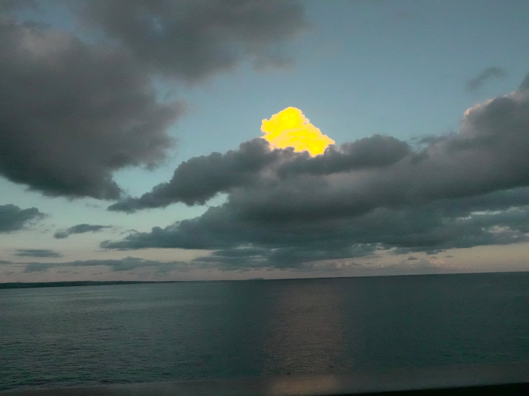
Fort de France Martinique
Fort-de-France is the capital of the Caribbean island of Martinique, a French overseas territory. It's known for colonial architecture, ornateiron balconies, tropical flowers, and beaches.
Columbus first discovered Martinique in 1493 but did not land there until 1502. Columbus named the island Martinique, but it was also known as "Jouanacaera," the island of iguanas. First inhabitants of the island were the Arawaks, followed by the Caribs and then the Tainos. Savane park has a statue of Napoleon I's wife Joséphine, a native of the island.
Exhibits at the Martinique Museum of Archaeology and Prehistory focus on the island's history, especially the pre-Columbian period. The Pointe Simon pier is now the most used dock. Local musicians' welcome visitors with lively Caribbean tunes.
St. Louis Cathedral is a Catholic cathedral located in Martinique, an overseas department of France. It was built in the late 19th-century in the Romanesque Revival style and serves as the cathedral of the Roman Catholic Archdiocese of Fort-de-France.
The Schoelcher Library is a building of glass and iron which mixes Romano-Byzantine, Art Nouveau, and neo-Egyptian influences. Schoelcher Library was built under the orders of the architect Pierre-Henri Picq in 1887. This public library houses the collection of the abolitionist Victor Schoelcher.
The Market Hall Fort-de-France was Inaugurated with great pomp and circumstance with three days of festivities on September 12, 1885, the Grand Marché is one of the places not to be missed if you want to taste and leave with fresh local fruits and vegetables. In addition to the gustatory aspect, you will also be able to get closer to the local population who come to buy from the fruit and vegetable sellers at dawn. Fort Saint Louis is a seaside fortress in Fort-de-France, Martinique. The present-day fort has evolved from earlier strongholds that were erected on the site as early as 1638 and has been known in previous incarnations as Fort Royal and Fort de la Republic . Fort Saint Louis is both an active naval base and a listed historic site of France.
The Balata Garden of Martinique now offer an incredible innovative experience to its visitors, allowing them to explore luxurious canopies while comfortably strolling fifteen-meter-high wooden bridges. These walkways along the top of one hundred-year-old trees, giving a magical, breathtaking aerial view of the garden, the bay of Fort de France and the Carbet Pitons. The Balata Garden is a real masterpiece and an internally renowned reference for the richness of its botanical collections. (Address: Arrondissement of Saint-Pierre 97250, Martinique)
Mount Pelée Is a stratovolcano's when in 1902 it’s eruption destroyed the town of Saint-Pierre, killing 29,000 to 30,000 people in the space of a few minutes. It was the worst volcanic disaster of the 20th century.The main eruption, on 8 May 1902, left only two survivors in the direct path of the blast flow. The volcano is currently active. A few volcano tectonic earthquakes occur on Martinique every year, and Mount Pelée is under continuous watch by geophysicists and volcanologists.
Anse Madame Beach (Address Plage de l'anse Madame, Martinique) is not far from city of Fort de France. Part of a spacious coastline with turquoise water and gray fine pebble, the beach is suitable for all type of people and has the following amenities: beach restaurant, changing rooms, showers, toilets. Distance from the Pier: Approximately 4.8km / 2.9mi
Plage De Madiana is not far from the city of Fort-de-France. The beach is in an urban area, surrounded by the cliffs. It is partially covered by trees which give natural shade. Plage De Madiana coast is free for all.
Pointe-du-Bout is home to some of the island's major resorts such as the Bakoua and Carayou which is a very popular center of nautical activities such as renting: jet sky, pedals, surf, windsurf also.ess such as Anse Mitan.
Anse Doufur is located in an urban area, among the mountains. It is partially covered by trees which give natural shade. Turtles can often be spotted here.
St Kitts & Nevis
St. Kitts has other attractions, including a number of lovingly preserved plantation great houses, the UNESCO World Heritage Site of Brimstone Hill Fortress and a scenic narrow-gauge sugarcane railway.
Basseterre is the capital of the Federation of St. Kitts and Nevis. The islands of St. Kitts and Nevis are two of the Leeward Islands in the Lesser Antilles, which is an archipelago of the West Indies in the Caribbean. Basseterre is located in the southern part of the island of St. Kitts. It is in the St. George Basseterre Parish, which extends south to the Narrows-a two-mile-wide channeling between St. Kitts and Nevis that connects the Caribbean Sea and the Atlantic Ocean.
Basseterre is home to lots of fascinating historic sites to visit, has a few prominent medical schools, and a 125-acre golf course, botanical gardens, and the National Museum, among countless other cultural treasures and more.
Saint Kitts is also the home of the oldest British settlement in the Caribbean, Old Road, which dates back to 1624. It may be the smallest country in the Caribbean, but the twin-island federation of Saint Kitts and Nevis rivals' other tropical destinations with its gorgeous beaches, lush rainforests, and authentic cultural experiences. A narrow two-mile-wide strait separates the two islands. Saint Kitts is the larger, more developed of the two islands. Nevis is quieter and offers a laid-back atmosphere. The beaches are never crowded.
The original track of St. Kitts Scenic Railway was laid from 1912 to 1926, to deliver sugar cane from the plantations to the new centralized sugar mill in Basseterre. The sugar mill was built by a group of investors in 1912, to reduce processing costs and increase profitability by applying the principle of economies of scale, due to a sugar price drop caused by the worldwide introduction of sugar beets. The privately owned St. Kitts Scenic Railway commenced running tourist trains on 28 January 2003. The scheme is run in an unusual partnership between the government and a private enterprise. The slogan "Last Railway in the West Indies" demonstrates its objective to preserve a link to the past, when sugar ruled the island's economy.
Independence Square, originally called Pall Mall Square, is the social and commercial center of Basseterre. A fountain marks the center of this park area, where tourists and residents go for a relaxing walk under the shade of the trees.
The Church of the Immaculate Conception is located just to the east of Independence Square. This church was built in 1927, after the original church, dating back to 1856, was demolished on this site.
St. Kitts' sister island, Nevis is reachable by ferry or water taxi from Basseterre Ferry Terminal and has departures to Nevis and back almost every hour. Each way and takes about 45 minutes.
St. John’s Antigua
Antigua and Barbuda, is an independent state in the eastern Caribbean Sea and are islands located at the southern end of the Leeward Islands chain. The capital, St. John's, is situated on Antigua, with Redonda being the only dependency.
Antigua's coastline is intricate, featuring bays and headlands fringed with reefs and shoals. Notable inlets like Parham and English Harbour provide anchorage, and St. John's boasts a deepwater harbor. Covering 108 square miles, the island is mostly low and undulating, distinguished by volcanic rocks in the west that rise to 1,330 feet at Mount Obama. Unlike its Leeward counterparts, Antigua lacks mountains and extensive forests. The absence of rivers and limited springs contributes to occasional droughts, despite an annual rainfall of approximately 40 inches.
Nelson's Dockyard Was built as a strategic naval base in the 18th century for Admiral Horatio Nelson, the famed British Navy hero. This Georgian-style dockyard is now a UNESCO World Heritage Site. Overlooking the narrow bay of English Harbour, this protected settlement is a popular landing spot for yachters and features a plethora of shops, art galleries, and museums to explore beyond the marina.
Shirley Heights Lookout Is located a short distance from Nelson's Dockyard, Shirley Heights is a restored military lookout point with stunning views of Antigua's rocky coastline and secluded bays. Pack comfortable shoes to hike to the 492-feet- (or 150-meter-) high summit; alternatively, you can ride a taxi to the top.
Ffryes Beach, is a stunning tropical paradise situated on the west coast of the island, Ffryes Beach Antigua is known for its white sandy beaches, crystal clear waters, and breathtaking sunsets.
Dickenson Bay is famous for it's red phone box perched right on the beach and is the most developed beach on the island, with hotels restaurants and water sports facilities.
Millions of years of reef formation amount to this: the Devil's Bridge. The natural limestone arch located in eastern Antigua, near Indian Town, has sustained the crash of ocean waves for hundreds of years to form the distinct shape it is today. At the meeting point of the Atlantic Ocean and Caribbean Sea, this natural wonder leaves an impression on sightseers.
A short drive from Falmouth Harbour on the south coast, Pigeon Point Beach is a peaceful oasis of calm, shallow waters surrounded by sea grape and palm trees. Surprisingly quiet considering the suite of amenities - including a restaurant, showers, bathrooms, and a playground - this beach hits the rare combination of comfortable and secluded.
Betty's Hope (Address: Betty's HopePares Village,St. Peter's)
Betty's Hope is a sugar plantation site where one of the two sugar mill towers has been fully restored complete with sails. With a small interpretation centre and interpretation signage throughout the estate, this heritage landmark is well worth a visit. It was one of the earliest sugar plantations, dating to 1651.
St. John's Cathedral also known as the St. John the Divine, the Cathedral Church of the Diocese of North Eastern Caribbean and Aruba, is an Anglican church perched on a hilltop in St. John's, Antigua and Barbuda. The Cathedral is represented as a city landmark, which is topped by Baroque-style towers, and has experienced many reincarnations.
The Museum of Antigua and Barbuda maybe small but is packed with information about the history of the islands, with exhibits displaying everything from pottery to pre-Colombian and historical artifacts. Located in the former St. John's Courthouse, which was built in 1750 and is believed to be the oldest building in town.
St John US Virgin Islands
Saint John, the smallest of the three US Virgin Islands, covering just 20 square miles. Despite its size, this island boasts unspoiled landscapes with green forests, mangroves, and coral reefs. Home to around 3,000 residents, Saint John was once visited by infamous pirates like Blackbeard.
At the heart of Saint John is the renowned Virgin Islands National Park, spanning half the island and preserving a haven for diverse bird species in its lush surroundings. The surrounding clear waters host dolphins, and sea turtles navigate with poise.
The National Park Visitor Center, in Cruz Bay, is a place to start exploration of St. John. The exhibits presented will introduce you to the park's history, hiking trails, historical sites and local flora and fauna. Park rangers can help answer questions about trails and hikes. Brochures about the Park, maps and books are also available.
Annaberg Plantation represents a well-preserved example of a colonial-era sugar plantation. It played a crucial role in the island's history during the time when sugar production was a major industry in the Caribbean.
The Lind Point Trail is a popular hike for travelers coming to St. John by ferry or those without a vehicle. That's because the trail is within easy walking distance of downtown Cruz Bay. It offers not only a great trail experience, such as the great views from the Lind Point Battery Overlook but also access to two beautiful beaches, Salomon Bay and Honeymoon Beach.
One of St. John's most beautiful seaside spots, Hawksnest Beach offers a beautiful and easy-to-reach locale with picnic tables, barbecue grills, and ample shade. A long snorkeling reef begins a few yards from the shore.
Trunk Bay is one of the better spots to relax on a pristine beach and do some snorkeling.
Cinnamon Bay is just east of Trunk Bay, and is about a mile west of Maho Bay beach. The shallow, clear water, and the short distance to Cinnamon Cay make Cinnamon Bay good for snorkeling.
Something Happened Aboard
the Quest Today
Something exciting, at least for us, happened to us today on the Seabourn Quest. Today our latest book, Bedtime Stories For Grownups, was released today. We chose the Quest as one of the stories, The Mystical Cruise, spends a majority of the story on a Seabourn ship.
You can find the book at https://store.bookbaby.com/book/bedtime-stories-for-grownups
You can find the book at https://store.bookbaby.com/book/bedtime-stories-for-grownups
Back in Miami Again
The first two weeks of our cruise are over and we are back in Miami to board about 400 new passengers. Quick math tells you that 55 of us are going back to back.
Just a few quick notes on the last 14 days.
First
The Quest is the same as we left it in 2019. She is elegant, well maintained and a real pleasure to cruise on. We are sailing with about 10 crew members that we have sailed with before
Second
The Staff was superb. As with any group, some were standouts. We are quick to use the feedback section on The Source when someone is exceptional.
On this cruise we had fairly long conversations with the Captain, the Hotel Director, the Cruise and Assistant Cruise Directors and The Senior Staff Engineer. It is not that we are special it is that they just took time to chat with us.
Third
Our fellow cruisers were exceptionally interesting as usual. As we have said before we like to share tables and because of that we met some wonderful people. For example last night we had dinner with a former legal secretary, a policeman and his wife and two theoretical particle Physicists. During the cruise we also had dinner with travel agents, a comedian and various ship’s officers.
Add to that several great conversationalists who gave great talks.
Fourth
The food was good and got better as time went on. The one down side was the fact that the dining room service was very slow on occasion.
We ate in The TK Grill where the service and food were great. In truth we will miss the Grill when it leaves the ship in January. We will also miss the Fried Chicken and Rib nights in the Colonnade when they disappear in January as well.
Fifth
Conversations
As usual they were very good. They varied in scope and topic.
All in all a good cruise.
Now we are off to the Eastern Caribbean so stay tuned.
Santo Tomas de Castilla Guatemala
Located on the eastern coast of Honduras, Santo Tomas de Castilla was originally settled in the 19th century by Belgian pioneers, and is administratively a part of Puerto Barrios. The coast - Guatemalans all call it the Atlántico, stretches 74 miles. Tourist brochures tout this coast as "The Other Guatemala" because predominantly indigenous and Spanish cultures of the highlands give way to an Afro-Caribbean tradition that listens to the rhythms of far-off Jamaica rather than taking its cue from Guatemala City. Although the indigenous culture here isn't as striking as that in the highlands, traces of the Mayan empire, such as the impressive ruined cities of Quiriguá and, just across the border in Honduras, Copán, mark the movement of this ancient people through the lowlands, and you'll run across many inland people who speak only their native Q'eqchí. The seaport of the city was built in 1976, after an earthquake had severely damaged the port of Puerto Barrios. Today it is among the busiest in Central America and currently expanding.
Once an important Maya trade route, the Río Dulce later became the route over which the conquistadores sent the gold and silver they plundered back to Spain. All this wealth attracted Dutch and English pirates, who attacked both the ships and the warehouses on shore. Spanish colonists constructed this fortress in 1595 to guard the inland waterway from pirate incursions. A 1999 earthquake in this region destroyed the river pier and damaged portions of the fort. The fort is listed on the UNESCO World Heritage Tentative List and is a popular regional tourist destination.
Perhaps the most beautiful of Guatemala's natural wonders, El Boquerón is a narrow limestone canyon whose 590-foot walls are covered in foliage heavy with hanging moss. Hummingbirds fly around lavish blooms, blue morpho butterflies flutter between branches, and kingfishers dive at minnows. Sometimes howler monkeys visit the trees nearby-listen for their thunderous cries in the late afternoon. All along the canyon are caves filled with clinging bats. Close to the entrance is a turnoff past a giant ceiba tree that leads to several thatch huts along the river; the proprietors, Antonio and Miguel, provide roughly fashioned kayukos (canoes) that you can rent for a ride through the canyon. The water is clean and cool, and great for swimming except after a heavy rain, when all the local rivers turn a muddy brown.
The northern banks of the Golfete, an expansive body of water between Lago Izabal and Río Dulce, are covered by the 17,790-acre Biotopo Chocón Machacas. Among the stretches of virgin rain forest and the extensive mangrove swamp here are gentle manatees-shy marine mammals also known as sea cows because of their enormous size. Manatees are as elusive as quetzals, so as you go through the reserve you're more likely to see other animals such as sea otters.
Some of the creeks go through thick forests where giant mahogany, ceiba, and mangrove trees hang over the water to form tunnels so thick they block out the sun.
A tiny island surrounded by the park's dozens of creeks and lagoons has a well-maintained nature trail that is easily walke. The trail has such interesting examples of old-growth trees as the San Juan, a tall, straight tree with yellow blossoms, and such exotic plants as orchids and bromeliads.
Known for its steaming waterfall, Finca El Paraíso is a natural spa. Don't be dissuaded from a trip here even if the weather is hot and humid, as the falls descend into an icy cold river. A trail from the front gate leads to a short yet somewhat bumpy climb to the falls-be careful, as the rocks can be slippery. Around the falls are small indentations in the rock that serve as natural saunas. You can also hike upstream to the narrow cave at the source of the river. The rock formations here are otherworldly.
Inhabited since the 2nd century a.d., Quiriguá, is famous for the amazingly well-preserved stelae, or carved pillars, which are the largest yet discovered and constitute an essential source for the study of mayan civilization. The stelae depict Quiriguá's ruling dynasty, especially the powerful Cauac Chan (Jade Sky), whose visage appears on nine of the structures circling the Great Plaza. Several monuments, covered with interesting zoomorphic figures, still stand. The most interesting of these depicts Cauac Chan's conquest of Copán and the subsequent beheading of its then-ruler, 18 Rabbit. The remains of an acropolis and other structures have been partially restored. The ruins are surrounded by a strand of rain forest. A small museum here gives insight into Quiriguá's history.
The Panama Canal
As we all know, that following the failure of a French construction team in the 1880s, the United States commenced building a canal across a 50-mile stretch of the Panama isthmus in 1904. The death toll due to disease was large to say the least. According to history.Com, there was “.. a massive public health campaign in the canal zone, undertaken by chief sanitary officer William Crawford Gorgas, who ordered the fumigation of homes, the drainage of pools of water and the attachment of screens to windows and gutters. To smother mosquito larvae, health officials sprayed crude oil mixed with kerosene in water sources and puddles. Thanks to those efforts, yellow fever cases on the isthmus were largely eradicated by the end of 1905. Although case numbers dropped, malaria proved more stubborn.”
Chief engineer John Stevens devised innovative techniques and spurred the crucial redesign from a sea-level to a lock canal. His successor, Lt. Col. George Washington Goethals, stepped up excavation efforts of a stubborn mountain range and oversaw the building of the dams and locks. Opened in 1914, oversight of the world-famous Panama Canal was transferred from the U.S. to Panama in 1999.
Bolstered by the addition of Madden Dam in 1935, the Panama Canal proved a vital component to expanding global trade routes in the 20th century. The transition to local oversight began with a 1977 treaty signed by U.S. President Jimmy Carter and Panama leader Omar Torrijos, with the Panama Canal Authority assuming full control on December 31, 1999.
The American Society of Civil Engineers recognized the canal as one of the seven wonders of the modern world in 1994. In 2020 about 14,000 ships transited the canal generating $2.6B in revenues.
At the Pacific terminus of the Panama Canal, Fuerte Amador is a manmade causeway jutting into the sea, constructed with material excavated from the Canal. Originally built as a fortification, today it is a park, the headquarters of the Smithsonian Institute of Tropical Research, and landing area for ships anchored off the Canal, with shops and restaurants.
Panama has a varied and unique history. The first human beings lived in Panama about 11,000 BC. By 2,500 BC they had learned to make pottery and later people from the region traded with others as far north as Mexico and as far south as Peru.
The first European to land in Panama was a Spaniard Rodrigo Galvan de Bastidas in 1501. The first Spanish settlement in Panama was made in 1510. Then on 25 September 1513, Vasco Nunez de Balboa became the first European to see the Pacific Ocean.
In 1519 Pedro Arias de Avila founded Panama City. The indigenous people were decimated by European diseases, to which they had no resistance. The survivors were enslaved. The Spanish introduced a kind of feudal system in which the indigenous people were forced to work on estates.
When Pizarro conquered the Incas in 1533 Panama became a transit point for gold on its way from Peru to Spain. The precious metal was taken overland by mule from the Pacific Coast to the Atlantic coast. The great riches in the area attracted the attention of the English. In 1572 Francis Drake raided Nombre de Dios. In 1671 a Welshman named Henry Morgan burned Panama City. It was rebuilt in a new location several kilometers away in 1673.
The Bio Museo is a museum focused on the natural history of Panama, whose isthmus was formed very recently in geologic time, with major impact on the ecology of the Western Hemisphere. Exhibits tell the story of Panama's rich biodiversity through engaging visuals, examining human presence throughout time and how the Atlantic and Pacific evolved differently.
Old Panama City was founded on August 15, 1519, by Spanish conquistador Pedro Arias de Ávila. The city of Panamá was the first European settlement along the Pacific. For 150 years it flourished as Spain exported Peruvian gold and silver to Europe via Panamá. In 1671, the privateer (pirate) Captain Henry Morgan sacked the city. It was relocated to the present-day Casco Viejo. Today much of Panamá Viejo lies buried under a poor residential neighborhood, though the ruins are a must-see.
The historic quarter of Panama City, known as Casco Viejo, is the southwestern tip of Panama City, overlooking the Pacific entrance to the canal. It's just three avenues wide and nobody uses addresses. It's a mix between Havana, New Orleans, Cuernavaca, Mexico and Miami's South Beach with Churches, Squares and Colonial Palaces.
The church of San José protects the famous Altar de Oro (Golden Altar), carved of wood & painted in gold flake, and is the sole relic salvaged after Privateer Henry Morgan sacked Panamá Viejo. According to local legend, when word came of Morgan's impending attack, a priest attempted to disguise the altar by painting it black, the baroque altar was later moved from the old city to the present site.
The Miraflores Locks Visitor Center is a space where you can live a unique Panama Canal experience. In one place you will find different activities to learn and fully enjoy the Panama Canal. The Exhibition halls are temporarily closed. The building has three levels for observing the Canal's operation, the passage of ships through the locks and how they move. It is the ideal place to take pictures and to hold memories of this engineering marvel.
Limon Costa Rica
It is a short stay in Puerto Limón however it is a port with limited things to see. We say this not to be derogatory, but to reflect the fact we have been here before.
Puerto Limón, is a district, the capital city and main hub of Limón province, as well as of the Limón canton in Costa Rica and it is home of the Afro-Costa Rican community.
Costa Rica's Caribbean coastal port gives access to a number of natural attractions. The canopy of the coastal rain forest can be visited by gondolas on aerial cable systems at the Veragua Rain Forest Park, which also offers zip-line adventures, as does the nearby Jungle Breeze Park. The mangrove forests of the Tortuguero Canal are an easy way to get close to sloths, monkeys and numerous varieties of birds and reptiles on canal boats.
A day at the Vargas Park is definitely worth your attention. Huge palm trees and exotic plants surround the park. Visitors that walk along the park, have the chance to come in close contact with some of the city's indigenous wildlife.
The Sloth Sanctuary of Costa Rica is a privately owned animal rescue center located near the city of Cahuita and is worth a visit. The Sanctuary is dedicated to the rescue, rehabilitation, research, and release of injured or orphaned sloths.
It's possible to head inland to Costa Rica's cosmopolitan capital, San Jose, just over two hours away by highway through lush highland coffee plantations.
The region of Limon offers access to various outdoor activities and natural attractions that are fairly spread out and best explored by car or on a guided excursion. We do not advertise going on your own. Shuttles are not needed as the town is next to the port.
The Caribbean greenery Parque Vargas (Vargas Park), located in Limón, was given by United Fruit Co., a plantation company, that at the end of the 19th Century donated a field of 42009.6 acres to the city of Limón. Due to this donation, in 1895 thanks to Balvanero Vargas, who got vegetal specie from other Caribbean areas like Cuba or Jamaica, the park was constructed. To construct this park was hired Andrés Bonife, a Frenchman who was living in Martinique; he inspired his designs in Versailles.
The Jaguar Centro de Rescate is named in honor of its original resident, a jaguar. This well-run wildlife-rescue center in Playa Chiquita now focuses mostly on other animals, including sloths, crocodiles, anteaters, snakes and monkeys. Founded by zoologist Encar and her late partner Sandro, a herpetologist, the center rehabilitates orphaned, injured and rescued animals for reintroduction into the wild whenever possible.
The Cacao Trails is a botanical garden and chocolate museum which has a couple of small exhibits devoted to indigenous and Afro-Caribbean culture, a lush garden bursting with bromeliads and heliconias, and an on-site chocolate factory where cacao is processed in traditional ways.
The Cahuita National Park is the most preserved coral reef in the Costa Rican Caribbean. You will find species like raccoons, coatis, sloths, iguanas and lizards. You can also find snakes like the eyelash viper and the rainforest hognosed pitviper, and birds like the common black-hawk.
Playa Bonita is Limon's most popular beach, and also its prettiest. It lies just a few meters due south of the bustling commercial sea port of Limon, but its wide swath of sand and tranquility are worlds away.
San Andres Columbia
Located in the Caribbean Sea off the coast of Nicaragua, San Andres is the largest island in an archipelago that was included in UNESCO's 2000 inscription of the Sea flower Biosphere Reserve. Although first mapped by the Spanish in 1527, its history includes serial colonization by English, Dutch and Welsh parties during the ensuing centuries. In the 17th Century, the famous Welsh pirate Henry Morgan used the island as his base of operations, and fortune hunters still seek legendary treasure supposedly cached on the island.
Even though it is a fairly small island you can swim, dive and snorkel in its warm, clear waters and enjoy La Loma, with a picturesque 19th Century Baptist Church and superb views of the spectacular "seven-colored sea," as well as colorful, but laid-back San Luis on the western coast.
Although it belongs to Colombia and the most common language spoken on the island is Spanish, the population is predominately protestant, mainly Baptist.
The island's flora and fauna are protected by several national and regional parks and preserves, and coral reefs and shallow coastal lagoons such as the one dubbed "El Acuario" provide excellent snorkeling and other water sports. At Hoyo Soplador, a system of submarine channels under the coral reef traps Caribbean swells and spews a geyser upward as much as 60 feet through a blowhole vent, depending on the tide and sea conditions.
The central point of commerce happens on the Avenue of the Americas (la Avenida de las Americas), near the North End, where buyers can purchase everything, they want.
Local vendors sell many products typical of the region, artisanal and handmade - all of which are pieces that are expressions of the island's history and culture.
Belize City Belize
As you might expect, Belize City is the largest city in Belize and was once the capital of the former British Honduras. It is located at the mouth of the Haulover Creek, which is a distributary of the Belize River. The Belize River empties into the Caribbean about 5 miles from Belize City.
Established in the 17th century as a British trading post for lumber, the city, then known as Belize Town, was an important source of mahogany and logwood. Though the Spanish and English fought over the Central American territory, it became a British colony in 1862, and remained so until it gained independence in 1981. Many of the traditional colonial structures have survived, including the Government House and St. John's Cathedral, as well as stately houses of the period.
The Government House is one of Belize's most preserved colonial buildings. It is now designated a house of culture but in the past it was used to host foreign dignitaries and as the residence of the Governor-General of Belize.
Altun Ha is one of Belize's most visited archaeological sites. It is where the famous Jade Head of the Maya Sun God, Kinich Ahau, was found. Marketing being what it is, the Maya temple is featured prominently in Belize's national beer.
Around the mid 50's, a Florida vegetable farmer came to Belize with the intention of growing vegetables (among them cucumbers) and exporting them to the U.S.A. in the winter months. He set up farms around the village of Burrell Boom and used this port to package and load vessels bound for the U.S.A., hence the name Kukumba Beach. As a point of reference Kukumba is creole for cucumber.
Haulover Creek, a tributary of the Belize River, divides the city into north and south sides; the famous Swing Bridge, a manually operated bridge from the 1920s, and much of the local boat traffic are found on this waterway. The north is where many of the cultural attractions are located, including the Museum of Belize and the Fort Street Tourism Village, a harbor front shopping and dining area catering to cruise-goers. Albert Street, on the south side, is considered the main downtown commercial area; it's lined with stores, gift and souvenir shops, banks and restaurants.
Cozumel Mexico
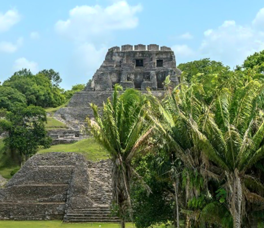
The Quest docked in the island of Cozumel, located just off the east coast of Mexico's Yucatan Peninsula; directly across the water from Playa Del Carmen. Cruise ships dock at one of three cruise ship ports in Cozumel.
Cozumel is located on the Mesoamerican Barrier Reef which is the second-largest coral reef system in the world. ,
The archaeological site of "San Gervasio" is the most important and well studied prehispanic site of all the documented settlements in Cozumel Island. It is named after its location in the former "San Gervasio" ranch. This archaeological set has been considered the center of pilgrimages where the Mayan worshiped the Goddess "Ixchel". Besides being a Mayan sacred center it was a strategic site for commerce and the politic development of the area.
The entire southern point of Cozumel Island is a sprawling nature reserve known as Punta Sur. It is one of the best places to see the island's vast natural habitat. It has some of the most beautiful beaches on the island and some wonderful mangrove marshlands
Chankanaab, translated as "small sea," consists of a saltwater lagoon, an archaeological park, and a botanical garden, with reproductions of a Maya village and Olmec, Toltec, Aztec, and Maya stone carvings are scattered throughout.
We are off to Miami
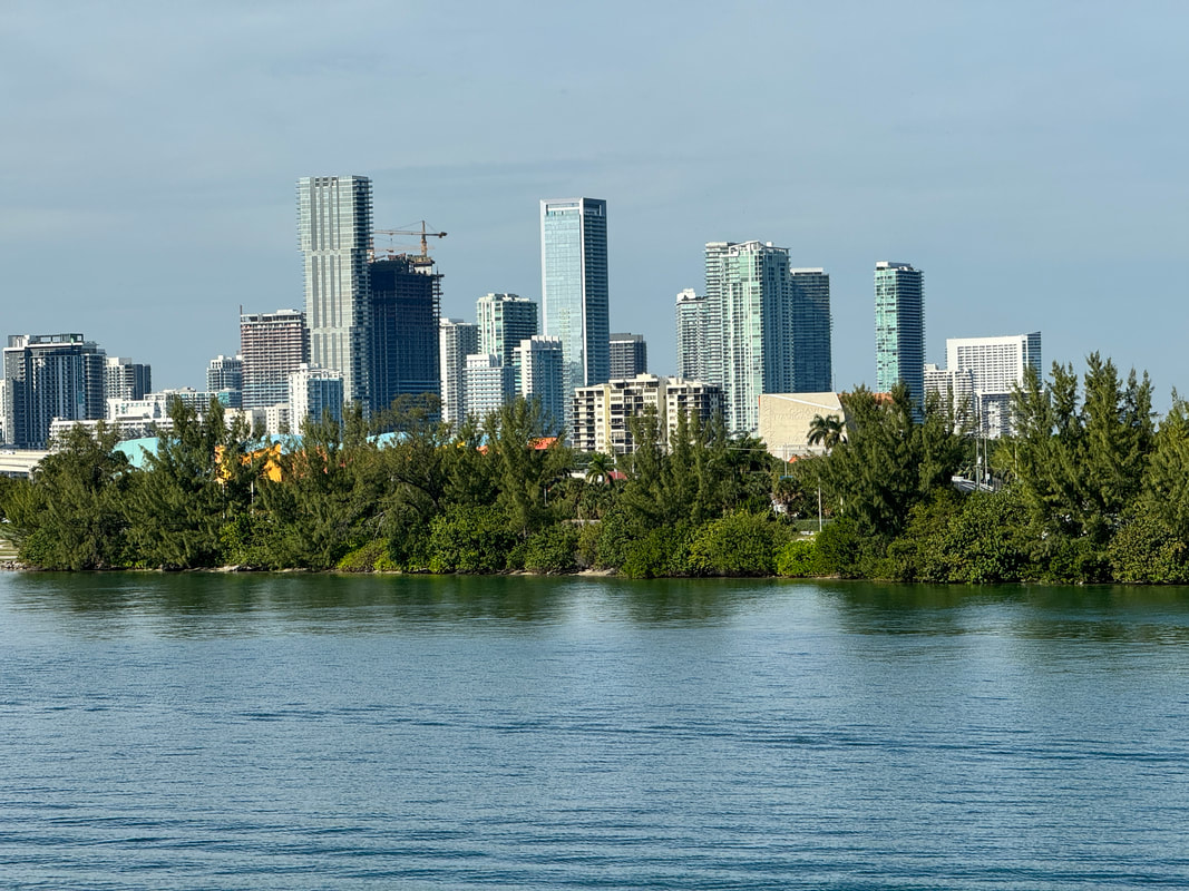
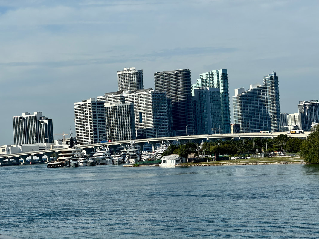
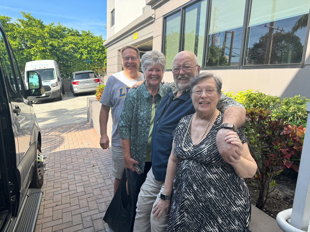
Our flight to Miami was pretty nice. Lunch was at best fair.
We were met by our friend and travel advisor who got us to our hotel, then off to a wonderful Italia Restaurant.
The next morning we were off to the port. They didn’t start boarding until 12:30 so we had a wait.where we met a nice couple.
Once aboard it was off to the Colonnade for a quick lunch, then off to our room to get organized, well not organized just moved the bags around. That evening it was off to the restaurant where we shared a table with a very nice couple..
The next day was a sea day and it was spent unpacking. That evening we went to the Thomas Keller Grill. The food and service was excellent. There we met a wonderful couple from DC. Then off to bed.
Tomorrow it is off to Cozumel.
We are about to board Seabourn again
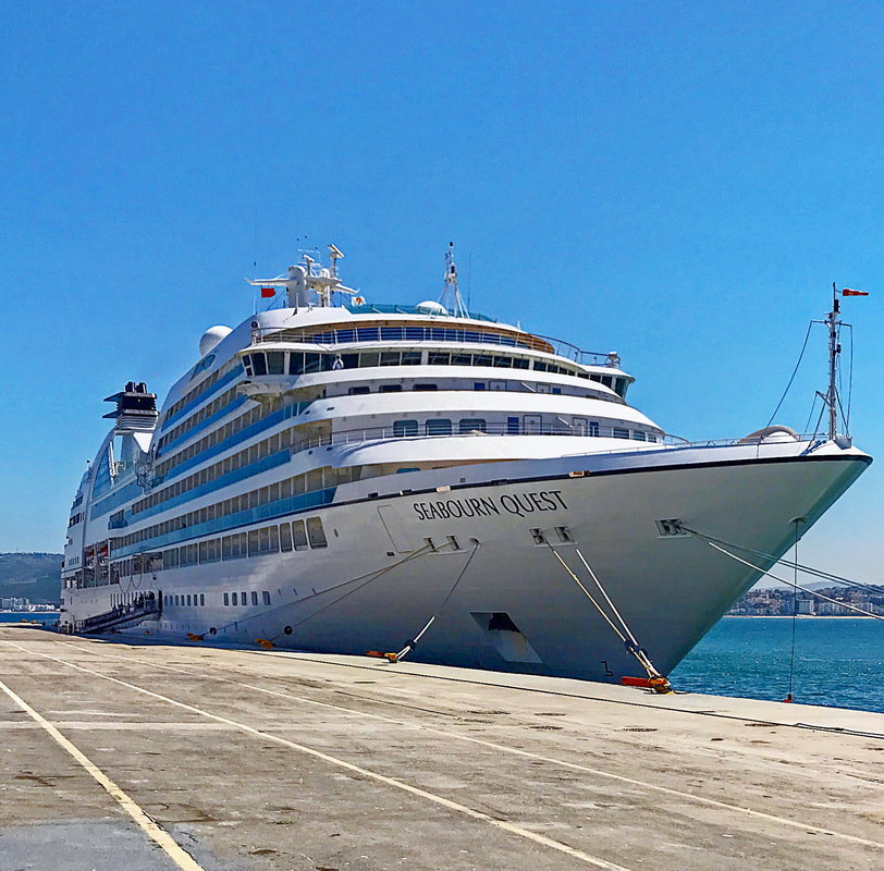
It’s that time again. Tomorrow (12/4) we head to Miami to board the Quest to start our next cruise. Our blog entries will start again next week so stay tuned.~
We use Apple Air Tags on our luggage
As you may know, we are heading to Miami in a few days. As you also probably know we shipped our bags on Luggage Forward.
We put an Apple Air Tag in each of the bags and as you can see they are working like a charm.
Sitting in our living room in Central Texas we can see our three bags are in Miami waiting for the Quest.
Now if you bring your bags with you, the tags will let you know if your bags are at least in the same airport as you are or on their way to Vietnam.
A Cruiser’s Hierarchy Of Needs

Most of us are familiar with Maslow’s hierarchy of needs. In an article Shep Hyken, a contributor to Forbes Magazine, adapted Maslow’s hierarchy to the business customer. We went one step further and adapted Mr. Hyken’s thoughts to a specific customer, those who cruise.
That being said here is our play on the cruise customer’s hierarchy of needs.
Let’s start at the bottom of the hierarchy and work up to the top.
The Ship’s Systems Must Work – There is nothing worse than a ship that “doesn’t work”. We realize that there are so many parts to a cruise ship’s systems, it takes a real effort and focus to keep everything working perfectly.
Cruising systems start with embarkation. There is nothing worse than a chaotic embarkation. The cruiser is tired, they may have been fighting traffic, fought their way through security at the airport, took a long flight, or just haven’t had a lot of sleep. If the cruise line’s embarkation plan is poor and chaotic, it sours the rest of their cruise.
The time between boarding the ship and ability to get to your cabin is another pressure point. Most cruise lines encourage you to go to the buffet restaurant or to a waiting area until the cabins are ready. A prolonged wait, a crowded restaurant, or a prolonged food service can kill the start of any cruise.
Then there is the cabin with all its components. It must be clean, well maintained and all systems(AC and heating) working. It helps if the suite attendants show up, introduce themselves and introduce you to the cabins system’s early on.
The muster drill is another pressure point. One of the great outcomes of COVID was the digitization of the muster drill. It simplified the process and made it more customer friendly. Some cruise lines are considering putting the muster drill back to the old way with its crowding, chaos etc. They do so at their own risk.
Food service is another major pressure point on the ship’s systems. The food’s taste and quality are very subjective and it is virtually, if not impossible, to satisfy each cruiser’s tastes. Because of that fact, this part of a ship’s operation is often its downfall. Secondly the quality of food can be ship specific. That being the case, a customer’s bad experience on one ship can turn them off the whole cruise line.
Housekeeping and cleanliness are also pressure points, although until COVID they were not as prominent. What may bring it to the forefront is the fact that this too is ship specific. Poor cleanliness, especially for new cruisers, will create a very negative experience.
Alignment with expectations– This is where the cruiser asks themselves, do their personal expectations aline with the cruise lines mission and vision statement. The cruise line’s customers don’t have to read those statements to know what they are. The customer should experience the cruise lines guiding beliefs when they cruise with them. If you have a positive experience, then your expectations align with their beliefs. It is this component that plays an important part of why some people are loyal to sailing on mega ships and others, like Dee and I, are loyal to small ship sailing.
The problem for cruise lines is that as your expectations change so does your cruising choice. We say that because our expectations changed when we went from Princess to Viking and finally to Seabourn. As our expectations increased, Viking and Princes fell from our cruise selection process.
Trust and Safety – If the cruise line has a bad reputation for customer safety, getting and keeping customers trust will be tough to say the least. Even customers willing to take a chance may eventually experience what others have warned them about.
Trust and safety belong together, but let’s first discuss trust. A sense of trust comes from different areas that can include (but are not limited to) a good reputation, positive reviews and ratings, customer-friendly policies, simple and frictionless processes, fast response times and a friendly, helpful crew.
Safety comes from creating a safe physical environment. Recently we have seen one line has been tied with an unsafe environment secondary to alcohol related incidents and copious fights.
The truth is, even if you have beautiful ships and a great marketing program, without trust and safety, you might not be able to keep your customers past the first cruise, assuming you get them at all.
Feeling Appreciated – Every cruiser that is willing to pay a cruise line $50 to $1,000 per person, per day for a cruise deserves to feel appreciated. If a cruise line doesn’t acknowledge their customer with a simple thank you, they may not have a second chance. However just saying thank you is not enough. Personal service and listening to customers are strong components in feeling appreciated. If a cruiser feels unappreciated, the cruise line will be at risk of losing them.
Emotional Connection – The emotional connection is at the top of Shep Hyken’s hierarchy of needs. Paraphrasing his comments, the emotional connection is where cruise lines move customers from being satisfied to becoming loyal. Satisfied customers come back until something better comes along. Loyal customers come back because they like doing business with the cruise line and have made an emotional connection with them. Cruisers know that the cruise systems work and they trust the crew. The cruise lines work hard to make the customer feel confident when crew member’s are engaging with them. At that point, the customers are feeling emotionally connected to the cruise lines.
When the cruiser can check all the boxes, they will have developed the emotional connection with the cruise line that drives their loyalty and advocacy
The Seven Lessons We Have Learned
From 800+ Nights of Cruising
On Four Different Cruise Lines
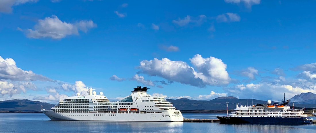
To add some cred to these words we want you to know that we have cruised on a mass-market cruise line, premium, entry-luxury and ultra luxury cruise lines.
What we have learned and put into the words below come from those cruises.
Pick The Cruise Line That Meets Your Expectations
Our expectations were simple. We wanted to cruise on a line that had great service, good food and wasn’t crowded (we don’t like crowded spaces). We quickly learned that picking the right cruise line was extremely important. Given our expectations we have never cruised on today’s mega ships and truthfully` we don’t intend to.
As we said, service is very important to us. One of the metrics that may well reflect the quality of service you receive is the cruiser/crew ratios. The mass market cruise line has 0.25 crew members for each passenger. The premium class has 0.3 crew members to serve each passenger. The entry-luxury level has 0.5 crew members for each guest and the ultra luxury lines have 0.9 crew members for each guest. We learned from experience that the more staff to serve each guest the better. We also experienced the fact that the better the ratio the greater the chance you will receive a more personal service.
Use CLIA Travel Agent
It didn’t take us very long to realize that booking a cruise is not for amateurs. Cruise line telephone booking agents are really worse than any company customer service. Their knowledge is based on what their computer screen tells them not from actual experience. It is not unusual for the agents to give different answers to the same question. It is well known that the connection between the company and the booking agents is less than optimum.
On the other hand the Travel Agent’s “pay check” depends on their quality of customer service. A great customer service equals more recommendations. More recommendations equals more bookings which equals a larger paycheck
In our case there isn’t enough space here to outline the times our agent has either discovered or solved potential problems.
We now sit back and let our CLIA certified travel agent walk us through the maze of cruise preparation and booking.
Treat the cruise line like a best friend.
This sounds weird, treat your cruise line like a best friend? This is more about mutual respect than friendship. The face of the cruise line is not the CEO. It is each and every staff member you interact with. Our experience has been that the vast majority of cruisers on the four cruise lines we have traveled on were very respectful. We have, however, witnessed some people who have treated the staff like servants or at worst they were abusive.
We always treat each crew member we meet with respect, in a friendly manner and have been rewarded in kind.
Consistent Service Is King
This comes from our professional past. Both of us were professionals in service industries. We both understand how important service is to the customer. We go back to a previous statement that the crew to customer ratio is very important. If you are on a ship of 3,000 plus there is much less of a chance of great consistent service no matter how hard the crew wish’s it to be true.
Of the four lines we have cruised on, only one has a ratio that was about one to one. Believe us when we say the service on that line is personal and terrific and now it is our favorite cruise line.
We learned that cabin choice can be a vacation saver
Cabin choice seems like a “ho hum” decision. Believe us when we say that is not true.
Many chose to get a guaranteed cabin. Even though they are less expensive, remember you are buying left overs. They are not the prime cabins in prime locations.
If you have a tendency towards motion sickness you want to chose a cabin that is as close to the middle of the ship and as low as possible.
If motion sickness is not a problem, you should select a cabin that has a cabin above, below and on each side of you. They will be the quietest. It is obvious that the closer your cabin is to a public area, the noisier it most likely will be.
If you have mobility issues find a cabin close to lifts that are close to restaurants and other areas you will visit frequently.
We learned that cruise fares shouldn’t be the deciding factor.
Many new to cruising place the cost of the cruise fare high up on their decision tree. What they don’t realize is that the fare is the window dressing of the cruise’s cost. Depending on the cruise line, with the exception of the all inclusive lines, you will pay for a lot of services including but not limited to water, beer, wine, booze, second helpings of certain menu items, rides, and specialty restaurants. Keep in mind it is possible for you to double the cost of the cruise’s fare through these extra costs.
Itineraries are important
The comments on this learned lesson maybe the result of our retirement status. When choosing a cruise, itineraries are far more important to us than bumper cars or water slides.
Secondly, we are not interested in the Cabo San Lucas’s of the world. Our interest’s lie in ports like Manus Brazil, Manta Equator, Easter Island or Deception Island Antarctica.
We learned that for the most part, ports like these are only visited by smaller ships. If you prefer unusual ports it is just another reason to look for small ship cruise lines.
With that said keep this anonymous saying in mind. “Travel is the only thing you buy that makes you richer.”
Another Look Back
Deception Island Antarctica
Sea Days, Love or Hate?
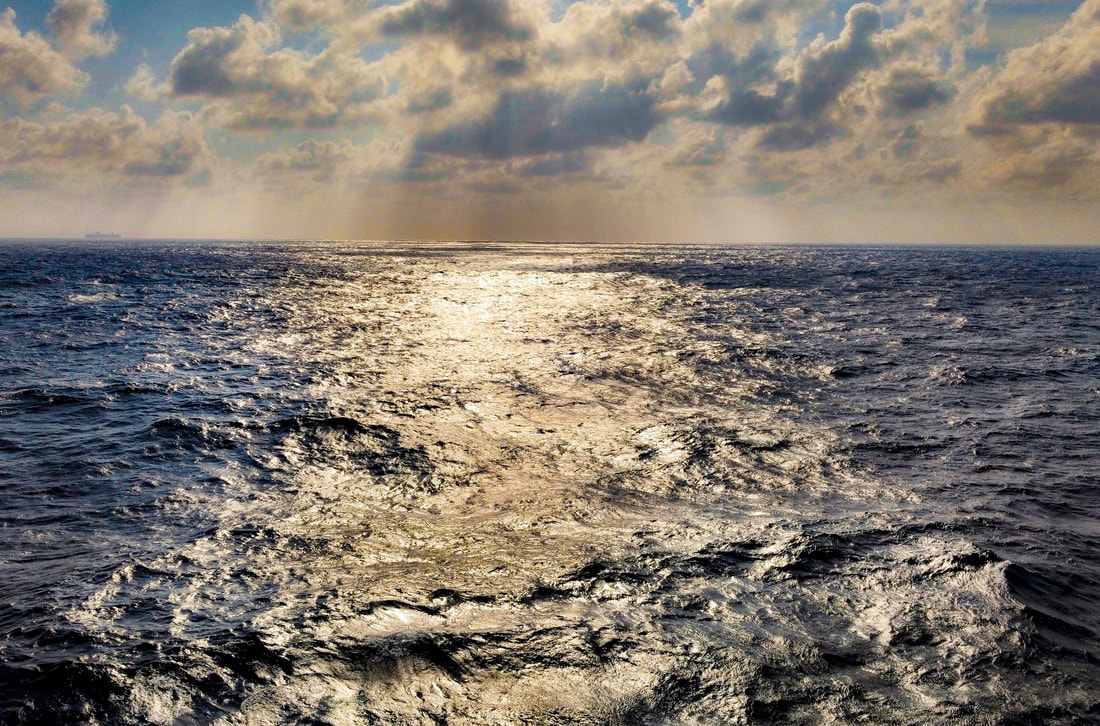
Sea days are two words that strike fear in the hearts of many cruisers. The problem is that sea days are frequently included in most itineraries where the ship must travel long distances between ports of call. Sea days may be more common on the schedules of the really big ships, because these ships have a limited number of ports they can enter due to their enormous size. On the large ships, sea days may have less of an impact because they have more than enough activities onboard to keep the cruisers entertained.
Itineraries are also a determinant. For example, d ays at sea are more frequent on Caribbean sailings than on the Mediterranean or European routes, because destination ports are closer together.
Seven to ten sea days are always part of the schedule for repositioning cruises like those that cross the Atlantic or Pacific oceans. Antarctic cruises also include numerous sea days, although those sea days may be very exciting.
The real winner of the sea day lottery are world cruises. The world cruise we finished at the end of May had twenty plus sea days of the one hundred forty day cruise.
Sea days have a love/hate relationship with cruisers. Some people enjoy them, while others try their best to avoid cruise itineraries that have them. Some individuals find sea days to be a good opportunity to explore their cruise ship or enjoy their cruise. Others find sea days boring and would rather spend their vacation time exploring new places.
Both Dee are on the side of loving sea days. Many of you probably know we are published authors and bloggers. A part of our sea days are spent researching, writing our blogs and books as well as editing the pictures we have taken. Foe example, on this last trip we finished our latest book “Bedtime Stories for Grownups” as well as worked to keep our blog posts up to date.
We are also fans of enjoying the amenities of the ship on port days when the ship is almost empty. We feel this way possibly because of our age, the fact that many times we have been to the port one or more times, or it may be because we like the quietude of small ship cursing.
There is little doubt we may be in the minority. As we travel we hear some say that they are bored on sea days. In small ships there just isn’t enough to do. Love them or hate them, sea days offer cruisers an opportunity to rest between port stops.
So if you don’t like sea days, you have several opportunities. Select a cruise line on a large ship with multiple activities to keep you busy, choose an itinerary with very few or no sea days or take a river cruise.
Another Look Back
Half Moon Island Antarctica
A Look Back
Cuverville Island Antartica
I can’t believe we made it to national TV
The Panama Canal
Padang Sumatra
Sydney Australia & The Blue Moutains
Casablanca & Rabat
The Seychelles
Dakar Senegal
Cape Town South Africa Video
We received this today
Dar es Salaam Tanzania
Zanzibar Tanzania
Namibia West Africa
Accra Ghana Video
Pitcairn Island Video
Easter Island Video
Comments on Seabourn Sojourn
and the 2023 World Cruise
Let’s start with a disclaimer. We are strong Seabourn advocates. We have sailed on Seabourn for years and have spent more than 500 nights aboard Seabourn Ships.
That being said, this review will be honest and we will share with you the good and fair on our trip. You will notice we did not use the word “bad”. The reason for us not using this word, is that we have had no bad experiences on this cruise or for that matter any of the Seabourn cruises we have been on.
Introduction:
For those reading this that may not know, Seabourn has six ships, two expedition ships, two ships with a capacity of 450 guests and two with a capacity of 600.
For those that may not know about this ship, she is one of the two remaining ships in the Odyssey class. She has 225 suites 90% of which have verandas.
Seabourn is a member of the luxury class of cruise ships. They say they provide a six star experience and that is supported by the fact that the customer to crew ratio s 1.3/1 which is excellent.
Seabourn is an all inclusive line. The fare includes meals, speciality restaurants, wine, beer, liquor, Wi-Fi, 24 hour room service, speciality coffee’s, caviar, champagne, special events and water. The only things not included, depending on what loyalty status you hold, are streaming Wi-Fi, laundry and excursions.
This cruise was a 141 day cruise around the world aboard the Seabourn Sojourn. Cruises of this length can expose any of the system’s weaknesses that may well be hidden on shorter voyages.
The Itinerary:
Dee and I have sailed around the world twice before this cruise. The first one was on Princess and then on Viking. The main difference between this and our other cruises was its itinerary among other things. We won’t go into the many differences between these cruise lines here.
This cruise started in Miami and ended 141 nights later in Barcelona. Seventy five percent of the ports on this cruise were new to us and that really created interest for us.
There were several ports that really held our interest. First there was Easter Island, Pitcairn island, Eastern Africa, South Africa and Western Africa. The Safari at Victoria Falls was an exceptional experience.
The itinerary for the most part met or exceeded our expectations. There were a few exceptions. The stops in Probowlingo Java, Indonesia, Surabaya Indonesia, Cotonou Benin, Tema Ghana, Lome Togo, Banjul Gambia were less than great stops and Port Elizabeth also had a major problem.
On another subject, one of the things we learned at a dinner with the Chief Purser on this World Cruise is that they have a series of challenges that shorter cruises may not. Among these is the logistics of refurbishing. It is a matter of timing and in some cases government action. In the case of this cruise it was both issues that affected this cruise. Keep in mind, the “supplies” are ordered in advance and then come in shipping crates. If the ship carrying the supplies is impeded or the transfer of the crate from one ship to another is impeded, the supplies will not arrive on the given day at a given port. This happened on several occasions during our cruise. In one instance an anti-government riot stopped the crates from being delivered to the ship. On another occasion it was a weather phenomenon. The Sojourn was forced to leave the port and anchor off shore because of large swells in the port. On those occasions shortages did occur and the less understanding of the guests were upset and complained.
The Cabin
We were in cabin 623. The cabin was just around the corner from the forward elevator and was close to being mid ship.
As usual the cabin more that fit our needs. What made this cabin stand out were the cabin’s housekeepers. As expected they did a great job. What made them standout was their personalities. They were very interactive and fun.
The Entertainment
Entertainment is not an important part of our voyage however the entertainers we got to know and see were really quite good.
In one case we met a singer from South Africa and her fiancé. Not only did we have dinner with them but we spent a fair amount of time with them on the seventh deck. They impressed us so much that, with their permission, we wrote them into one of the stories in our next book “Bedtime Stories For Grownups”
Conversation Speakers
This is one area that we really enjoy. In this area our assessment on a scale of 1 to 10 is an eight. The reason we didn’t rate it higher was the number of repeat messages. We heard to many talks on longitude and Captain Cook. On the other side there were some great conversations given by articulate and personable people on subjects that are seldom covered.
Special WC Events
Being a person with mobility issues I am not sure we are the ones to really evaluate these events. That being said, there were on and off ship events.
The off ship events dinners were just OK except for the last one which was really not available to those with mobility problems. We say this because that with the exception of the pre boarding dinner, the food was almost warm at best. The entertainment on the other hand, was excellent and fun to watch.
The in ship special events were hosted in the Colonnade which in truth was not large enough to house the Around The World cruisers. That meant if you were slow, you waited quite a while for an open table, sat out side and hoped for the warm weather, or head to the restaurant and skip the event. We can attest to how great the first one. The food was excellent and the entertainment really fun. We missed the second one. This sound like sour grapes however line crowding filled all the inside tables so rather than wait for a table, we joined friends in the Restaurant.
The Food
Dee and I are not foodies. Even if we were, food is difficult to evaluate as it relates to it’s quality so these comments relate only to our experiences.
It is unrealistic to expect the chefs meet the quality standards and expectations of 450 different palettes.
With the number of venues onboard, there was always more than an ample selection of great food to choose from.
We ate in the Colonnade almost every day at lunch. The Maître d'hôtel and the Food and Beverage Manager were always available and “walking the floor”. They were very interactive, they knew your name and food wishes. In Cape Town they both headed home and we are sorry to say that their replacements were not as attentive as their predecessors. The service didn’t change much as the waiters were on the ball. The new Maître d'hôtel wasn’t as available nearly as much and we don’t remember seeing the Food and Beverage more than twice between Cape Town and Barcelona. That change was really noticeable.
The food and service in the Restaurant was excellent. The selections offered were somewhat limited at times because of the logistics issues. All in all the preparation, quality, and selection was excellent.
Earth and Ocean’s quality, service and selection were excellent. It has a fairly fixed menus however the quality, service and ambiance made a difference. Our love of being outside didn’t hurt our beliefs either. Our favorite Earth and Ocean’s menu item was their 16 oz cowboy steak. The truth is that it rivaled the Grill’s steak.
The Grill, fleet wide, needed to up its game. Thomas Keller sent his right hand chef to the fleet to make necessary changes and there was an immediate improvement.
The Grill however seemed to be a point of contention. The main complaint we heard revolved around it’s fixed menu. The truth is that the Grill has a daily special which we found to be very very good. That being said, we really enjoy the Grill, not only it’s fixed menu but it’s daily specials as well. Not only is the food great, but so is the ambiance and service.
Finally, there was a French Executive Chef from corporate on board when we boarded in Miami. The French Executive Chef that was assigned to the Sojourn became ill. When he recovered he returned and we had two French Chefs aboard for a short period of time. Our regular executive chef really did an excellent job. He was out and about getting a sampling the guest’s comments about the food’s quality.
Service
As we wrote earlier, we have been on Seabourn for 500 plus days. In those 500 days the service has been exceptional with very few exceptions. This trip was no different even with the multiple crew changes. If you are a perfectionist, you would notice a drop in service at the change but in a day or two things are back to normal. A long cruise like this one, crew changes are more noticeable however. The truth is that the effects of crew changes are as much a matter of personality loss as it is about service changes.
The Store
First the shop is a contacted operation. As hard as they tried it just didn’t meet its expectations. The staff were great and the manager was very personable. The problem was the shop provider’s container shipments did not link with the Sojourn so there were a number of shortages.
The Spa
The Spa is a contracted service as well. We are not Spa people. Our only contact was for hair cuts. From that perspective our experience was good. For us. our only comment on our experiences are they were expensive. The cost of a haircut was three times more than what we have experienced at home.
Wi-Fi
Wi-Fi is a chronic complaint at the Seabourn Square. There is no doubt it is slow and at times spotty. What drew the most complaints was when we were cruising towards Easter Island. The signal was all but gone secondary to a lack of satellites and therefore there was little or no coverage in that area.
During this time, complaints came out of Seabourn Square with a bit of volume. The two complaints that stood out were ridiculous in our opinion.
“People have to pay bills and with the loss of Wi-Fi they can’t.”
As to bill payment issues. We put our bills on auto pay. As a security check, we have our bank email us every time an expense is paid. Any body can do the same just prepare.
“I have to talk to my patients daily and the loss of Wi-Fi makes that impossible.”
I can’t understand a practitioner that would subject their patient interactions to the vagaries of a cruise line’s Wi-Fi, but that’s is just me.
The truth is, if you are going on a 141 day world cruise, there will be times when Wi-Fi will be lost and you should expect this issue and prepare for it. Screaming at the people in Sojourn Square will not replace your lack of preparation.
.
On the bright side, Seabourn has made a commitment to install Starlink fleet wide. Once installed it will improve upload and down load speeds, however there still may be areas of poor coverage. That being said this upgrade can’t come soon enough.
The Source App
The Source app is much better than it was a year ago but still has a ways to go. All cruise lines are installing more customer related technology. An excellent example of this is the Princess medallion.
My next comment may raise some hackles. Hold your breath for just a minute.The demographics on this trip was older than we have seen before. It’s also known that seniors seem to be less tech savvy than other demographics. This may be a reason to be slow in this area. On the staff side, some of the tablets used in the Restaurant died and the waiters had to return to paper, which impacted service. It is clear that Seabourn needs to improve their technology infrastructure, both for its customers and staff.
What continues to amaze us however are the abilities, knowledge and patience of the Seabourn staff when dealing with technology questions and complaints.
The On Ship Environment
This was a long cruise for one hundred and sixty eight of us. I don’t know if the cruise length caused an environmental change or not. What was apparent to us and others we talked to, there was a small number of guests that believed they were special and should be recognized as such. We mention this only because it was an unusual for us to see. We will just leave it at that. On the other side of the coin, we met many great people on this trip.The people we met were from the US, Australia, South Africa, the UK, Germany and New Zealand just to name a few
Seabourn Moments
Seabourn moments are one of the important things about sailing on Seabourn so here are just a few of them that we experienced.
When we came back from our safari there were notes and a heart saying welcome back.
One of the great things about sailing on Seabourn is sailing with crew members we have sailed with before. That smiling face and welcome back means a lot.
We ate in the Colonnade every lunch on sea days and when we were not on an excursion. The daily interaction and joking with the staff made our day.
We went on a ten and half hour excursion to Marrakesh Morocco. The destination staff wasn’t sure we could do all the walking so they arranged, while we were getting there on the bus, for a less strenuous excursion in Marrakesh.
The waves off of Easter Island were really rough. Transfer to the island was via tender. The tender rose and fell five feet as compared to the ship. As bad as it was, the crew made sure I got in the tender. They crew were really amazing.
One evening we were heading back to our cabin after dinner. We ran into the captain and his wife. We said hello to them and he said, “Good evening Ms. Coffeen and Mr. Russell.” In all the 750 days we have cruised across four cruise lines has the Captain has never known our name.
One of the great things about Seabourn is the Block Party. Everyone steps out of their cabin to meet their neighbors. Champagne and snacks are brought out and you get to know the people around you.
Seabourn has hosted tables that many were invited too. We were invited numerous times. Those invitation offered us numerous opportunities to meet new people. Hosted tables are one of the benefits of solo travelers so they don’t have to eat alone.
Hosted tables are an excellent opportunities. Two that stood out to us were with a photographer and his wife as well as an an anthropologist.
Both were not only very experienced in their fields, articulate, exceptionally engaging, and had the ability to make the complex understandable. In both cases the table was active past 9:30PM which in itself is a sign of a successful table.
As I have said before, the crew gets to know what you like. I really liked Nine Hats Cabernet Sauvignon with dinner. Supply line issues caused the supply of Nine Hats to go to zero. Our waiter, from some where, got me a glass of Nine Hats for two nights after they officially ran out. I didn’t ask where it came from so he wouldn’t have to tell.
When we got back from our Safari there was our own personal bottle of Nine Hats in our room with a note our wish was their desire. Now that is a Seabourn moment.
Excursions
Seabourn excursions are good as well as some what expensive.
Four excursions stand out with us, one however was through a private company. The Easter Island excursion was exciting, the Cape Town excursion was really fun, Marrakesh excursion was terrific, and the Safari through a private excursion company was phenomenal.
Some were not that great however in truth there was little to see at these stops.
In the end, the destination team was excellent and we used them extensively.
Summary
All in all this cruise was typically Seabourn, great service, good food, responsive staff, great captains and surrounded by a classy environment.
The weaknesses revolved around some very poor port selections and according to some, poor supply planning.
The real question is, would you do a world cruise again? As we noted earlier this was our third World Cruise. We have stepped on all seven continents and visited over 100 countries. There are two reasons we probably will not go on a fourth world cruise. First, there are countries in the world we have not visited and they will be at the head of our travel list. Secondly our age and mobility are factors. That does not mean we will stop taking longer cruises. We are booked on an 80 day cruise that travels around South America, into Antarctica and the Amazon for a second time. Like the world cruise, this cruise will visit ports we have never been too.
Marrakesh Morocco
Marrakesh, is one of the four imperial cities of Morocco. It is located in western Morocco, it is a major economic center and home to mosques, palaces and gardens. The Medina is a densely packed, walled medieval city dating to the Berber Empire, with maze like alleys where thriving souks (marketplaces) sell traditional textiles, pottery and jewelry. A symbol of the city, and visible for miles, is the Moorish minaret of 12th-century Koutoubia Mosque.
Originally the Marrakesh area was inhabited by Berber farmers from Neolithic times, and numerous stone implements have been unearthed in the area. Marrakesh was founded by Abu Bakr ibn Umar, chieftain and second cousin of the Almoravid King Yusuf ibn Tashfin. Historical sources cite a variety of dates for this event ranging between 1062 and 1078. The date most commonly used by modern historians is 1070. The Almoravids, a Berber dynasty seeking to reform Islamic society, ruled an emirate stretching from the edge of Senegal to the centre of Spain and from the Atlantic coast to Algiers. They used Marrakesh as their capital and established its first structures, including mosques and a fortified residence, the Ksar al-Hajjar, near the present-day Kutubiyya Mosque. These Almoravid foundations also influenced the layout and urban organization of the city for centuries to come. For example, the present-day Jemaa el-Fnaa originated from a public square in front of the Almoravid palace gates, the Rahbat al-Ksar, and the major souks of the city developed roughly in the area between this square and the city's main mosque, where they remain today.
Points of interest in Marrakesh
The Majorelle Garden is a one-hectare botanical garden and artist's landscape garden in Marrakech, Morocco. It was created by the French Orientalist artist Jacques Majorelle over almost forty years, starting in 1923, and features a Cubist villa designed by the French architect, Paul Sinoir in the 1930s.
The Bahia Palace is a mid to late 19th-century palace in Marrakesh, Morocco. The palace was first begun by Si Musa, grand vizier of Alaouite sultan Muhammad ibn Abd al-Rahman, in 1859 and then continued and expanded by his son Si Ba Ahmed ibn Musa, grand vizier of Sultan Moulay Abdelaziz between 1894 and 1900.
The Kutubiyya Mosque or Koutoubia Mosque is the largest mosque in Marrakesh, Morocco. The mosque's name is also variably called Jami' al-Kutubiyah, Kutubiya Mosque, Kutubiyyin Mosque, and Mosque of the Booksellers.
The Saadian Tombs are a historic royal necropolis in Marrakesh, located on the south side of the Kasbah Mosque, inside the royal kasbah district of the city.
Bab Agnaou is one of the best-known gates of Marrakesh, Morocco. Its construction is attributed to the Almohad caliph Abu Yusuf Ya'qub al-Mansur and was completed around 1188 or 1190. The gate was the main public entrance to the royal kasbah in the southern part of the Medina of Marrakesh.
The Agdal Gardens are a large area of historic gardens and orchards in Marrakesh, Morocco. The gardens are located to the south of the city's historic Kasbah and its royal palace. Together with the Medina of Marrakech and the Menara Gardens, the Agdal Gardens were listed by UNESCO as a World Heritage Site in 1985.
All in all not only is Marrakesh an Arab city with a Berber culture, the city also has a strong French influence as well. The Civil law is French with the exception of marriage, divorce and inheritance
Marrakesh’ s culture is a unique as well. Berbers brought the pam trees to Marrakesh. To this day palm trees are protected by law. They may not be cut down or moved without the city’s permission. If you want to plant a palm tree you must also get permission.
All buildings in Marrakesh must be ochre in color. That law is in affect so the buildings color is not changed by the environment. If a builder wishes to use another color, the building or house will not be connected to electric grid. Believe us when we say, given the summer heat, by the summer the building’s color will be ochre.
May 27-28 2023,
Barcelona, Spain
Barcelona is a city on the coast of northeastern Spain, the capital and largest city of the autonomous community of Catalonia, as well as the second most populous municipality of Spain.
The origin of the earliest settlement at the site of present-day Barcelona is not clear. The ruins of an early settlement have been found, including different tombs and dwellings dating to earlier than 5000 BC.
The founding of Barcelona is the subject of two different legends. The first reference to the founding of the city was to the mythological Hercules. The second legend attributes the foundation of the city directly to the historical Carthaginian general, Hamilcar Barca, father of Hannibal, who supposedly named the city Barcino after his family in the 3rd century BC, but there is no historical or linguistic evidence that this is true. Archeological evidence in the form of coins from the 3rd Century BC have been found on the hills at the foot of Montjuïc with the name Bárkeno written in an ancient script in the Iberian language. Thus, it might be concluded that the Laietani, an ancient Iberian people of the Iberian peninsula, who inhabited the area occupied by the city of Barcelona around 3 – 2 BC, called the area Bàrkeno, which means "The Place of the Plains.
Today, Barcelona, the cosmopolitan capital of Spain’s Catalonia region, is known for its art and architecture. The fantastical Sagrada Família church and other modernist landmarks designed by Antoni Gaudí dot the city. Museu Picasso and Fundació Joan Miró feature modern art by their namesakes. City history museum MUHBA, includes several Roman archaeological sites.
Places you might want to see.
Dee spent a summer in Barcelona as a student studying Spanish, plus we have been to Barcelona twice. We really like Barcelona and think you will as well.
The Basílica Temple Expiatori de la Sagrada Família, shortened as the Sagrada Família, is an unfinished church in the Eixample district of Barcelona, Catalonia, Spain. It is the largest unfinished Catholic church in the world.
Designed by architect Antoni Gaudí, his work on Sagrada Família is part of a UNESCO World Heritage Site. On 7 November 2010, Pope Benedict XVI consecrated the church and proclaimed it a minor basilica
Park Güell is a privatized park system composed of gardens and architectural elements located on Carmel Hill, in Barcelona, Catalonia, Spain. Carmel Hill belongs to the mountain range of Collserola.
Casa Batlló is a building in the center of Barcelona. It was also designed by Antoni Gaudí, and is considered one of his masterpieces. The house was remodel and it was redesigned in 1904 by Gaudí. The house has been refurbished several times after that.
Casa Milà, popularly known as La Pedrera in reference to its unconventional rough-hewn appearance, is a Modernista building in Barcelona. It was the last private residence designed by the architect Gaudí and was built between 1906 and 1912.
As the name suggests,The Museu Picasso is an art museum in Barcelona. It houses an extensive collection of artworks by the twentieth-century Spanish artist Pablo Picasso, with a total of 4,251 of his works.
The Cathedral of the Holy Cross and Saint Eulalia, also known as Barcelona Cathedral, is the Gothic cathedral and seat of the Archbishop of Barcelona, Spain. The cathedral was constructed from the thirteenth to fifteenth centuries, with the principal work done in the fourteenth century.
Palau de la Música Catalana is a concert hall in Barcelona. Designed in the Catalan modernista style by the architect Lluís Domènech i Montaner, it was built between 1905 and 1908
Montjuïc is a hill in Barcelona, Catalonia, Spain.
Montjuïc, meaning "Jewish Mountain" in medieval Latin and Catalan, is a broad, shallow hill in Barcelona with a rich history. It overlooks Barcelona and a great place for photographers.
The Parc de la Ciutadella is a park on the northeastern edge of Ciutat Vella, Barcelona. For decades following its creation in the mid-19th century, this park was the city's only green space.
Casa Vicens is a modernist building situated in the Gràcia neighbourhood of Barcelona. It is the work of architect Gaudí and is considered to be his first major project. It was built between 1883 and 1885, although Gaudí drew up the initial plans between 1878 and 1880.
The Palau Güell is a mansion designed by the architect Antoni Gaudí for the industrial tycoon Eusebi Güell, and was built between 1886 and 1888. It is situated on the Carrer Nou de la Rambla, in the El Raval neighborhood of Barcelona.
Plaça de Catalunya is a large square in central Barcelona that is generally considered to be both its city centre and the place where the old city and the 19th century-built Eixample meet.
The Arc de Triomf is a triumphal arch in the city of Barcelona in Catalonia, Spain. It was built by architect Josep Vilaseca i Casanovas as the main access gate for the 1888 Barcelona World Fair.
The former Hospital de la Santa Creu i Sant Pau in English it is Hospital of the Holy Cross and Saint Paul. It is located in the neighborhood of El Guinardó. The complex was built between 1901 and 1930. It is one of the most prominent works of the Catalan modernisme architect Lluís Domènech i Montaner. The complex was listed as a Conjunto Histórico in 1978. Together with Palau de la Música Catalana, it was declared a UNESCO World Heritage Site in 1998.
Casablanca & Rabat Morocco
Casablanca, is located on the Morocco’s Atlantic coast, has 4 million inhabitants, is Morocco's largest city, and is the largest port in Africa. Built on the site of ancient Phoenician Anfa, it remained a small fishing village for many centuries until the French arrived in 1912. Since then Casablanca has become a vast modern city, ever on the increase since Morocco's independence from France in 1956.
Casablanca is a blend of oriental-style, white cubic dwellings with modern Moroccan quarters which gives the city an interesting flair.
To help understand Moroccan culture you should visit the Medina, the quaint old Moorish quarter. Swimming at the city's beaches is not recommended due to rip currents. Casablanca is the gateway for day trips to the imperial cities of Rabat and Marrakech.
The Mahkama du Pacha Courthouse is the working courthouse which is sitting by the grandiose Mohammed V Square and near the Quartier Habous. The beautiful city courthouse is an example of the late Moorish style architecture. Built around 1942, it is full of fascinating architectural details and furnishings.
Hassan II Mosque is an opulent mosque, which is set on the shore, overlooking the ocean with a 210m-tall minaret that's a city landmark.
The Hammams are built in the basement of the courtyard of the Mosque, on an area of 6.000 m2. They are designed to accommodate 1,400 people equally divided between women and men. It is accessed by an enormous staircase decorated with green marble columns and friezes finely encrusted with Zellije. From the reception room succeeds a series of hammam and columns leading to the locker room. Each hammam consists, in the pure Moroccan tradition, of three communicating bathrooms, each covered by an openwork dome and coated with marl. Part of the Hammam has been equipped with heated swimming pools for women and men like therapeutic baths.
The Mosque is a showcase of the finest Moroccan artisanship. It has hand-carved stone and wood, intricate marble flooring and inlay, gilded cedar ceilings and exquisite zellige abound. It's one of two Moroccan mosques open to non-Muslims. There are multilanguage guided tours which are conducted outside prayer times. There's also a small museum showcasing the craftwork involved. To see the interior, visitors must be 'decently and “respectfully” dressed which means knees and upper arms are covered. Women are required to wear a headscarf.
Kathy Kriger, a former American diplomat and long-time fan of the iconic movie Casablanca, which now considered to be one of the greatest films of all time, founded Rick's Cafe. The setting is based on the 1942 classic. Starring Humphrey Bogart and Ingrid Bergman, the story is a tale of deceit, danger, love and betrayal. Nowadays the characters, dialogue, and music have become iconic in the film world, including the lines "Here's looking at you, kid," and "We'll always have Paris.
The Old Medina is one of the city's remaining historic districts. Here you can wander the narrow winding alleys, see remnants of ancient city walls, barter with a local shopkeeper, and peruse the unusual and often practical wares at the bazaar. Central Market (Address: Bd Mohammed V, Casablanca.
The Habous Souk was built by the French in the 1930s, Casablanca's New Medina combines a blend of European influences and traditional Moroccan designs. There's plenty of elegant architecture to admire, including numerous attractive Art Deco buildings.
May 18, 2023
Mindelo, Cape Verde
The most important city on the Cape Verde island of Sao Vicente, Mindelo originally thrived as a coal depot for steamships plying the Atlantic. With the advent of diesel engines, its importance waned, although it is still an important port for the maritime trade. The island is volcanic, dry and mostly low. The town has replica of Lisbon's Belem Tower, located near the fish market, in an interesting part of the city. The late Cape Verdean singer Cesaria Evora started her career singing in the taverns of Mindelo, and later brought the uniquely lilting CapeVerdean form of fado music to the world through her bestselling records and concert tours.
If you get off the ship in the morning, you should visit one of the many classic cafes on the Rua Lisboa, which is now officially called Rua Libertadores d'Africa. As many would agree, it is considered to be the soul of Mindelo. A market hall and the former governor's palace in the classical style are located on this street as well.
Palácio do Povo is a bright pink colored colonial building, used to serve as a government building, and has since then been redesigned to host changing exhibitions, covering various art disciplines. Admission fee applicable.
The Museu do Mar Mindelo's is the island’s most intriguing museum. It gives an overview of São Vicente's history, from the island's role in the triangular trade to whaling in the late 19th century. Displays from shipwrecks reveal intriguing finds like 200-year-old bottles of port wine (still sealed) and massive elephant tusks.
This fish market is a sight in itself, where fishermen sell their catch of the day and experts fillet large tuna in the back. But what is really special about this place is that you can purchase what you want from the market stalls and take them to any of the surrounding eateries to be prepared however you like, ensuring one of the freshest meals you've ever had.
Casa Cafe Mindelo is a small guesthouse, restaurant, cafe and bar, located in a beautifully restored colonial building from 1870 in the heart of Mindelo, overlooking the Porto Grande bay. Come at any time of day for great home-cooked meals, or a coffee. Ask to try some Cachupa, a stew that is considered the national dish of Cape Verde, which includes mashed maize, onions, green bananas, manioc, sweet potatoes, squash and yams.
The drive to the village of Calhau is considered to be one of the most scenic drives on the island of São Vicente. The views of tall mountain peaks and tiny villages where life moves at its own pace. On a clear day you can see the uninhabited island of Santa Luzia from Calhau. There are small stone beaches called 'Salto' where you can go for a swim, and from here you can also reach the volcano of Calhau.
The Baia das Gatas music festival is located in the northeastern part of the island of São Vicente. Norte Baia hosted a Street Art Festival in 2017, when the small village was visited by various artists who created amazing murals around the town. The festival was partially inspired by the Sonvela Arte project, which has its roots in the Ribeira Bote neighborhood in Mindelo.
May 17, 2023
Santiago Cape Verde
Santiago is the largest of the Cape Verde islands, and nearly half the nation's population lives on the island. Originally volcanic, Santiago is unusually fertile, and agriculture is an important part of the islands' economy.
The Cape Verde Islands only won their independence from Portugal in 1974, following a violent revolution. The nation is struggling valiantly to progress after a repressive history. Accordingly, visitors will notice a striking difference in development between it and many of its neighbors. The Cape Verdeans, though, are friendly and optimistic, and welcoming to visitors.
The old capital, formerly known as Cidade Velha, has been renamed Ribeira Grande de Santiago, which was its name when it was an important port in the infamous slave trade. Dating from 1466, it was the first European colonial settlement in the Tropics.
One thing you will notice a cluster of well-restored colonial-period houses, as well as a monument to the original pelourinho, or pillory where enslaved people were both punished and sold. This area is a UNESCO World Heritage Site.
The Alexandre Albuquerque Square is at the heart of The Plateau in town. It, is a gathering spot for the people of Santiago. Cape Verde's oldest settlement is Cidade Velha, and is a UNESCO heritage site on the southern coast of Santiago. While you are here you can visit the Fortress of San Filipe, built by orders of Filipe I, King of Portugal and Spain. Also in the village, you will visit the Pelourinho -- a reminder of the islands' history of slavery and the sad commerce of human souls.
One of Cape Verde's beautiful old colonial houses called sobrados has been converted into Praia's Ethnographic Museum (Museu Etnográfico), devoted to the country's rich past as a cultural crossroads. Displays range from the history of fishing and traditional panos (woven cotton fabrics) to cooking utensils used in the days before electricity. Musical instruments represent Cape Verde's signature claim to fame in the world, and another, more modest, sobrado is today the Quintal da Música, a famous club where many legends have performed.
If you drive through the mountains to the Serra Malagueta Natural Park, you can enjoy guided hiking through fertile area at an altitude of 850 meters above sea level. The area is home to more than 124 species of plants and 19 species of birds. You can also enjoy the breathtaking scenery of the surrounding mountains.
The Sucupira Market is located in the area known as "The Plateau", in the heart of the town. The Market paints an anthropological portrait of Cape Verde, with its colorful produce and lively vibe. The gates to the market on the Avenue Cidade de Lisboa are an entry into a labyrinth of stalls laden with all sorts of things for sale, from fresh fruits, vegetables and raw meat.
The market of Assomada is one of the largest on the island of Santiago, with a large variety of agricultural products and crafts. It is the central collection and distribution point for produce from the surrounding countryside. This wholesale market is very large and vibrant. Most of the trade is between middlemen (Rabidantis), who sell the produce at larger national and international markets.
May 15, 2023
Dakar, Senegal
Dakar is the capital and largest city of Senegal. The city of Dakar proper has a population of 1,030,594, whereas the population of the Dakar metropolitan area is estimated at 3.94 million in 2021.
The area around Dakar was colonized by the Portuguese in the early 15th century. The Portuguese established a presence on the island of Gorée off the coast of Cap-Vert and used it as a base for the Atlantic slave trade. France took over the island in 1677. Following the abolition of the slave trade and French annexation of the mainland area in the 19th century, Dakar grew into a major regional port and a major city of the French colonial empire. In 1902, Dakar replaced Saint-Louis as the capital of French West Africa. From 1959 to 1960, Dakar was the capital of the short-lived Mali Federation. In 1960, it became the capital of the independent Republic of Senegal. Places of Interest
Senegal, and Dakar in particular, is well-known for its religious tolerance, with the majority Muslim and minority Catholic populations living in perfect harmony. As such, Dakar has a rich tapestry of stunning mosques and churches, such as the imposing 3,000 capacity cathedral in Plateau, and the distinctive green dome and four minarets of Mosque El Hadji Omar Al Foutiyou. The jewel in the crown, however, must surely be the Mosque of the Divinity. Uniquely set in a horseshoe cove in Ouakam, its twin towers stare out across the endless Atlantic, while fishermen ward off pelicans from their haul on the beach in front. A must for any visit to Dakar.Grand Mosque. The Dakar Grand Mosque is one of the most prominent religious buildings in Senegal, and the home of dedicated Islamic research and teaching.
Ile de Goree is a small island off the eastern coast of Dakar which served as a depot for the West African Slave Trade. Today the island houses museums exploring slavery, and the women of Senegal. The House of Slaves (Maison des Esclaves) is a museum and memorial to the West African Slave Trade on tiny IIe de Goree Island.
The Institut Français du Sénégal is a French cultural organization for the diffusion of French culture in Senegal. Its secondary purpose is to promote the culture of Senegal and, more generally, cultural diversity.
The African Renaissance Monument is a 52 m tall bronze statue located on top of one of the twin hills known as Collines des Mamelles, outside Dakar, Senegal.
The House of Slaves and its Door of No Return is a museum and memorial to the victims of the Atlantic slave trade on Gorée Island, .
The Mosque of Divinity built 1997, is a mosque located in Ouakam, Senegal. It is a structure with two minarets. The mosque provides a view of the Atlantic Ocean, as the mosque lies near the shore, at the Corniche-Ouest.
The Our Lady of Victories Cathedral or Cathedral of Dakar, is a religious building that serves as the Catholic cathedral in the city of Dakar, the capital of the African country of Senegal, which is the seat of the Archdiocese of Dakar.
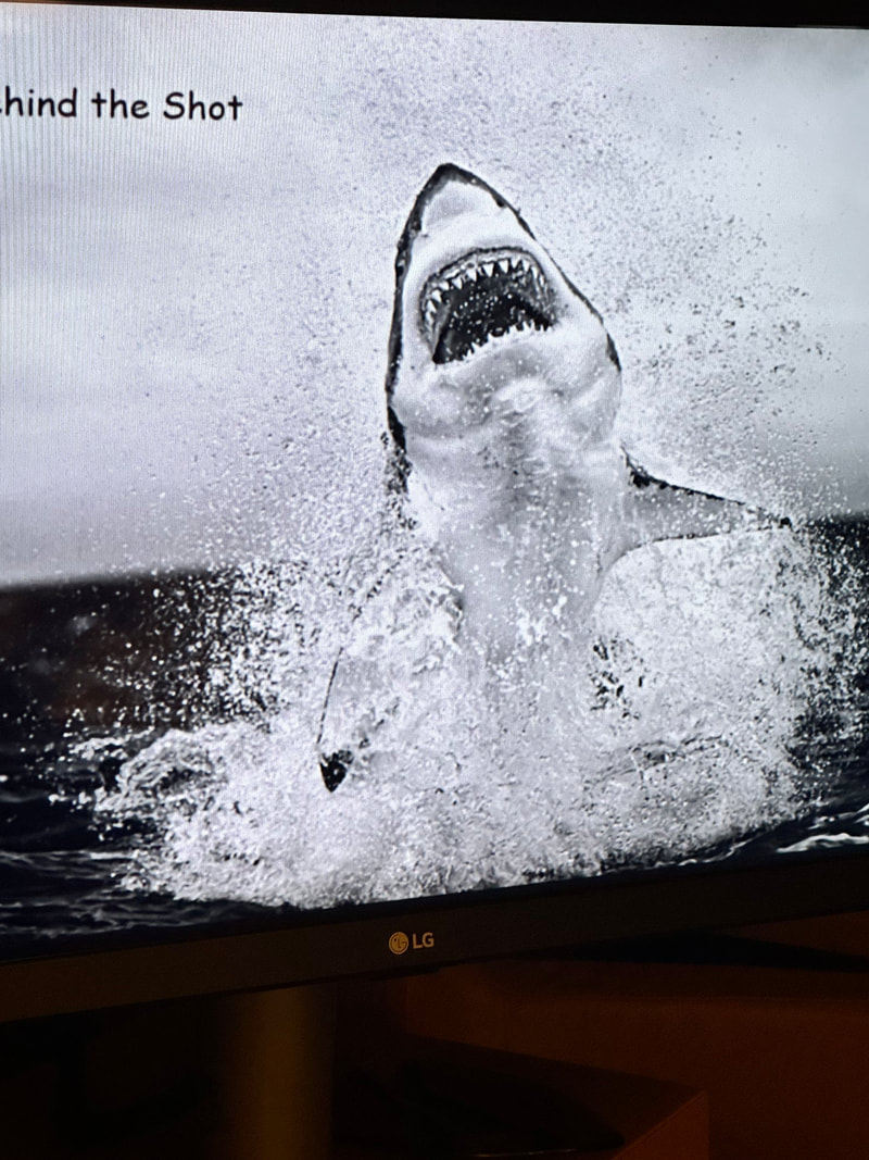
Got to know Chris and Monic Fallows who were conversationalists on the world cruise. Terrific people. The picture of the shark he took started his great career.
May 10, 2013
Banjul Ganbia
May 9, 2023
Lome Togo
Lomé is the capital of Togo, in West Africa. It's known for its palm-lined Atlantic coastline. The central Independence Monument is in a landscaped traffic circle. The nearby Congressional Palace houses the National Museum, exhibiting West African jewelry, masks, musical instruments, and pottery. To the northeast, the Akodésséwa Fetish Market sells voodoo items like animal skins and skulls.
The Monument de L'Independance was built as a tribute to Togo's independence from France on April 27, 1960. The structure is composed of a human silhouette carved within it and surrounded by promenades, palm trees, manicured lawns, fountains and a black gold iron fence.
The Sacred Heart Cathedral It is the mother of the Archdiocese of Lome, one of the seven Catholic church districts of the African Republic of Togo. Built in just over a year by the German colonial authorities, then it became one of the iconic buildings of the new capital of Togo.
The Palace of the Governors is the old official residence of the President of Togo, and the residence of the First Minister since 1991. It is located just north of the city of Lomé, the capital city of the Togolese Republic, next to the presidential residence.
The labyrinthine Grand Marché is Togo at its most colourful and entrepreneurial. You'll find everything at this market, from Togolese football tops to cheap cosmetics. 8am - 8:50pm daily.
The home of the president is an imposing modern structure, worth a few pics and the chance to see the guards dressed in their finest.
Lomé Grand Market is a large market place in the city of Lomé, the capital of Togo. Located near Lomé Cathedral near the city centre, the market often has live African music by local performers. 8am - 8:50pm daily.
Togo National Museum is the national museum of Togo. It is located in the capital of Lomé. Founded in 1975, it houses ethnographical, cultural and artistic exhibits. It is located in the Congress Palace near the Independence Square , opposite the hotel February 2 . This fully air-conditioned museum is the perfect place to discover Togolese culture . Inside, well-lit display cases tell the local story and present excellent specimens of traditional art.
Lake Togo is a lagoon in the south of Togo. It lies east of the capital, Lomé, and is separated from the Atlantic by a narrow coastal strip. On the north shore, Togoville village is known as a center for voodoo practices. Its 1910 Notre-Dame Cathedral is decorated with paintings of African saints. Nearby, the wooden Slave House, in Agbodrafo village, was used in the transatlantic slave trade.
The Akodessawa Fetish Market is located at Akodessawa, which is a district of Lomé, the capital of Togo in West Africa. The Akodessawa Fetish Market or Marche des Feticheurs is the world's largest voodoo market
The market features monkey heads, skulls, dead birds, crocodiles, skins and other products of dead animals.
May 8, 2023
Tema, Ghana
Tema is a city on the Bight of Benin and Atlantic coast of Ghana. It is located 25 kilometers east of the capital city; Accra, in the region of Greater Accra, and is the capital of the Tema Metropolitan District. Accra is the capital of Ghana, on the Atlantic coast of West Africa. Kwame Nkrumah Memorial Park honors Ghana's first president, who helped lead the country to independence. The park contains Nkrumah's mausoleum and a museum charting his life. Makola Market is the city's vast, colorful bazaar. The city consists of two million residents so you will feel the lively nature of it. In short it is crowded.
Kwame Nkrumah Mausoleum Kwame Nkrumah's grave inside the Kwame Nkrumah Memorial in Accra The Kwame Nkrumah Mausoleum and memorial park is located in downtown Accra,
Black Star Square - The Independence Arch in Accra, Ghana, is part of the Independence Square which contains monuments to Ghana's independence struggle, including the Independence Arch, Black Star Gate, and the Liberation Day Monument.
Osu Castle is a castle located in Osu, Ghana on the coast of the Gulf of Guinea. A substantial fort was built by Denmark-Norway in the 1660s, thereafter the fort changed ownership between Denmark-Norway, Portugal, the Akwamu, Britain, and finally post-Independence Ghana.
The National Museum of Ghana is in the Ghanaian capital, Accra. It is the largest and oldest of the six museums under the administration of the Ghana Museums and Monuments Board.
The Legon Botanical Gardens is located in the University of Ghana, Accra. It is owned by the University of Ghana and managed by both the Department of Botany and Mulch Company Ltd. It has a natural vegetation of 124 acres. It was founded in 1950.
For the shoppers, the Accra Mall is the only World-class shopping mall in Ghana, with over 70 choices of retail stores and entertainment offerings.
The Holy Trinity Cathedral, officially known as Cathedral Church of the Most Holy Trinity is an Anglican church in Accra, Ghana. Completed in 1894, it is part of the Anglican Diocese of Accra in the Church of the Province of West Africa.
Osu Oxford Street is a premier business centre located in the Accra metropolis. This street is the most popular street in Ghana with shopping, hotels, and restaurants.
The Ghana National Mosque is a mosque in Ghana. It is the second largest mosque in West Africa. The mosque was built at a cost of $10 million. It was funded by the Turkish Hudai Foundation in Accra with the support of the Turkish government. The complex includes a residence for the imam, a school and a library.
May 7, 2023
Cotonou, Benin
Cotonou is a port city on the south coast of Benin, in West Africa. At the eastern end of central Boulevard St. Michel is the huge Dantokpa Market, which features religious items and spices alongside everyday objects. To the southwest, the 19th-century Cotonou Cathedral has a striking red-and-white striped facade. Nearby, in the Haie Vive district, the Fondation Zinsou museum shows contemporary African art.
The Dantokpa Market, or simply Tokpa, is the largest open-air market in West Africa, located in Cotonou, Benin. It is one of the most important retailing areas in Benin, covering over 20 hectares. It is also economically important for the country, with a reported commercial turnover of over a billion CFA Francs a day. Open Sundays 7am - 7pm.
The cathedral of Notre Dame de Miséricorde, commonly known as Cotonou Cathedral, is a Roman Catholic cathedral, it is a place of prayer for the faithful. The Roman Catholic Church is located near the Ancien Pont Bridge in Cotonou, Benin. It is noted for its distinct burgundy and white striped tiled architecture. Its tower stands towards the rear-end left side of the main building. The cathedral is the seat of the Roman Catholic Archdiocese of Cotonou.
The Zinsou Foundation Museum of African Art is a contemporary African art museum located in Ouidah, Benin Republic. The Foundation provides free access to contemporary African arts. It is known as the Musee de la Fondation Zinsou in French. It is host to several African art exhibitions. Pythons Temple
Pythons Temple in Benin Republic is located in Ouidah town, the Voodoo capital of Benin Republic. The Pythons Temple is one of the main tourist attraction in this small town. Inside the abode of the serpents is chilling and several of them is seen either huddled together at a corner or slithering around.
May 6, 2023
Null Island?
Seabourn some times does the unexpected. This time the Seabourn Sojourn added a stop, or really a coast by, to its itinerary early this morning. They added Null Island to our itinerary. It is unique as there are no ports, no population, and no excursions. You see it doesn’t really exist. In case you are not familiar with Null Island don’t consider yourself lacking in geographic knowledge. You see Null island doesn’t really exist. It is a point on earth where longitude and latitude are both zero degrees.
The only way you might know where it is, is if you have one heck of a navigation system or you bump into the wandering weather buoy Station 13010-Soul. Well that is not a very good indicator so let’s stick with the navigation system.
So where is it? As written in an article in Big Think, Null island is located in the Gulf of Guinea. “Think of the Gulf of Guinea, part of the South Atlantic Ocean, as Africa’s armpit. It’s the body of water just off the coast of where West Africa bends south to become Central Africa. The Gulf is right in the middle of your standard world map, and that’s no coincidence. It is the meeting point of the two baselines of geodetic measurement, the prime meridian and the equator. Or, expressed in longitude and latitude: 0°N, 0°E.”
So add that to your bucket list.
May 4, 2023
We got this from the Captain tonight
We went through this twice when passing Yemen on previous cruises. Now here we are off the coast of Africa and at it again.
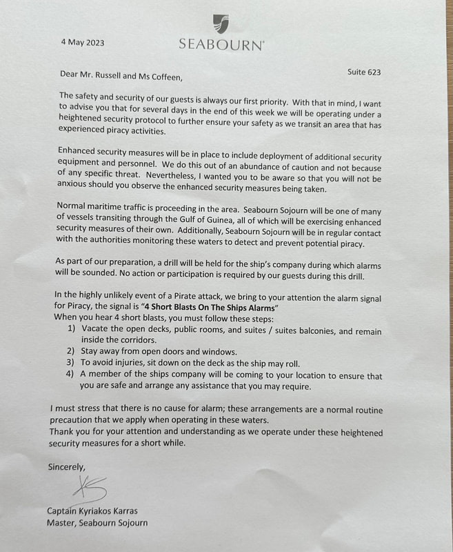
April 30, 2023
Walvis Bay Namibia
Walvis Bay (Afrikaans Walvisbaai, German Walfischbucht or Walfischbai, all meaning Whale Bay) is a city in Namibia, located on Namibia's West coast. It is the largest deep-water commercial port of the country. Although discovered by Diaz in 1487, Walvis Bay was only founded in 1793 by the Cape Dutch. Two years later it was annexed by the British.
In 1910, Walvis Bay became part of the South African Union. In its eventual proclamation, it came to be called Walfish Bay, then Walvish Bay, and ultimately Walvis Bay.
The Walvis Bay Lagoon attracts board sailing enthusiasts from all over the world. Walvis Bay is one of the world's best spots for windsurfing, kite surfing and kayaking.
Wetlands in and around Walvis Bay are home to a large number of migrant birds and to more than half of southern Africa's flamingos. Located against the sand dunes and the sea just south of Walvis Bay within the Namib-Naukluft Park, Sandwich Harbour is another wetland of international importance. Sandwich Harbour's northern wetland is sustained by water seeping from an aquifer beneath the dunes. This freshwater wetland supports 36 species of fish and a large bird population of shorebirds, waders and flamingos. Peak bird counts suggest up to 70,000 birds in summer.
Walvis Bay, with its large bay and sand dunes, is an important centre of tourism activity in Namibia. This area was once a superior fishing area. Over fishing collapsed the industry and jellyfish filled the gap. As the jelly eat the fish eggs, fish are very slow to return.
Walvis Bay's oldest remaining building, the Rhenish Mission Church was prefabricated in Hamburg, Germany, reconstructed beside the harbor in 1880 and consecrated the following year. Because of machinery sprawl in the harbor area, it was relocated to its present site in the mid-20th century, and functioned as a church until 1966.
Dune 7 in Namibia is the highest sand dune in the world. It's height from the base is about 1,000 feet and is 1,870 feet above sea level. The 1,256-foot dune got its name because it is the seventh dune past the Tsauchab River, which runs through part of the Namib Desert. The desert itself, is believed to be dry for at least 55 million years.
The shallow and sheltered lagoon is about 11,1100 acre. It is southwest of town and west of the Kuiseb River mouth. It attracts a range of coastal water birds and enormous flocks of lesser and greater flamingos. It also supports chestnut banded plovers, curlew sandpipers, as well as the rare Damara tern.
Swakopmund was established by German colonists in 1892. It has colonial landmarks which include the Swakopmund Lighthouse and the Mole, an old sea wall. Next to the lighthouse, the Swakopmund Museum which documents Namibian history. Inland, the elegant Swakopmund Railway Station, now a hotel, also dates to the colonial era.
April 29, 2023
Luderitz, Namibia
Lüderitz is a coastal town in southwestern Namibia. It's known for its German colonial buildings, including the art nouveau Goerke Haus, built into the rock face on Diamond Hill. Nearby, Felsenkirche is a hilltop church with panoramic bay view's stretching around to Robert Harbor.
The prominent Evangelical Lutheran church dominates Lüderitz from high on Diamond Hill. It was designed by Albert Bause, who implemented the Victorian influences he'd seen in the Cape. With assistance from private donors in Germany, construction of the church began in late 1911 and was completed the following year. The brilliant stained-glass panel situated over the altar was donated by Kaiser Wilhelm II, while the Bible was a gift from his wife.
After becoming one of the richest towns in Africa during a diamond boom in 1910, Kolmanskop was left by all inhabitants in the following decades. Kolmanskop became a ghost town in the desert. Situated only eight miles east of the harbor town of Lüderitz, Kolmanskop used to be a small railway station in 1908, when the railway between Lüderitz and Keetmanshoop was built. As far as legend has it the station derived its name from a Nama man named Coleman, who got stuck at the site with his ox wagon and consequently died of thirst.
The sheer scale of Goerke Haus and the way it blends into the rock face is very impressive. Originally the home of Lieutenant Hans Goerke, and designed by architect Otto Ertl and constructed in 1910 on Diamond Hill, it was one of the town's most extravagant properties. The house has undergone renovation job and is certainly worth a look.
The Diaz Point Lighthouse is a lighthouse on the Atlantic Ocean, located at Diaz Point near Lüderitz.
The lighthouse opened in 1915. It is about 84 feet high with a lantern and gallery set on a one-story-high hexagonal stone base. The tower is painted in red and white bands.
Nearby you can also view the stone cross, commemorating the landing location of the famous Portuguese explorer Bartolomeu Diaz. The point still bears his name even today.
When we arrived, Lüderitz had started their Crayfish Festival. Here they call lobster a crayfish. This is a gourmet event that attracts many locals and travelers around the world every year. The festival is a smorgasbord of culinary delights with local produce, crafts and of course delectable crayfish dishes on display at the many stalls, which was set up at the waterfront.
When we left Luderitz to nine foot swells making walking difficult at best. Luckily within an hour or two the sea calmed down>
A Taste of Our Safari
Going into the Africa hinterlands has something we wanted to do, and here we are.
We left Durban on schedule. Before we go any further we want to us sing the praises of VIP services. The following may sound like an advertisement, it is not. It is just an accounting of our experience with them. They met us at the airport and guided us through the maze of security, checking and boarding. All we had to do was sit in the wheelchairs and look dumb.
The flight to Johannesburg was very nice. Even though we were in coach, there was plenty of leg room. The stewardess was superb. She boarded the disabled first, got us all settled and gave us instructions. Even though we were in economy, we got lunch which included wine and beer in our ticket. As is mandated by law,Insecticides were sprayed in the cabin on each flight.
VIP Services met as we deplaned and got us to the hotel. We stayed at the Intercontinental Hotel which was great as well.
The next morning we were met by VIP again and the trek started. The Johannesburg airport is huge, complicated and busy to get through to say the least. Given how complicated it seemed to be, I doubt without the VIP services we would have gotten through it before the plane left.
Part of the VIP service benefits was a stop in one of the Johannesburg’s airport’s lounges. As is our way, we have the reputation of being able to talk to a telephone pole. That being the case, we started talking to a couple from Sweden that were on their way to Botswana. They were going to be there three weeks. On top of that they were each carrying 15Kg of camera gear.
We boarded the plane which was located out on the tarmac. Because of the, wheelchairs we were boarded via a lift truck. The flight was good and like our last flight we were served lunch and a choice of beverages,
We arrived in Victoria Falls and that was where the fun began. When you arrive in Zimbabwe
you must acquire a visa at the airport. This can only be acquired using cash, no cards. We brought $100 with us. Guess what, the visas were $50 each. Now I would not want to say the Zimbabwean immigration service was behind the times, however it took two officials twenty minutes plus to create one visa. They were not sure what to do with Dee and I as we were directed to four different stations. Our only saving grace was the wheel chair guy moved us to the head of the line at each station. After an hour and a half plus we arrived at the car from the Victoria Falls River Lodge. The Lodge is located on an island in the Zambezi River, so the final 10 minutes of the trip to the lodge was via boat up the Zambezi River. The lodge is first privately owned safari lodge to be built within the Zambezi National Park (Zimbabwe), the Lodge is beautifully located for exploring Victoria Falls and combines the African Safari experience with one of the 7 Natural Wonders of the World, the iconic Victoria Falls. The force of the falls produces the spray of which can be seen from the lodge.
The island lodge is comprised of six treehouse units. Each tree house has a butler, and the service is individualized and wonderful. Secondly because people are at a minimum, the environment is extremely relaxing and quiet. We could sit out on our porch both in the morning and evening watching the River and hearing the sounds of the bush around us.
Dinner and breakfast seldom had more than six our eight people in what was a porch on the River.
Some of the wonders of being in the African bush.
On our way to breakfast one morning we came face to face with a young bull elephant.
As instructed we stood still. Seeing our insignificance he took his time to move and let
us pass. That same Bull elephant tried to turn over an exhibition vehicle the night
before.
Then there was the monkey at our front door who wanted in. We sat there and stared at
each other until he got bored and left.
Finally we had a family of wart hogs swing by one afternoon for a visit.
Some lessons we learned on this trip into the bush.
Patience is a virtue
American Cash is king
Bureaucracy is everywhere which leads back to patience
Your preconceptions are most likely wrong
The Victoria Falls airport was financed and built by the Chinese
80% of the Victoria Falls economy is tourism and during COVID there was no help from
government so times were exceptionally hard
All families have to pay for their children’s education.
In summery, we had a great time, saw and learned a lot. If Africa and a Safari are not on your bucket list put them there
We are going to do this in two different sections.
Cape Town South Africa
Cape Town (Afrikaans: Kaapstad) is, for all intents and purposes, the coastal city in South Africa. South Africans call it the mother city. It is the second-most populous urban area in South Africa after Johannesburg. It is also the capital and primate city of the Western Cape Province.
As the seat of the Parliament of South Africa, it is also the legislative capital of the country. The city is famous for its harbor, for its natural setting in the Cape Floristic Region, and for such well-known landmarks as Table Mountain and Cape Point.
It is one of the most multicultural cities in the world, reflecting its role as a major destination for immigrants and expatriates to South Africa. In 2014, Cape Town was named the best place in the world to visit by both the New York Times and the British Daily Telegraph.
Located on the shore of Table Bay, Cape Town, is the oldest urban area in South Africa and was first developed by the Dutch East India Company as a victualing station for Dutch ships sailing to East Africa, India, and the Far East. Jan van Riebeeck's arrival on 6 April 1652 established the first permanent European settlement in South Africa. Cape Town quickly outgrew its original purpose as the first European outpost at the Castle of Good Hope, becoming the economic and cultural hub of the Cape Colony.
A visit to table mountain is almost a must see, however you should also hope for a clear day. You depart from the quayside and travel up Kloof Nek, the saddle between Table Mountain and Lions Head, to the Lower Cableway Station. Ascend from the Valley Station (363m) to the Mountain Station (1060m) in a cable car. The journey from the base to the summit takes just under 4 minutes and one can enjoy spectacular views, as the floor of the car rotates 360 degrees during the ascent and descent.
The Castle of Good Hope is the oldest building in South Africa, The Castle of Good Hope known locally as the Castle or Cape Town Castle is a bastion fort built in the 17th century. Originally located on the coastline of Table Bay, the fort is now located inland following land reclamation.
The cultural history museum contains a collection of old Cape Dutch porcelain, historic paintings, and many antique pieces of furniture.
Cape of Good Hope Nature Reserve where, by tradition, the Atlantic and Indian oceans and their differing ecosystems are said to meet. The reserve occupies flora and fauna and Cape Point with its dramatic sea cliffs, among the highest in South Africa - is the main attraction in the reserve.
Sitting several miles off the coast of Cape Town's Victoria & Alfred Waterfront is Robben Island, Robben Island stands as a reminder of South Africa's troubled history. Since the city was founded back in the 17th century, this UNESCO World Heritage Site has acted as a military base, a home for a leper colony, a mental institution, and, most famously, a prison. It was on this desolate land mass that Nelson Mandela, militant anti-apartheid activist and former president of South Africa, was held captive. Today, Robben Island houses a fascinating museum detailing the history of the island and offering tours led by former inmates of the former prison, including Mandela's cell.
The Iziko South African Museum is a South African national museum was founded in 1825, the first in the country. It has been on its present site in the Company's Garden since 1897. The museum houses important African zoology, palaeontology and archaeology collections.
The Bo-Kaap is an area of Cape Town is formerly known as the Malay Quarter. It is a former racially segregated area, situated on the slopes of Signal Hill above the city centre and is a historical centre of Cape Malay culture in Cape Town. The Nurul Islam Mosque, established in 1844, is in the area.
The District Six Museum is a museum in the former inner-city residential area and, District Six, in Cape Town, South Africa in an old Methodist church.
South African Jewish Museum - Polished venue presenting artifacts & displays documenting Judaism & Jewish life in South Africa. Address: 88 Hatfield St, Gardens, Cape Town, 8001, South Africa. 10am - 5pm Admission fee
Cape Town Diamond Museum - This modern museum features exhibits exploring the science & history behind diamonds.
Cape Town is a great visit with lots of things to see. We are sad to say, while we were on Safari the ship made a stop in Port Elizabeth. During the stop Seabourn had a walking excursion. During that excursion it was held up at gunpoint while other member of the gang cut purse, bag, camera and bag packs from the excursioners and ran off. Word to the wise, the world can be a tough place to travel in, so be aware of that fact.
April 27 2023
We are back
We got back with a card full of photographs and lots of notes. It will take me a day or two to get through them however, I’m here are some teaser pictures of Cape Town and the Safari to whet your curiosity.
April 19, 2023
an FYI
We are going to be off the “grid” starting April 22nd until April 28th. We are leaving the ship in Durban and won’t get back to the ship until Cape Town.
We are off to Victoria Falls and the surrounding National Parks. Our hope is to fill up my camera card with great pictures of the falls, the animals and the surrounding savanna.
We will share with you some of what we have seen when we get back, so check in often.
We are off to Victoria Falls and the surrounding National Parks. Our hope is to fill up my camera card with great pictures of the falls, the animals and the surrounding savanna.
We will share with you some of what we have seen when we get back, so check in often.
April 17, 2023
Dar es Salaam
Dar es Salaam or commonly known as Dar, is the largest city and financial hub of Tanzania. It is also the capital of the Dar es Salaam Region. With a population of over six million people, Dar is the largest city in East Africa and the seventh-largest in Africa.
Located on the Swahili coast, Dar es Salaam is an important economic centre and is one of the fastest-growing cities in the world. The town was founded by Majid bin Said, the first Sultan of Zanzibar, in 1865 or 1866. It was the main administrative and commercial center of German East Africa, Tanganyika, and Tanzania. The decision was made in 1974 to move the capital to Dodoma and was officially completed in 1996.
Dar es Salaam represents a growing power within Africa, in that there is the combination of a small but growing economically well off demographic surrounded by a much larger poorer demographic.
The National Museum of Tanzania is a consortium of five Tanzanian museums whose purpose is to preserve and show exhibits about the history and natural environment of Tanzania. The consortium developed from the National Museum of Dar es Salaam, established in 1934 by Tanganyika governor Harold MacMichae.
This consortium is important keeping in mind that Tanzania is the home of the Olduvai Gorge or Oldupai Gorge. This gorge is one of the most important paleoanthropological localities in the world. The many sites exposed by the gorge have proven invaluable in furthering understanding of early human evolution.
It was there in 1959 that English-born archaeologist Mary Leakey discovered a skull fragment belonging to an early hominin that her husband, Louis Leakey, named Zinjanthropus boisei The skull was dated to about 1.75 million years ago. The discovery indicated that hominins evolved in Africa. Specimens of Homo habilis, a more humanlike species, were also found at Olduvai.
The Askari Monument or Dar es Salaam African Memorial in Kivukoni Ward in Ilala District of Dar es Salaam, Tanzania, is a memorial to the askari who fought in the British campaign against the German Army in East Africa in World War I. It was unveiled in 1927.
The Makumbusho Village is a museum that showcases authentically constructed houses and equipment from a few of the tribes of Tanzania. It is one of the five major museums in the country, the others being the Dar es Salaam National museum, the Mwalimu Nyerere museum, the natural history museum and the Arusha declaration museum.
The Azania Front Lutheran Church is a Lutheran church in Dar es Salaam, serving as a cathedral for the local diocese. It is among the most well-known landmarks and tourist attractions of the city. It is in the city center, close to the ocean, facing the harbour.
The Mwenji market for wooden crafts is located in the northern part of Dar es Salaam, and it is one of the most prominent landmarks in the city. Mwenge Woodcarvers Market gathers over 200 carvers, who sell their sculptures and crafts.
Tinga Tinga Arts Cooperative Society represents a genre of painting born in the 1960s in Tanzania, Tingatinga is characterized by bright colors and naive subjects inspired by African nature and life. The name comes from the founder of the school, Edward Said Tingatinga,
The Nyerere Bridge is a 680-meter-long bridge in Tanzania that connects the Dar es Salaam ward of Kurasini from the east to the west of Kigamboni district across the Kurasini estuary. Construction work began in February 2012 and completed in April 2016.
What was impressive to us was the local fishing culture. Eight to ten men were aboard long boats driven in some cases by outboards. They went out to sea to fish using large nets. You can see what we mean in the pictures above. As you can see, it appears dangerous to say the least.
April 14,15,16, 2023
Zanzibar Tanzania
Zanzibar is an insular semi-autonomous province which united with Tanganyika in 1964 to form the United Republic of Tanzania.
Zanzibar's main industries are spices, raffia and tourism. In particular, the islands produce cloves, nutmeg, cinnamon, and black pepper. For this reason, the Zanzibar Archipelago, together with Tanzania's Mafia Island, are sometimes referred to locally as the "Spice Islands".
Tourism in Zanzibar is a more recent activity, driven by government promotion that caused an increase from 19,000 tourists in 1985, to 376,000 in 2016. In an attempt to increase the tourism the Revolutionary Government of Tanzania’s Minister of Tourism came aboard the Sojourn to film. During this effort we met the minister. A nice enough man, however he knew he was special as did his entourage.
On the main island, Unguja, familiarly called Zanzibar, is Stone Town, a historic trade center with Swahili and Islamic influences. Its winding lanes present minarets, carved doorways, and 19th-century landmarks such as the House of Wonders, a former sultan's palace. The northern villages Nungwi and Kendwa have wide beaches lined with hotels.
Jozani Chwaka Bay National Park, is a 19 sq mi national park. It is the only national park in Zanzibar. The park encompasses two adjoining Important Bird Areas (IBAs) designated by Bird Life International. Jozani Forest supports populations of Fischer's turacos, mangrove kingfishers, brown-headed parrots, black-bellied starlings, east coast akalats, mouse-coloured sunbirds and Zanzibar red bishops.
Chiwaka Bay and its surrounds on the east coast, including extensive stands of mangroves along its southern shore, support populations of greater sandplovers, crab plovers and Saunders's terns.
The Palace Museum, commonly known as the Sultan's Palace, is perhaps the most historic building in Stone Town. The Palace Museum is located in the waterfront, overlooking the ocean, and was built in the 19th century as a home for the Sultan and his family. After the 1964 revolution the site was used as a government building and was renamed as The People's Palace. Today it serves as a museum that showcases relics of the past Sultan family.
One of the first sights travelers see when arriving by ferry are the twin spires of the Roman Catholic cathedral. Serving the local Catholic community, including Goans, Europeans and Tanzanians from Zanzibar and the mainland, it was designed by French architect Berange, whose other work includes the cathedral in Marseilles, and built by French missionaries between 1893 and 1897.
The Old Fort with its pale-orange ramparts which overlook Forodhani Gardens and the ocean beyond. The fort was built by Omani Arabs when they seized the island from the Portuguese in 1698. Today the scale of the fortifications is still impressive, although there has been some modernization inside, notably a line of souvenir shops and a pleasant cafe that turns into a bar in the evening.
Stonetown of Zanzibar, also known as Mji Mkongwe, is the old part of Zanzibar City. The newer portion of the city is known as Ng'ambo, Swahili for 'the other side'. Stone Town is a city of prominent historical and artistic importance in East Africa. Its architecture, mostly dating back to the 19th century, reflects the diverse influences underlying the Swahili culture, giving a unique mixture of Arab, Persian, Indian and European elements. For this reason, the town was designated as a UNESCO World Heritage Site in 2000.
The heart of Stone Town mostly consists of a maze of narrow alleys lined by houses, shops, bazaars and mosques. Since most streets are too narrow for cars, the town is crowded with bicycles and motorbikes.
Stone Town's architecture has a number of distinctive features, as a result of Arab, Persian, Indian, European, and African traditions mixing together. The name "Stone Town" comes from the ubiquitous use of coral stone as the main construction material; this stone gives the town a characteristic, reddish colour. Traditional buildings have a baraza, a long stone bench along the outside walls; this is used as an elevated sidewalk if heavy rains make the streets impracticable, or they are use as benches to sit down, rest, socialize.
Another key feature of most buildings is large verandas protected by carved wooden balustrades. The best-known feature of Zanzibari houses are the finely decorated wooden doors, with rich carvings and bas-reliefs, sometimes with big brass studs of Indian tradition. Two main types of doors can be distinguished: those of Indian style have rounded tops, while those in the Omani Arab style are rectangular.
The Zanzibar Butterfly Centre is an interactive butterfly exhibit near to Jozani-Chawka Bay National Park on Unguja island, though outside the park boundaries. The exhibit consists of a netted tropical garden with usually hundreds of butterflies, all of which are native species to Zanzibar.
Most visitors to Jozani Forest come in hopes of sighting the rare red colobus monkey. Thousands of years of isolation from sibling species on the African mainland have made this simian specimen a special beauty, with distinct cries and vibrant coats.
The House of Wonders is a Unesco World Heritage site. The House of Wonders, aka Beit-al-Ajaib, is fragile in places to the point of collapse and indeed, a partial collapse happened in December 2020, prompting the Omani government to pledge millions of dollars towards repairs. The largest house in East Africa upon completion in 1883, it was the first to have a lift, hence the House of Wonders name. It was also the first on Zanzibar to have the luxury of electricity.
Born Farrokh Bulsara in Zanzibar in 1946, Freddie Mercury, the flamboyant Queen front man, is remembered in Mercury House. The small museum in the family's former home pays homage to the island's most famous son. Yellowing family photographs, the first piano he ever played, and a selection of stage costumes are available at the museum in Stone Town.
Changuu Island, commonly referred to as Prison Island. In a dark chapter of Zanzibar's history, this island was once a place where enslaved people were kept - which explains the unofficial name.
Darajani Market, Zanzibar's main market, is a hive of activity, with everything from spices, fresh fish, slabs of meat and huge baskets full of live chickens to sandals, plastic buckets, and mobile phones. All set out in a series of covered halls and overflowing into the surrounding streets.
Being the end of Ramadan, the markets were really packed.
Nakupenda (Swahili for I love you) is the name of a slender slice of sandbank just off the coast of Stone Town and off the port where we are. Abutting the brilliant blue of the ocean, this tiny beach is an idyll of sand as soft and white as baby powder. It's the perfect spot for swimming in clear waters.
I some ways, Zanzibar reminds us of the Amazon. The number of boats large and small crisscross the bay with numerous people piling into them.
In summary Zanzibar is a place of beauty, history and photographic opportunities. I should mention here that two of the pictures above are the work of Kueiwen Cheng a shipmate.
April 11, 2023
Praslin Seychelles
Praslin is the second largest island in the Seychelles. It was named Isle de Palmes by explorer Lazare Picault in 1744. During that time it was used as a hideaway by pirates and Arab merchants. In 1768 it was renamed Praslin in honor of French diplomat César Gabriel de Choiseul, duc de Praslin.
Today it's known for palm-fringed beaches, like Anse Georgette and Anse Lazio, both bordered by large granite boulders.
The main beach, Anse Volbert-Côte D'Or, faces the offshore islet Chauve Souris. Praslin's rugged, jungle-covered interior is home to Praslin National Park, which encompasses Vallée de Mai Nature Reserve. Despite being the second biggest island in the Seychelles it has fraction of the population, inhabited by a mere 6,500 people.
Praslin is laid back and far less developed than neighboring Mahe, yet still large enough to explore. The beaches on Praslin stand out, with famous names like Anse Lazio and Anse Geogette frequently making top ten lists of best beaches and most beautiful destinations worldwide. Not that it mattered to us, Praslin is the only island where you can enjoy an 18 hole round of golf on a championship course. Then there is the amazing Coco De Mer, an exotic plant that lead to the belief the Seychelles were the true Garden of Eden.
This national park is spread across the hills of Praslin's interior. At its core is the Unesco World Heritage-listed Vallée de Mai, one of the most beautiful stands of forest anywhere in the Seychelles. Vallée de Mai is one of only two places in the world where the rare coco de mer palm grows in its natural state, the other being nearby Curieuse Island. It's also a birding hotspot. There you might see the Seychelles bulbul, the lovely blue pigeon, the Seychelles warbler and the endangered black parrot, of which there are between 520 and 900 left in the wild. It's a real slice of Eden.
The Anse Lazio beach located on the northwest tip of the island, is picture-perfect everywhere you look. The long beach has beautiful waters with great waves, a thick fringe of palm and takamaka trees, and granite boulders at each extremity. Although there is some good snorkeling among the rocks along the arms of the bay fish swim in the shallow waters.
As you can imagine Praslin is not a shopping mecca. Praslin's shops mostly offer artisanal crafts and curios and are fairly limited. The unique double-nut Coco de Mer seeds are on sale in the Vallée de Mai Park, but they're part of a strictly controlled quota-if you buy one, make sure that it has a label that authenticates its origins. Most shops cluster around the Bay St. Anne jetty and the popular Côte d'Or beach.
April 10, 2023
Victoria Seychelles
After seven sea days we landed on the Seychelles Archipelago.
The Seychelles is an archipelago of 115 islands in the Indian Ocean, off East Africa. It's home to numerous beaches, coral reefs and nature reserves, as well as rare animals such as giant Aldabra tortoises.
The archipelago was uninhabited until the 18th century when Europeans arrived with enslaved Africans. It remained a British colony from 1814 until its independence in 1976. Interestingly the Seychelles have never been inhabited by an indigenous people, but its islanders maintain their own Creole heritage.
The Seychellois culture and society is a mix of French, British, and African influences, with more recent infusions of Chinese and Indian elements. It has developed from a largely agricultural society to a market-based diversified economy, characterized by rapidly rising service, public sector, and tourism activities. From 1976 to 2015, it’s GDP grew nearly 700%, and purchasing power nearly 1600%.
Mahé, a hub for visiting the other islands, is home to capital Victoria.
In Victoria, The Seychelles National Botanical Gardens showcases endemic palms and orchids, as well as giant tortoises and fruit bats. The Botanical Garden is spread over 15 acres.
The colorful Sir Selwyn Clarke Market is the island’s markets. It's small by African standards, but it's a bustling, colorful place nonetheless. Alongside fresh fruit and vegetables, stalls sell souvenirs such as local spices and herbs, as well as the usual assortment of pareos (sarongs) and shirts.
The Morne Seychellois National Park is where you can see the highest Seychelles' peak, Morne Seychellois.
The imposing Cathedral of the Immaculate is noteworthy for its elegant portal and colonnaded facade. The extraordinary building immediately west of the cathedral is the Domus - it's the priest's residence and a national monument.
Close to the highest point you can reach on Mahé by road, Mission Lodge has a superb lookout with spectacular views of central Mahé and the west coast, and some low-slung stone ruins slowly returning to the forest. A school was built here by the London Missionary Society in the 19th century to care for slave children who had been dumped on the island after the abolition of slavery.
The focal point of the city center is a downsized replica of the clock tower on London's Vauxhall Bridge. It was brought to Victoria in 1903 when the Seychelles became a crown colony.
April 2, 2023
Pedang Sumatra
Padang, the capital of Indonesia's West Sumatra province, lies on Sumatra's west coast. Its old quarter features Dutch colonial buildings and fishing boats around the Batang Arau port and river. Aside from this, We don’t have a great deal to say about Padang. It is an mining city that exports coal through out the world. It also exports a great deal of natural gas. Secondary to its natural resources, It is one of the fastest growing economies in the world. Even as it grows, the corruption seems to stymie the growth of the poorer people. That being said Indonesia is best seen outside the cities, and this was quite true in Padang. The pollution in this city was 95% better than our other two stops.
Once out of the city the beauty of the country really comes through. The rice fields and the traditional buildings really capture your eye
Once out of the city the beauty of the country really comes through. The rice fields and the traditional buildings really capture your eye
March 30, 2023
Surabaya Indonesia
We arrived in Surabaya to this warning from the ship: “ Guests are advised that when going ashore in Bali & Surabaya not to take expensive jewelry or watches with them and should leave these in the suite safes.
Pickpockets operate in the town and city centers, and guests should be mindful of carrying a lot of cash whilst ashore. If taking cash ashore, please distribute it around the body and do not carry it in one place.
Never leave valuables unattended whilst visiting the beach and do not leave bags unattended in restaurants.”
The name Surabaya means Shark and Crocodile. It is said that once upon a time, there were two animals fighting to claim their territory.
With that in mind, Surabaya has many corners of interest. Its historic Arab Quarter is a fascinating labyrinth of lanes. The city is said to have one of Indonesia's biggest Chinatowns and some impressive, though disintegrating, Dutch buildings.
Surabaya is Indonesia's second-largest city with a population of over 2.7 million, and the capital of the province of East Java.
Joko Dolog is a Buddhist statue. It is said to have been constructed in the year 1289 in honor of the funeral of King Kertanagara, who was the last king of Singosari. It is believed to have been carried to Surabaya about 300 years ago. The statue can be found directly in front of the mansion of the governor of East Java, and the aroma of incense remains in the air as it is still a popular pilgrimage site.
Kayoon Flower Garden Market is on the Western bank of the Kayoon River. Beautiful gardens, orchids and tropical decorative blossoms are every where.
Jembatan Merah was originally the old city and was divided along ethnic lines. The Europeans were on the west side of the Kali Mas river and Chinese, Arabs and Javanese on the east bank. Jembatan Merah is a famous bridge that connected the two halves of the city. It also saw fierce fighting during Indonesia's battle for independence.
Jl Jembatan Merah, running parallel to the canal and is a grungy replica of Amsterdam,
The Submarine Monument Is a real KRIP asopati 410-type. Whiskey-Class Russian submarine, used in 1952 by the Indonesian Navy.
Kong Co Kong Tik Cun Ong Templeia primarily Buddhist complex with dashes of Confucian and Taoist influences. It spans two sides of a small gang, arched with temple gateways. You can be overcome with flickering candles, incense, praying pilgrims, concrete columns wrapped with dragons and latticed teak altars. .
The Jagat Karana Temple is considered to be the second largest Hindu Temple in East Java. This temple is dedicated to the singular God of Hindu called Ida Sanghyang Widi, with manifestations of Brahma, Wishnu and Ciwa.
From our point of view the city, and to this point in Indonesia, there is a dichotomy both financially and beauty. There is little doubt that there is financial success seen within the city. At the same time that beauty is somewhat overcome by the poverty ridden areas at the cities edges.
Then there is the beauty and history seen in the city’s art and culture.
March 29, 2023
Probowlingo Java, Indonesia
This will be the shortest note so far on this world cruise. If Seabourn is listening, they will never visit this port again. This was a tender port. Many we heard from said the best part of their visit here was the Tender trip back to the ship.
Garbage was seen on the streets and the place was in general disrepair.
They put garbage on a man made island in the bay and the air was thick and polluted.
The Indonesian’s were said to have drug dogs on the ship although in truth I did not see them.
They do take their visa rules seriously as we had to produce them getting off the ship.
March 27 & 28
Benoa and Denpasar Bali, Indonesia
Benoa is located on the southeastern coast of Bali and is the small village of Tanjung Benoa. Still considered a fishing village, Benoa has developed over the past 20 years into a major player in the tourism sector. The calm waters and the beautiful white sand beaches have made Benoa the prime water sport area of Bali. Being a peninsula that is only accessible from one direction, Tanjung Benoa is still relatively quiet with a more relaxed feeling.
Unfortunately shuttle buses are not permitted due to a strong taxi union so it is either a ship’s excursion or the taxi.
Bajra Sandhi Monument is the centerpiece to a popular park, this huge monument is as big as its name. Inside the Borobudur-like structure are dioramas tracing Bali's history.
Museum Negeri Propinsi Bali in Denpasar, is considered the British Museum or the Smithsonian of Balinese culture. It's all here, however not well organized. Most displays are labelled in English. The museum comprises several buildings and pavilions, including many examples of Balinese architecture, housing prehistoric pieces, traditional artifacts, Barong (mythical lion-dog creatures), ceremonial objects and rich displays of textiles.
Pura Jagatnatha, in Denpasar, is the state temple, built in 1953. It is dedicated to the supreme god, Sanghyang Widi. Part of its significance is its statement of monotheism. Although the Balinese recognize many gods, the belief in one supreme god, who can have many manifestations, brings Balinese Hinduism into conformity with the first principle of Pancasila - the 'Belief in One God'.
Taman Wedhi Budaya is The arts center located in a sprawling complex in the eastern part of Denpasar. Its lavish architecture houses an art gallery with an interesting collection.
As a part of our visit, we has a Balinese dinner and dance program. The food was quite good and the dance was beautiful and unique. As was our luck, a torrential thunderstorm hit just as we were to start dinner. The good news was that we were under a large cover.
Indonesia definitely presents a duality of views. Their temples are a wonder, their dance culture and costumes are something to behold, yet their cities and infrastructure are third world. In any case it is worth seeing over all.
March 26, 2023
Thoughts on Australia and Millie the stowaway
Well we have left Australia and it was a wonderful visit. Four things stand out not only from this visit but from our two previous visits.
First. Australian’s are a very friendly people. This holds true both on and off the ship. We were in north, south, east and west of the continent and Australians were wonderful welcoming people.
Second. Australian Cities are vibrant places. From Cairns to Sydney, to Adelaide, and around to Broome you could feel the vibrancy in the air. They are a very proud people and. Keep their cities modern and clean.
Third. You can see the country’s history every where ever you look especially in their architecture. In many towns older buildings can not be taken down so they are refurbished.
There is even a movement within the citizenship to be identified as a descendent of one of the convict founders.
Fourth. If there is an indicator of the country’s view of the future, it is in the presence of children. There were children everywhere, in the streets, parks and even museums.
In short if you get the chance to visit Australia do it.
A final note. As we left Broome a large storm came in behind us. It appears that a Black Kite was blown away from the main land, came aboard ship and made herself at home.
For those that might not know, a Black Kite is a medium-sized bird of prey in the family Accipitridae, Black Kites are opportunistic hunters and are more likely to scavenge. They spend much time soaring and gliding in thermals in search of food. Their angled wings and distinctive forked tail make them easy to identify. They are also vociferous with a shrill, whinnying call.
What was not known. about this bird, until very recently, was that it has love for Seabourn ships and the steak served aboard.
March 25, 2023
A change in itinerary
We received this note today from the Capitan:
We wish to advise you of a change to our scheduled itinerary. Our Security team has been closely monitoring the situation in Kenya. Recent events have heightened security concerns in the area, and there is an increased risk during the period of Ramadan. As a result, we have made the difficult decision to prioritize the safety of our guests and have canceled our scheduled call to Mombasa, Kenya from Friday, April 14 to Sunday, April 16, 2023.
Instead, we have moved and extended our call to Zanzibar, Tanzania, which will now be a three-day call from Friday, April 14 to Sunday, April 16. We have also added a call to Dar es Salaam, Tanzania on Monday, April 17, our original date for Zanzibar. Tanzania's largest city and former capital, Dar es Salaam is a vibrant and bustling metropolis that offers visitors a wide range of cultural, historical, and natural attractions. Due to this change, we will now depart Praslin, Seychelles at 3:00 PM on Tuesday, April 11 rather than 5:00 PM.
The revised portion of your itinerary will be as follows:
Guests with overland tours will be contacted by the Destinations Manager regarding their specific arrangements, as we are working to accommodate overland tours from Zanzibar. For those guests with shore excursions booked for Mombasa, your shipboard folio will be credited automatically and there is no need to visit Destinations Services or Seabourn Square for a refund. We are working with our local tour operators to arrange excursions for our additional days in Zanzibar and our call to Dar es Salaam, and we will advise you when they become available.
When we create itineraries, we look forward to taking our guests to the destinations they expect to visit and regret any disappointment these changes may cause. The safety and security of our guests and crew is always our highest priority, and our Security department continuously monitors worldwide alerts and other assessments in close contact with governmental authorities and local law enforcement agencies, as well as private sources. Itinerary changes such as this are only undertaken after comprehensive review and evaluation, and we appreciate your understanding that it was made with your safety in mind.
March 24, 2023
Broome, Australia
Entering and leaving Broome is a challenge. This time of year tides rise and fall about 34 feet. The ship had to delay putting out the gangplank until it settled a bit. It was still steep but not like when we returned four and a half hours later.
They had to shut down the gang way an hour plus early because the tide was changing. If we left shortly after 3:30 we would go with the tide. If we left at 5:00 we would have to fight the 14 knot flow leaving the bay.
On to Broome. In the 1870s, pearl fishermen discovered the rich waters of Roebuck Bay. A decade later, Broome was founded as a base for the mother of pearl button trade and was soon described as "the pearling capital of the world." Japanese, Chinese and Aborigine divers toiled in arduous, dangerous labor to harvest oysters from the seabed. For all its importance to the pearling industry, Broome remained a remote outpost on Australia's Kimberley Coast until its discovery as a travel destination. The legacy of its pearling days can be seen in the town's colorful mix of 19th- and early 20th century buildings. Broome also boasts Cable Beach - a 13-mile strand of white-sand that stretches along the azure waters of the Indian Ocean.
Pirate William Dampier was the first European to visit Western Australia. Dampier, who circumnavigated the globe three times, landed near Broome in 1688 and again in 1699.
Willie Creek Pearls offer the complete pearl experience, from telling the story of history and pearling in Broome, to educating thousands of visitors a year about modern-day Pearling, right through to commercial pearl farming and jewellery manufacture. This protected tidal estuary is famous for growing the Pinctada Maxima oyster that produces the world-renowned South Sea Pearl.
Cable Beach is situated in the western part of Australia, Cable Beach is known for its powdery white sand shores that line the turquoise waters from the Indian Ocean. As fate would have it the high tide covered the beach and only a few rocks were exposed.
Broome is a town rich in history, which can be experienced on a walk around Chinatown. The town's popularity rose as it was discovered to be a prominent destination for pearling. In the first days of the industry, many migrants from Asia came to work on the pearling boats. This gives Broome the diverse society that it has retained to this day. Thus the town has named this area 'Chinatown'. Today Broome has developed into an iconic Western Australian tourism town and Chinatown is its heart and soul. A boutique retail hub and a site of historical significance, it is a unique and special place worth visiting! What is interesting is because of the hurricanes they use corrugated steel on all their buildings.
The pearling industry was not without its problems. In fact, while 80% of the world's mother of pearl was found in Broome before WWI, many divers met tragedy under the water. The Japanese Cemetery is the final resting place for over 900 Japanese divers who gave their lives in pursuit of the glamorous and elusive pearl.
The Broome Historical Society Museum offers an great look into Broome's diverse cultural history. A former general store built in the 1890s, is now the town's museum. It provides insight into the town's fascinating pearling history and the terrifying Air Raid attack during World War II and the impact it had on the local residents and allies who had taken refuge there.
You can also see Aboriginal artifacts and memorabilia from the area. Regarded as one of the best regional museums in Australia, the Broome Historical Museum is governed by a dedicated volunteer group who devote their time to keeping the museum open 7 days a week.
Gantheaume Point was named on 24 July 1801 for Honoré Joseph Antoine Ganteaume, by Nicolas Baudin during the Baudin expedition to Australia: this was a French expedition to map the coast of Australia, then known as New Holland. It has red stone cliffs which contrast with the white sandy beach and waters of the Indian Ocean.
Here, preserved in the reef rock for over 125 million years, are the footprints of long-extinct dinosaurs and a few plant fossils too, making it one of the best paleontological sites in the world. Like cable beach the footprints are only visible at low tide, so they were under water.
Gantheume Point lighthouse was commissioned in 1905, and was one of 10 built between 1900 and 1913. A short stroll to the northern side of Gantheaume Point and you'll find a touching piece of local history at Anastasia's Pool. This natural spa pool was cemented by one of the early lighthouse keepers, making it a therapeutic warm water pool easily accessible for his wife, who suffered terribly with arthritis
March 20, 2023
Fremantle/Perth Australia
Seabourn Sojourn docked at Victoria Quay, which is an easy walk from the town center of Fremantle and the railway station.
A bit of history. Lying at the mouth of the Swan River, historic Fremantle was founded in 1829. Prior to British settlement, the indigenous Noongar people inhabited the area for millennia, and knew it by the name of Walyalup.
Fremantle was the first area settled by the Swan River colonists in 1829, and is named after Captain Charles Fremantle, an English naval officer who claimed the west coast of New Holland as British territory. The settlement struggled for its first few decades, and in 1850, with the advent of penal transportation to the colony, Fremantle became Australia's primary destination for convicts. The convict-built Fremantle Prison operated long after transportation ended in 1868, and is now a World Heritage Site.
Fremantle is the gateway to Perth, the capital of Western Australia. As we found out, Perth is a bustling city known for its maritime history, Victorian architecture, and remnants from Australia's days as a British penal colony.
Perth's growth in recent decades has engulfed the old historic port of Fremantle - some 70 percent of Western Australia's population live in and around Perth.
While the Roundhouse in Fremantle may not look like a photographic spot, we were told that it should be on our list to see. Built-in 1831, the roundhouse is the oldest public building in Western Australia that's also heritage-listed. It has 8 cells and was used as a prison for colonial and indigenous prisoners until 1886. After that Fremantle prison was in control of keeping the prisoners and the roundhouse continued to be used as a police lockup. The removal of the Roundhouse has been suggested a number of times in the 1920s since its usage keeps on changing but it was saved by the Fremantle city council.
The Fremantle Prison is Western Australia's only UNESCO world heritage-listed building and former Australian prison. The Prison was built by convicts in the 1850s and was used continually as a place for punishments like flogging and hangings until 1991. After its closure, the WA state government preserved the Prison for future generations and for its history. Today, Fremantle Prison is one of the largest surviving convict prisons in the world. One of the best things to do in Fremantle today is to step inside the prison and have the feel of convict life on a range of fascinating guided tours. "Convict Prison", "Behind Bars" and "True Crime" tours highlight convict and prison life, and daring escapes.
The Western Australian Maritime Museum is especially popular with its stunning maritime design. The museum is home to some iconic vessels from WA's maritime history such as the internationally renowned Australia II yacht, an Oberon class submarine, and many more. The maritime history is also well documented through a series of world-class exhibits and presentations.
The Western Australia Shipwrecks Museum is another maritime museum is a great visit. It houses the original timbers of Batavia which sank in 1629 along with countless artifacts from the Dutch shipwrecks Zuytdorp, Zeewijk, and Vergulde Draeck. There are a number of galleries inside that can be explored.
March 19, 2023
Bunbury, Australia
We were told today that the Sojourn was the first cruise ship to dock in Bunbury Australia since the start of Covid. A great event for both the Sojourn and Bunbury.
Seabourn Sojourn was docked at Bunbury Harbour. The town it’s self is very walkable. Victoria Street is the main street, and it's known for, independent shops, restaurants, small bars and great street-side people watching.
So what is this city? Bunbury is a coastal city in the Australian state of Western Australia, approximately 109 miles south of the state capital, Perth. It's known for wild bottlenose dolphins that often swim close to the beach at Koombana Bay.
Situated on a peninsula, Bunbury is known as the City of Three Waters, making it an aquatic playground. There's the Indian Ocean to the west, the Koombana Bay and Leschenault Inlet. Surfing, stand up paddle boarding, canoeing and boating are all very popular here.
The face of Bunbury has changed over the years. Once seen as just an industrial port, the city has received an injection of boutiques, wine bars and top-notch restaurants, mostly thanks to a group of young entrepreneurs who decided to transform their city into a place they wanted to work and play. Bunbury as well is a home to the largest collection of street and public art in regional Australia.
The Bunbury Wildlife Park has seven acres of beautiful trees and more than 150 Australian native animals.
The Dolphin Discovery Centre is a non-profit organization committed to dolphin research, education, conservation, and tourism. This center has a beachside zone where dolphins regularly come to interact with people in the shallows and you can wade in alongside. This impressive Interpretive Centre now showcases an expanded range of themed fish and coral aquariums and amazing 360-degree Digital Dolphinarium, as well as an interpretation of the Koombana Bay environment and its history.
The Bunbury Regional Art Gallery is the premier exhibition space in the South West of WA. Housed in a restored pink convent (1897) it has six different gallery spaces and exhibitions that change often. It is also home to the City of Bunbury Art Collection, which has approximately 1100 pieces dating back from 1940's.
March 17, 2023
Albany, Australia
About an hour or two before we entered into Princess Royal Harbor and Albany it was like the ship was a roller coaster. We pitched, shuttered and rolled similar to a medium ride through Drakes Passage. If you were one who had a pension for motion sickness, you may have become good friends with the toilet.
Well on to business. Albany is the southernmost town and seaport of Western Australia. It lies on the northern shore of Princess Royal Harbor which is one of the world's best and beautiful natural deep-water harbors.
Albany is well regarded for its natural beauty and preservation of heritage as the oldest permanently settled town in Western Australia before Perth and Fremantle were settled. Albany was Western Australia's first European settlement in1826.
Many of the original colonial buildings are now museums, restaurants and galleries which adds to its uniqueness.
To make Albany more interesting, it is on the migration route for several species of whales. That being the case, whaling rose as an industry here. The Cheynes Beach Whaling Company was the last whaling company to cease operations in Australia, closing in 1978.
The Albany Whaling Station tells the story of whaling off of Australia and is said to be the only experience of its kind in the world. You see an intact whale processing factory as well as a fully restored whale chasing ship.
Today, the Whaling Station is dedicated to whales and the historic industry with interactive exhibits.
The National ANZAC Centre exhibits historical artifacts examining the Australian and New Zealand forces that served in World War I. One of the unique components of this museum is you will learn about the Anzac Legend and the stories of the servicemen and women and their experiences in the war. Their stories start at recruitment and continue through training and embarking, life on the convoys and the conflicts at Gallipoli, the Middle East and the Western Front.
The Princess Royal Fortress takes up the entire summit of Mt Adelaide. The fort was built as a result of all the Australian states contributing money and the Imperial British Government providing guns. Opened in 1893, the Princess Royal Fortress was the first federal defense of Australia. Albany's Historic Whaling Station:
The Torndirrup National Park is also home to some of Albany's most famous natural attractions,The Gap, Natural Bridge and the Blowholes.
Then of course there is The Great Southern Distilling Company which is located on the edge of Princess Royal Harbour. They say Great Southern Distilling Company creates world-class whisky using Albany's pristine waters and pure air.
March 14, 2023
Kangaroo Island, Australia
Kangaroo Island lies off the mainland of South Australia, southwest of Adelaide. Over a third of the island is protected in nature reserves, home to native wildlife like sea lions, koalas and diverse bird species. In the west, Flinders Chase National Park is known for penguin colonies and striking coastal rock formations, like the sculpted Remarkable Rocks and the stalactite-covered Admirals Arch.
Penneshaw is a township in South Australia located on the northeast coast of the Dudley Peninsula on Kangaroo Island about 66 mi south of the state capital of Adelaide. It is the island's main ferry port with regular services from Cape Jervis. Downtown Penneshaw is about two blocks long and features features a Maritime and Folk Museum. One of the big draws is the evening tour to a colony of Little Penguins, the only species of penguin to breed in Australian waters.
From wildlife experiences to outdoor bush adventures and trail walks, there are plenty of things to do on Kangaroo Island. We met a couple who live on the island six months a year that recently Kangaroo Island has become a wining and dining paradise for foodies with fine local wines, beer, cider and spirits. They claimed that Kangaroo Island can is a gourmet's delight.
Seal Bay offers one of the most exceptional nature-based experiences in the world. The fees they take in are invested into ongoing research and conservation efforts.
At Kirkpatrick Point, a few kilometers east of Cape du Couedic, the much-photographed Remarkable Rocks are a cluster of hefty, weather-gouged granite boulders atop a rocky dome that arcs 75m down to the sea. They are really unique.
The rock, named Frenchman's Rock, was inscribed by the members of Nicolas Baudin's crew on the ship Le Geographe in 1803 on their expedition to map the coast of New Holland (now Australia). They stopped at the bay to collect meat and fresh water. Baudin and his crew stayed for 3 weeks and during that time, he mapped the island and collected many flora and fauna
All in all it is a very nice island and worth visiting.
March 13, 2023
Adelaide, Australia
The Sojourn docked at the Outer Harbour Wharf in Adelaide.
For the record, Adelaide is the fifth-most populous city in Australia and the capital city of the state of South Australia. Adelaide is located on the original land of the Indigenous Kaurna people and was established in 1836 as a British colony. The city is home to over one million people of all cultures, ethnicities and walks of life. What we discovered was that Adelaide is a part of one of the driest states in Australia. To keep their parks green the reclaim about 90% of their gray water for park irrigation.
The Adelaide Zoo is Australia's second oldest zoo (after Melbourne Zoo), and it is operated on a non-profit basis. It is located in the parklands just north of the city center of Adelaide. It is administered by the Royal Zoological Society of South Australia Incorporated. The zoo houses about 300 native and exotic species, with over 2,500 animals and 250 species of exotic and native mammals, birds, reptiles and fish exhibited over eight hectares of magnificent botanic surroundings. Adelaide Botanic Garden
The Adelaide Botanic Garden is an oasis in the cosmopolitan heart of the city, not far from Adelaide Zoo, featuring beautifully landscaped gardens, majestic avenues and stunning architecture, spanning 50 hectares, the historic garden (opened in 1857) features some of Australia's finest plant collections.
The South Australian Museum is a natural history museum and research institution, founded in 1856 and owned by the Government of South Australia. It occupies a complex of buildings on North Terrace in the cultural precinct of the Adelaide Parklands. Plans are under way to split its Australian Aboriginal cultural collection (the largest in the world), some of which will be housed in a new building housing these along with other works of art, in a new National Gallery for Aboriginal Art and Cultures.
The Adelaide Oval is located in the parklands between the city center and North Adelaide. The venue is predominantly used for cricket and Australian Rules Football, but has also played host to rugby league, rugby union, soccer, tennis among other sports as well as regularly being used to hold concerts.
Victoria Square, also known as Tarntanyangga, is the central square of five public squares in the Adelaide city center. It is one of six squares designed by the founder of Adelaide, Colonel William Light, who was Surveyor-General at the time, in his 1837 plan of the City of Adelaide which spanned the River Torrens Valley, comprising the city center and North Adelaide. The square was named on 23 May 1837 by the Street Naming Committee after Princess Victoria.
Then there is the mall. We normally wouldn’t go there but Dee needed something so off we went. Frankly it was fun. Aside from the fact there were places that sell everything, there were talented musicians in several areas of the “square” inside the mall area. Then there was the chocolate. Talk about good stuff, but that is another story.
Victoria is also known for its wine. But that too is another story.
The ship provided shuttles to and from the port and they were very disabled friendly. If you had a walker or wheel chair, there was a ramp to get on and off. In the middle of the buss there were six spaces for you to park.
March 10&11 2023
Melbourne, Australia
We want to start this note out with a fact that many of you know, Aussie’s are a very friendly lot. On land and at sea we haven’t run into a grumpy one yet.
Another thing we have learned and relearned is the cities we have visited have a real spark of life within them. We were in Melbourne last evening and you saw vitality every where you looked. The streets were crowded, the restaurants were overflowing, and the conversations were pleasant and appeared to be happy in nature.
Finally another discovery was in many ways Australian’s are more technologically advanced than we are in the US.
Let’s get back to work. The Sojourn docked at Station Pier located in Port Melbourne about two miles south-west of Melbourne's city center.
Melbourne is the coastal capital of the southeastern Australian state of Victoria. The city was founded on the 30 August 1835, in what was the British colony of New South Wales, by free settlers from the colony of Van Diemen's Land. It was incorporated as a Crown settlement in 1837 and named in honor of the British Prime Minister, William Lamb, 2nd Viscount Melbourne. It was declared a city by Queen Victoria in 1847, after which it became the capital of the new colony of Victoria in 1851. After the federation of Australia in 1901, it served as interim seat of government of the new nation until 1927.
For the architecture buffs, this city has some wonderful buildings both old and new,
Melbourne's Royal Botanical Gardens are simply glorious. Dee being a Master Gardner has a love for Botanical Gardens. The 94-acre gardens evokes a giant green lung in the middle of the city. The gardens are considered one of the finest examples of Victorian-era landscaping in the world. You'll find a global selection of plantings and endemic Australian flora. Mini ecosystems, such as a cacti and succulents area, an herb garden and an indigenous rainforest, are set amid vast lawns.
The National Gallery of Victoria is housed in a vast, beautiful, bunker like building. The international branch of the National Gallery of Victoria has an expansive collection that runs the gamut from the ancient to the most modern. Key works include a Rembrandt self-portrait, Tiepolo's The Banquet of Cleopatra and Turner's otherworldly Falls of Schaffhausen. It's also home to Picasso's Weeping Woman, which was the victim of an art heist in 1986.
The 1st floor is given over to Asian art, with exquisite pieces from China, Japan, India and Southeast Asia. Designed by architect Sir Roy Grounds, the NGV building was controversial when it was completed in 1967 but has come to be respected as a modernist masterpiece.
The Melbourne Zoo, which we visited on an earlier visit, was established in 1861. This compact zoo is the oldest in Australia and the third oldest in the world. It remains one of the city's most popular attractions and it continues to innovate, recently becoming the world's first carbon-neutral zoo. Set in prettily landscaped gardens, the zoo's enclosures aim to simulate the animals' natural habitats and give them the option to hide if they want.
Built in 1880, the Royal Exhibition Building won the UNESCO World Heritage status in 2004. This beautiful Victorian edifice symbolizes the glory days of the Industrial Revolution, the British Empire and 19th-century Melbourne's economic supremacy. It was the first building to fly the Australian flag, and Australia's first parliament was held here in 1901. It now hosts everything from trade fairs to car shows.
The State Library of Victoria, Australia was established in 1854 as the Melbourne Public Library, making it Australia's oldest public library and one of the first free libraries in the world. The inside of the library is like what you see in the movies.
In front of the library is a lovely park. On the evening we visited the library someone with a bull horn was trying to convince those in the park of his position, what ever it was. The truth is it didn’t appear he was successful as those we saw were talking among themselves or glued to their cell phones.
March 9, 2023
Phillip Island Australia
Getting to Phillips Island had its usual challenges, namely the Tasman sea. It is certainly not a Drakes Passage, but the winds were 40 plus knots and the swells were three to four meters. It was rough enough that the sea sick bags were out in plane sight.
On to Phillips island. Synonymous with penguins and race care lovers, Phillip Island attracts a curious mix of holiday lovers and tourists. At its heart, the island is still a farming community, but nature has turned it into one of Victoria's most popular tourist destinations.
The good news is that the ship tendered off shore in a quite cove. The not so good news is that it took 30 to 45 minutes to get to shore.
The draw of the island is the smallest penguin in the world that comes out of the surf en-mass at sun set as well as the annual it’s Motorcycle Grand Prix.
There's also a rich Indigenous history here. The Boon Wurrung people are the traditional custodians of the island.
Like many of Australia‘s islands, there is an abundant bird life and fauna.
It seems that Koala Conservation Reserves are everywhere you look in Australia and Phillips Island is no different.
As a part of the Phillip Island Grand Prix circuit there is a small museum that is dedicated to the history of motorsport on the island. There's a background history of the track, where the first Australian Grand Prix - cars, not bikes - was held in 1928, with old footage, displays of bikes, V8 race cars and memorabilia such as Aussie former world champ Wayne Gardner's leathers.
The Penguin Parade is probably the most visited attraction on the island. It attracts more than half-a-million visitors annually to see the little penguins. As I said earlier they are the world's smallest, and probably cutest of their kind.
At the island's southwestern tip is this dramatic viewpoint for the Nobbies offshore rock formations. A boardwalk winds down to vantage points of the formations, as well the blow hole, and beyond to the Seal Rocks. This area is inhabited by Australia's largest fur-seal colony.
Off to a two day stay in Melbourne to night.
March 6&7, 2023
Sydney Australia
Sydney is the capital of New South Wales and one of Australia's largest cities. It is is best known for its harbor front Sydney Opera House, with a distinctive sail-like design.
Indigenous Australians have inhabited the Sydney area for at least 30,000 years, and it remains one of the richest cities in Australia in terms of Aboriginal archaeological sites. In 1770, during his first Pacific voyage, Lieutenant James Cook landed at Sydney, where he claimed possession of the east coast of Australia for the British Crown, naming it "New South Wales". In 1788, the First Fleet of convicts, led by Arthur Phillip, arrived in Botany Bay to found Sydney as a British penal colony, the first European settlement in Australia. Phillip named the city in recognition of Thomas Townshend, 1st Viscount Sydney. Penal transportation ended soon after Sydney was incorporated as a city in 1842.
A gold rush occurred in the colony in 1851 and over the next century, Sydney transformed from a colonial outpost into a major global cultural and economic city. After World War II, it experienced mass migration and became one of the most multicultural cities in the world.
From our point of view, Sydney is a great city to visit. We have been here two previous times and loved every minute of our visit. This time we went outside the city to the Blue Mountains which was a great visit.
.
March 4, 2023
Brisbane, Australia
Brisbane is the Capital city of Queensland and it is located on the River Brisbane near Moreton Bay. Brisbane was named after Sir Thomas Brisbane, the governor of New South Wales at the time of the settlement, and is the fourth-largest of Australia's capitals.
Most of Brisbane's major sights lie in the city's central business district and South Bank directly across the river. While the former offers colonial history and architecture, the latter is home to Brisbane's major cultural institutions and the South Bank Parklands.
Among the older older buildings in Brisbane are Parliament House (1868), the Central Railway Station (1901), the People's Palace, notable for verandas and cast-iron balustrades and the town hall. The only two surviving public buildings from the convict past are the stone Commissariat Store on the river and the Old Windmill (1827-1829)..
Of much more recent provenance (completed 1985) is the arts complex on the South Bank just across Victoria Bridge. This comprises the Queensland Art Gallery, which has an interesting Australian collection, the museum, and the state library and performing arts theaters.
The Queensland Museum is a museum of natural history, cultural heritage, science and human achievement that tells the changing story of Queensland, Australia. The Museum houses permanent and changing exhibitions that connect visitors to Queensland, its people and Queensland's place in the world.
Anzac Square provides permanent recognition for those who have served Australia and offers a tranquil place to commemorate and reflect on their commitment, bravery, and sacrifice.
At the Line Pine Koala Sanctuary you can discover over 70 species of Australian native animals in a beautiful, natural bush setting at the world's first and largest koala sanctuary.
Then there is the Australian Zoo where we spent most of our day. It was not like the average zoo as it was surrounded and inundated by the Australian Bush. The grounds we immaculate. The number of ex
The Whitsunday Islands
The Whitsunday Islands are 74 continental islands of various sizes off the central coast of Queensland, Australia.
It is said that on Sunday 3 June 1770, (the day Whitsun—Pentecost was celebrated on the Christian calendar) Captain James Cook sailed his ship H.M.B. Endeavour, through a broad expanse of islands which provided an unimpeded passage to the north. Cook named the passage "Whitsundays' Passage".
You will note what appears to be an NCL ship sailing off our starboard bow.
The size of that ship is one of our reasons why we sail Seabourn, small and intimate.
March 1-2, 2023
The Great Barrier Reef
We are spending the next several days cruising the Great Barrier Reef. It will be a slow yet calm cruise.
In case you were not aware, one of Australia’s most remarkable natural gifts, the Great Barrier Reef is blessed with the breathtaking beauty of the world’s largest coral reef. The reef contains an abundance of marine life and comprises of over 3000 individual reef systems and coral cays and literally hundreds of picturesque tropical islands with some of the worlds most beautiful sun-soaked, golden beaches. Because of its natural beauty, the Great Barrier Reef has become one of the worlds most sought after tourist destinations.
A bit more in-depth look at this wonderful natural phenomena is this YouTube video
https://youtu.be/wbNeIn3vVKM
February 28, 2023
Airlie Beach
Airlie Beach is an Australian resort town on Queensland's Whitsunday Coast. It is a gateway to the Whitsunday Islands and the Great Barrier Reef.
Airlie Beach and the nearby Whitsunday Islands enjoy a tropical climate. The Whitsunday Islands were named by James Cook in 1770 as a sailors' paradise. Cook named the islands as he believed he passed through the area on the Christian festival day of Whit Sunday.
Airlie Beach is also an access destination to the Great Barrier Reef and Whitsunday Island.
The Airlie Creek Track slowly winds up the hill behind Airlie Beach along a gravel path, featuring rare flora and fauna such as the Whitsunday Bottle Tree and the endangered Proserpine Rock Wallaby which are only found in this region. The track winds through the forest which is home to fig trees, sub tropical plants, beautiful native birds and ends up at scenic natural rock pools. .
The Great Barrier Reef is one of Australia's most remarkable natural gifts. It is blessed with the breathtaking beauty of the world's largest coral reef. The reef contains an abundance of marine life and comprises of over 3000 individual reef systems and coral cays and literally hundreds of picturesque tropical islands with some of the world's most beautiful beaches. Because of its natural beauty, the Great Barrier Reef has become one of the world's most sought-after tourist destinations.
February 27, 2023
Townsville, Australia
Townsville Australia boasts over 300 days of sunshine each year, which lends itself to tourism activities all year round and an abundance of outdoor activities. Popular attractions include 'The Strand', a long tropical beach and garden strip. River Way, a riverfront parkland attraction located on the banks of Ross River; Reef HQ, a large tropical aquarium holding many of the Great Barrier Reef's native flora and fauna; the Museum of Tropical Queensland, built around a display of relics from the sunken British warship HMS Pandora and Magnetic Island, a large neighboring island, the vast majority of which is a national park.
Townsville is unique because of the convergence of differing landscapes. With the Great Barrier Reef to its east, the city is bordered by pristine palm-lined beaches. The dense rainforests and the beautiful islands near Mission Beach to the north and the sugarcane and mango farming communities to the south, complete the amazing and diverse picture that one associates with holidays in Queensland.
Jezzine Barracks & the Army Museum provides an overview of the region's fascinating military history and Aboriginal heritage. Located in a beautiful seafront setting on Kissing Point headland, at the northern end of the Strand. The centerpiece of this 15-hectare precinct is the restored Kissing Point Fort, which has been in continuous use from 1885 through 2006 and played a key role in Australia's defense. From the observation decks here, you can admire beautiful views over The Strand, the city, and the sea. Also part of the complex is the free Army Museum North Queensland, with excellent exhibits on the history of the Australian Army in North Queensland and related military conflicts, including the Boer War, WWI, WWII, the Vietnam War, and the Korean War.
Museum of Tropical Queensland is an absolute must for me as it is based around grown-up science and history fans The Museum of Tropical Queensland reconstructs scenes using detailed models with interactive displays.
Near the Ross River, Townsville Palmetto hosts one of the largest public collections of palms in the world. It displays around 300 species of palms, including most of Australia's 60 species, and it's a great spot for bird-watching. Highlights include the rainforest walk and the beautiful lily-topped pond.
Castle Hill is the city's most prominent landmark. It's a 290-meter-high granite monolith with beautiful 360-degree views from its peak. You can see all the way across the city and beyond the curvaceous coastline to Magnetic Island, or look inland over the patchwork of fields and houses.
February 26, 2023
Cairns, Australia
It was a very rainy day when we arrived in Cairns. It had been raining to the point that flash floods forced cancellation of several of the great excursions.
Having said that the pictures we are posting will be of a previous visit.
Being the first day in Australia a face to face visit with Australian customs was required. The face to face visit requires the ship to be empty of all guests before the re-boarding of the ship was allowed.
Now Cairns, considered the gateway to Australia's Great Barrier Reef, is a city in tropical Far North Queensland. Its Tjapukai Aboriginal Cultural Park tells the stories of indigenous Aboriginal and Torres Strait Islander people which to say the least was interesting.
St Monica's Cathedral in Cairns houses the Creation Windows which have been described as the world's largest themed stained glass windows. They were installed in St Monica's Cathedral in Queensland's Catholic Diocese of Cairns late in 2000. There are 24 windows, depicting the cycle of creation.
Flecker Botanic Gardens epitomizes the diversity of tropical flora that can be found across the world's tropical regions including plants from the steamy jungles of South East Asia, South America, Africa and of course Far North Queensland.
The Skyrail Rainforest Cableway is about a 3 mile scenic cableway running above the Barron Gorge National Park in the Wet Tropics of Queensland's World Heritage Area north of Cairns. The cableway journeys through the world's oldest continually surviving rainforest on earth, older than the Amazon. The cableway, which travels over the McAlister Range between Smithfield and Kuranda, includes six-person gondola cabins that travel metres above the treetops. A one-way trip takes about 1.5 hours and a return trip is about 2.5 hours. Two rainforest stations, Red Peak Station and Barron Falls Station, allow exploration of the forest floor on boardwalks, interaction with the environment and education of the World Heritage area.
The Great Barrier Reef, off the coast of Queensland in northeastern Australia, is the largest living thing on Earth, and even visible from outer space. The 2,300km-long ecosystem comprises thousands of reefs and hundreds of islands made of over 600 types of hard and soft coral. Its home to countless species of colourful fish, mollusks and starfish, plus turtles, dolphins and sharks.
As usual there is more to do than time to see.
February 22, 2023
Noumea, New Caledonia
The earliest history of Europeans arriving on these islands, now known as New Caledonia, is when Captain James Cook of Great Britain landed in these islands in 1775 at a time when there were reportedly 70,000 Kanaks living in the archipelago. The Kanak were and are the indigenous Melanesian inhabitants of New Caledonia.
Cook gave the name of the islands "New Caledonia" after Caledonia, a traditional name for his Scottish Highlands.
On to the dull stuff. Nouméa is the capital of the South Pacific archipelago and overseas French territory of New Caledonia. Nouméa is situated on the main island, Grand Terre and it's known for its beaches and its blend of French and native Kanak influences.
The Port Noumea cruise terminal is located very close to downtown, with the downtown's Coconut Square located just at 5-min walking distance from the terminal at Moselle Marina. Terminal's building is surrounded by an outdoor handicraft market.
The Jean-Marie Tjibaou Cultural Centre showcases Kanak heritage, and the Musée de Nouvelle-Calédonie has exhibits from across the Pacific region.
The Zoological and Forest Park Set in 36 acres and contains a whole variety of unique New Caledonia flora and fauna. See the rare Cagou bird, the emblem of New Caledonia. Other animals at the park include Caledonian parakeets, the very intelligent Caledonian crow, and the New Caledonia blossom bat, the only mammal native to the island.
The unassuming Aquarium of Lagoons is home to many amazing and spectacular creatures. The aquarium is split into a number of zones, including mangroves, coastal, lagoon, deep sea, open sea, and fluorescent fish. Each offers an interesting and sometimes surprising glimpse into the marine world.
February 21, 2023
Lifou, New Caledonia
Lifou Island, historically spelt Lifu or Lefu in English, and known as Drehu in the local language, is the largest, most populous and most important island of the Loyalty Islands, in the archipelago of New Caledonia, an overseas territory of France in the Pacific OceanEaso is the capital of Lifou, the largest and most populated of the Loyalty Islands. Home to around 10,000 Kanak people, it's a simple, relatively undeveloped and largely unspoiled place famed for two things: a sandy palm-fringed beach that fans out on either side of the main dock, and a very friendly atmosphere.
The island itself offers a diverse landscape that ranges from the steep cliffs of the northern coast to the pristine white-sand beaches and stunning turquoise waters along the southern coast. The island's many walking paths and trails take in pretty churches-including the famous missionary chapel, the Chapelle Notre Dame de Lourdes-and pass scenic observation points, not to mention a wide variety of wildflowers and plants. Visitors can also tour vanilla plantations to learn about this venerable spice and its production.
Cruise ships are not able to dock, so we were ashore to Easo.
Constructed in 1898 to commemorate the arrival of Catholic missionaries in New Caledonia, the Notre Dame de Lourdes stands as a reminder of Lifou's history.
Located close to Easo, the chapel and its bright white walls overlook the ocean below, cutting a striking figure in an area otherwise covered in greenery. Even if you aren't religious, a visit to the chapel is an interesting stop.
Lifou's Jinek Bay Marine Reserve is a great place to snorkel and encounter the incredible world that exists below the surface. Hose in the know say this reserve offers some of the best snorkeling in the South Pacific, For ecological reasons, only 200 visitors are permitted to enter the marine reserve each day.
If you love a beache’s white sands, Luengoni Beach certainly deserves a place on your itinerary. The waters at this beach are incredibly clear, giving you a clear line of sight direct to the sea floor.
Lifo is also known for its production of vanilla. Unbeknownst to us the vanilla bean is the result of an orchid.Although English missionary Macfarlane gave a few Madagascan vanilla plants to one of the island’s clans as early as 1860, it was not until the 1980s-90s that the beautiful orchid truly began to be exploited. Until then, though abundant in wooded undergrowth, its value was considered purely ornamental.
Of the hundred or so species that are responsible for vanilla, only three are cultivated for their aromatic pods in the world.
What was missing when vanilla was introduced in Lifou was the bee that pollinates the flower. As the flower has both male and female parts careful manual pollination is required so the flower is not injured and a pod is produced.
The first plantations in Lifou date back to 1993. Today, over 120 producers and planters provide 100% natural vanilla. Within just a few years, vanilla has become Lifou’s “brown gold”!
From picking to ready for sale, a very labor intensive process is required that takes several months to complete.
All in all Lifou is an island that almost appears to be set back in time.
February 17, 2023
Suva Fiji
Well let’s start off with the interesting stuff. It seems that Suva either blocks it’s Wi-Fi signals out to 10 miles from shore or they are just not available. We are not sure why but that is just the way it is. So here we are surrounded by a quite sophisticated city and we can’t get Wi-Fi. People that tried to get Wi-Fi in town said the speed and reception was really poor.
Enough of that.Suva is the capital of the South Pacific island nation of Fiji. It's a city of broad avenues, lush parks and grand British colonial buildings.
. Suva has been the capital city of Fiji since 1882, Suva rose to prominence when the British moved their headquarters there and cleared the land. One of Fiji's most dramatic struggles began in this area, with a bloody raid by the Rewan Chief Qaraniqio that sparked an 11-year war between powerful Chiefs and led to Fiji becoming a part of the British Empire. Fiji's capital,
We docked right in the thick of the action at King's Wharf, which is directly across from the main bus terminal and municipal market. It is easy to step off the ship and walk or take a short taxi ride to any of Suva's attractions. You will find ATMs, supermarkets, banks and more helpful places within a few minutes of the wharf.
Like many places in the islands Suva Municipal Market is the beating heart of Suva and a great place to spend an hour or so poking around with a camera. The boys with barrows own the lanes and they aren't afraid to mow down a few tourists to deliver their cassava on time. Besides the recognizable tomatoes, cabbages and chilies, look out for bitter gourds, jackfruit, dalo, cassava and yams.
Opened in June 1992, the parliament complex is considered one of the world's most striking political hubs. The aim of maintaining indigenous Fijian values is apparent through the open-air corridors, traditional arts and structures, and masi cloths throughout. The Parliament House, takes its form from the traditional vale (family house).
The Holy Trinity Cathedral , with its unique boat-shaped interior, interesting Fijian tapestries and wood-beamed ceiling, is nice visit. The gigantic tree in front of the church is a showcase of Pacific plants, with cacti and ferns making themselves at home in its branches.
The city of Suva has plenty of places to buy things. 'Bula' dresses and shirts are popular, which are the multicolored, often with flower prints or tribal style designs, Virgin coconut oil and noni fruit oil are local treasures. These can be bought in the Fiji store and several other local stores. They are really wonderful products, totally natural and smell incredible,
February 16, 2023
Savusavu, Fiji
Vanua Levu, where we are, is Fiji's second-largest island and still largely immune to the outside world. The local economy is based on copra. For those unfamiliar with copra, copra is the dried sections of the meat of the coconut, the kernel of the fruit of the coconut palm. Copra is valued for the coconut oil extracted from it and for the resulting residue, coconut-oil cake, which is used mostly for livestock feed.
Tourism is growing however, with snorkeling and diving in the clear seas, kayaking or stand-up paddling.
The island is blessed with rivers and waterfalls as well. There are also hot springs and mineral mud baths. It is not uncommon to see the islanders cooking their meals using the heat from the hot springs.
We were brought ashore by tender, and disembarked at the Copra Shed marina in Savusavu. The Copra Shed has a cafe, a restaurant, and the Yacht Club where there is a bar and live music. This is a great place to relax, and you are most welcome to enjoy these facilities.
Justin Hunter started his pearl company over 10 years ago having studied aquaculture in the United States. On returning home to Savusavu, Justin set about turning his vision into reality J. Hunter Pearls. He shares his dream with local villagers by creating a working partnership with the Savusavu local community and people of Kioa Island. At both farm sites, women from the village are contracted to harvest spat collectors (the special ropes that hold young oysters) and tie chaplet ropes used to hold adult oysters on the farms. Mr. Hunter also employs and trains villagers to work as farm divers. They are in charge of monitoring and checking the oysters to ensure lines do not get tangled underwater. There is also an oyster cleaning crew, responsible for checking on the health of individual oysters and to gently clean each one to ensure they can feed well.
The KokoMana Chocolate Factory works its chocolate magic among giant rain trees in a peaceful forested valley just a couple of miles from the centre of Savusavu town. At first sight, it looks like a natural rainforest. However, if you take the tour, the neat rows of carefully tended cocoa trees become apparent, set in a diverse agroforestry system that includes over thirty other species of useful trees and shrubs, and provides ecosystem services such as replenishing soil fertility and protecting the hillside from erosion.
One of the most easily accessible sites is Vuadomo, The waterfall itself is a 10-minute walk up a reasonable track. Once there, you'll be greeted by a mighty cascade pouring into a wide pool.
There are three natural hot-spring mineral baths available to all. The water has been tested in a US laboratory and proven to contain excellent mineral content. The baths are filled on request with fresh water whose temperature is around 104 F. For only FJ$15 (about US $6.75) per visit you may bathe for as long as you wish.
Split Rock Located just off the beach in front of the Jean-Michel Cousteau Fiji Islands Resort, Split Rock is considered the best snorkeling spot in Savusavu Bay. Split Rock is a large coral head, cleft on one side, that sits less than 500 feet from shore. The site is home to some of the most vibrant and colorful coral in the bay, as well as several reef species, such as clownfish, sergeant fish and damsels. Giant clams, grouper and parrotfish are also commonly seen in and around split rock.
Savusavu itself isn't too really very tourist friendly as it relates. To shopping as it is just a small working town. There are a few stores found with beach attire and accessories. The local Savusavu Market has a large choice of local fresh fruit, vegetables, herbs, spices, and kava roots on sale, as well as having a small craft market in the center of it.
February 13 or maybe 14, 2023
it depends on where you are.
First things first. The Sojourn went way out for the Super Bowl. Three large screens, Hot dogs, chicken wings and legs, hot dogs, French fries, chips, pop corn, and a few more things. All in all a great afternoon.
Now which day is it? Well it depends on where you are. On the Sojourn it is 2/14. Depending on where you read this it may well be 02/13. Last night we crossed the international date line so we gained a day.. in any case Happy Valentines Day today or tomorrow.
Now which day is it? Well it depends on where you are. On the Sojourn it is 2/14. Depending on where you read this it may well be 02/13. Last night we crossed the international date line so we gained a day.. in any case Happy Valentines Day today or tomorrow.
February 11, 2023
Uturoa Raiatea
Like all the islands in French Polynesia, Uturoa Raiatea is a beautiful island. Believed to be the original birthplace of Polynesia, this legendary island is a secret garden of ancient myths and hidden temples. The island’s unique and fascinating heritage gives the island of Raiatea an intriguing sense of place.
Raiatea, which translates to "faraway heaven," was once the cultural and religious center of the Society Islands. Known in legends as Hawaiki, "the homeland." Many cultures believe that this is where the great Polynesian migration began, from which large double-hulled sailing canoes set out to colonize Hawaii and New Zealand. Believed to also be the final resting place for the spirits of these ancestors, the island has remained a place of pilgrimage today.
Raiatea is the second largest of the Society Islands, next to Tahiti. The island shares its expansive lagoon and surrounding coral reef with sister island Taha'a. This central location and large, protected lagoon make Raiatea one of the best islands in French Polynesia for sailing, deep-sea fishing and scuba diving.
Cruise ships dock at Gare Maritime Cruise terminal in the center of Uturoa, Raiatea is the main town and it is the second largest town in French Polyensia.
Getting around isn’t cheap. Our neighbors tried to hire a taxi to take them around the island which would take about an hours and a half. The cost was USD $300.
Marae Taputapuatea touchstone for Polynesian spirituality and culture for thousands of miles, Marae Taputapuatea sits in the middle of the "Polynesian Triangle," which reaches from Hawaii in the north to New Zealand and Easter Island at the bottom of the triangle, with Tahiti, the Marquesas, Tonga, and Samoa all inside. Taputapuatea translates to "sacrifices from abroad." Chiefs, priests, and warriors traveled long distances from other island nations to meet at the renowned site, which was dedicated to the god of war, Oro. Taputapuatea has long had far-reaching importance and even if voyagers were just passing by, it was tradition to stop there to pay their respects. Marae on other islands were even built from Taputapuatea's sacred stones.
The Belvédère scenic viewpoint at Fa'aroa is at the top of the road which crosses the south of the island of Raiatea. It offers magnificent views over the Fa'aroa estuary and the lush green countryside.
The Gare Maritime on the waterfront has several black-pearl and other shops.
The best part of the visit at least for us was leaving the island through the lagoon. The island is surrounded by reefs with one entry/exit point. From the port to the exit point takes about an hours sail time. The trip is filled with beautiful sights and close passages to small islands. The trip terminates with a wonderful site of Bora Bora in the distance
February 10, 2023
Huahine Iti
The islands of Huahine Nui and iti has length of 10 mi and max width of 8 miles. It covers a total area of approx 29 square miles and consists of two main isles surrounded by a coral reef with several smaller islets. Big Huahine (Huahine Nui) is the northern one, and Little Huahine (Huahine Iti) is the southern. The two are divided by a few hundred yards of water. They are naturally linked via a sand spit during low tide.
A bridge was later built to connect both Huahine islands. The brackish lake Lac Maeva is in Huahine Nui's northwestern part. The lake is all that remains of ancient atoll lagoon.
One of the island's most famous tourist attractions is a bridge crossing over a stream with up to 7 ft long eels. The eels are deemed sacred by the local mythology. Tourists can buy a can of mackerel to feed them.
Maroe Bay where we anchored, is on the southern end of the French Polynesian island of Huahine. There is a tender dock in the village of Morae on Huahine Iti.Unlike the more touristed islands of French Polynesia, there are a very limited number of actual hotels on Huahine. At the tender dock there are some souvenir shops, some local tours on offer, small cafe's but not much else.
Conveniently located directly next to the town is one of the island's most gorgeous beaches: Fare Beach. You can expend countless hours strolling along this sandy shoreline and floating in the crystal-clear lagoon water, which fluctuated between vibrant turquoise and calm cerulean, depending on the sun and wind conditions.
Huahine's dive sites are less discovered than other islands and present a quiet underwater world perfect for beginning and intermediate divers. Sites feature yellow coral gardens and concentrations of reef fish, eagle rays, tuna, and grey reef sharks.
February 8, 2023
Bora Bora
Bora Bora has long been noted for its stunning beauty. A tiny island, less than 20 miles in circumference,
Bora Bora is dominated by the castle-like Mount Otemanu and Mount Pahia, two volcanic peaks with lush tropical slopes.
A protective coral reef encloses Bora Bora, and the lagoon is dotted with colorful motus, or islets. Perfect white-sand beaches give way to brilliant turquoise and sapphire-colored waters, and locals in the small village of Viatape sell colorful fabrics, sculptures carved from native wood and precious black pearls.
Cruise ships are not able to dock here so we had to be tendered ashore to Vaitape which is the main town of Bora Bora. For the shopper, there is a local souvenir market inside the terminal .
Bora Bora has one road that circles the island. However, there is a road that will lead up to the mountain which is often where the shore excursions also take you.
Bora Bora is great for a beach day or snorkeling experience. Our neighbors came back and said the snorkeling was great.
Mount Otemanu on Bora Bora island is a jagged remnant of an ancient volcano that rises up to a sharp point at 2,385 feet from the surface of a turquoise blue lagoon. The French Polynesian islands in general are blessed with some incredible picture-perfect sceneries but Mount Otemanu takes the crown. There is something very magical about this unique landform that can be seen from every part of the island.
Bora Bora is not a one horse pony however. There is something to find here for everybody. Whether you want to explore the incredible lush interior, visit the world's most renowned spas, or go hiking through the jungle.
February 7, 2023
Papeete Tahiti
The islands of French Polynesia are acclaimed as the most beautiful in the South Pacific and there is little doubt about that. Tahiti is the largest of the Polynesian islands and home to the capital city of Papeete, which houses a blend of cultures. Papeete, meaning the "water basket," was once a gathering place where Tahitians came to fill their calabashes with fresh water. Today, it is the gateway to the country, and boasts great resorts, fine dining, exciting markets, pearl shops, and boutiques.
As you can see from the port, Tahiti's has a mountainous interior which is adorned with deep valleys and scenic waterfalls. The rugged coastal lands on the other hand have fields of tropical flowers, and wonderful beaches.
We docked in the heart of Papeete, Tahiti's capital city, alongside a charming waterfront esplanade reminiscent of the French Riviera.
The Notre Dame Cathedral is a late 19th-century church that serves as the cathedral of the Roman Catholic Archdiocese of Papeete. We can see it off the aft end of the ship.I
Bougainville Park is a popular spot to take a walk through the tropical gardens and admire the ships along the nearby waterfront. attractions, like the municipal market and the cathedral of Papeete. The park stretches along the Papeete waterfront from Boulevard Pomare to Rue du General de Gaulle. It's within easy walking distance of just about everything in town.
The Papeete market can be considered as the heart of the city. There, you will find freshly caught fish, local fruits and vegetables and handicraft products. The market is quite cosmopolitan in that you will hear Tahitian, French and Hakka which is Chinese dialect spoken by Chinese of Tahiti. Believe it on not it is a great place to visit.
The Arahoho Blowhole is found along the rocky coast of Tahiti and bordered by a scenic black sand beach. The Arahoho Blowhole is one of the island's most visited natural wonders. As waves crash against the shore, a powerful geyser-like eruption sends spectacular plumes of water into the air, wowing visitors and creating the opportunity for some impressive photos.
We would be remiss if we didn’t mention the Tahitian pearls. Dee has some and they are beautiful.
The Gala dinner was nice. The show and companionship was terrific Let me say this before you read what is next~. We are not foodies. We love the Seabourn Food. Having said that the food at the hotel where the gala was held was “okay”. It was nothing to,write home about. Aside from the food the evening was fun.
February 5 2023
A Sea Day and Anaa Atoll
First thanks to Google Earth for the interior pictures of the Atoll.
One of the great pleasures of cruising, especially on Seabourn, is meeting interesting people. Today we were talking to a couple about West Africa. They shared with us an off ship excursion they were taking to Victoria Falls. The husband, like myself, has mobility issues so this excursion was built around his abilities. The excursion hit a button with us as it was what we were looking for, Victoria Falls, flora and fauna over a four day time.
We will let you know what happens.
On 6 forward the diamond members had a get together. As with most Seabourn events it was fun.
This morning we passed Anaa, which is a part of the Tuamotu archipelago, of French Polynesia It is located in the north-west of the archipelago, 350 km to the east of Tahiti. It is oval in shape looking at it from afar it appears uninhabited but that is not the case.
Pictures from Google earth shows civilization with an airport.
February 2, 2023
Pitcairn Island
First a bit of history.
The mutiny on the Royal Navy vessel HMS Bounty occurred in the South Pacific Ocean on 28 April 1789. Disaffected crewmen, led by acting-Lieutenant Fletcher Christian, seized control of the ship from their captain, Lieutenant William Bligh, and set him and eighteen loyalists adrift in the ship's open launch. The mutineers variously settled on Tahiti or on Pitcairn Island. Bligh navigated more than 3,500 nautical miles in the launch to reach safety, and began the process of bringing the mutineers to justice.
Now the rest of the story. The Pitcairn Islands are a loosely grouped handful of tiny islands in the remote South Pacific, farther from any continent than any other inhabited island.
The islands are the last British colony in the South Pacific and the most isolated British dependency, apart from Tristan da Cunha. The rugged main island was settled by the infamous mutineers of the HMS Bounty and their Polynesian companions, and most of Pitcairn's mere four dozen current inhabitants are their descendants. They are one of the least-populated entities given an country code.
The four islands; Pitcairn, Henderson, Ducie and Oeno, are scattered across several hundred miles of ocean and have a combined land area of about 18 square miles (47 km2). Henderson Island accounts for 86% of the land area, but only Pitcairn Island is inhabited. The islands nearest to the Pitcairn Islands are Mangareva (of French Polynesia) at 688 km to the west and Easter Island at 1,929 km to the east. When we arrived the territory had only 47 permanent inhabitants. The earliest known settlers of the Pitcairn Islands were Polynesians who appear to have lived on Pitcairn and Henderson islands, and on Mangareva Island 340 mi to the northwest, for several centuries from at least the 11th century. They traded goods and formed social ties among the three islands despite the long canoe voyages between them, which helped the small populations on each island survive despite their limited resources. Eventually, important natural resources were exhausted, inter-island trade broke down and a period of civil war began on Mangareva, causing the small human populations on Henderson and Pitcairn to be cut off and eventually to become extinct.
Archaeologists however believe that Polynesians were living on Pitcairn as late as the 15th century they also believe that the islands were uninhabited when they were rediscovered by Europeans.
At best Pitcairn is difficult to land on, plus because of the island’s make up, either walking or ATV’s are required to get around. Then there is the fact that natural resources are limited and they don’t need potentially 6 to 8 times the islands population wandering around at any given time. As small as it is the island is beautiful.`
|
|
January 27, 2023
|
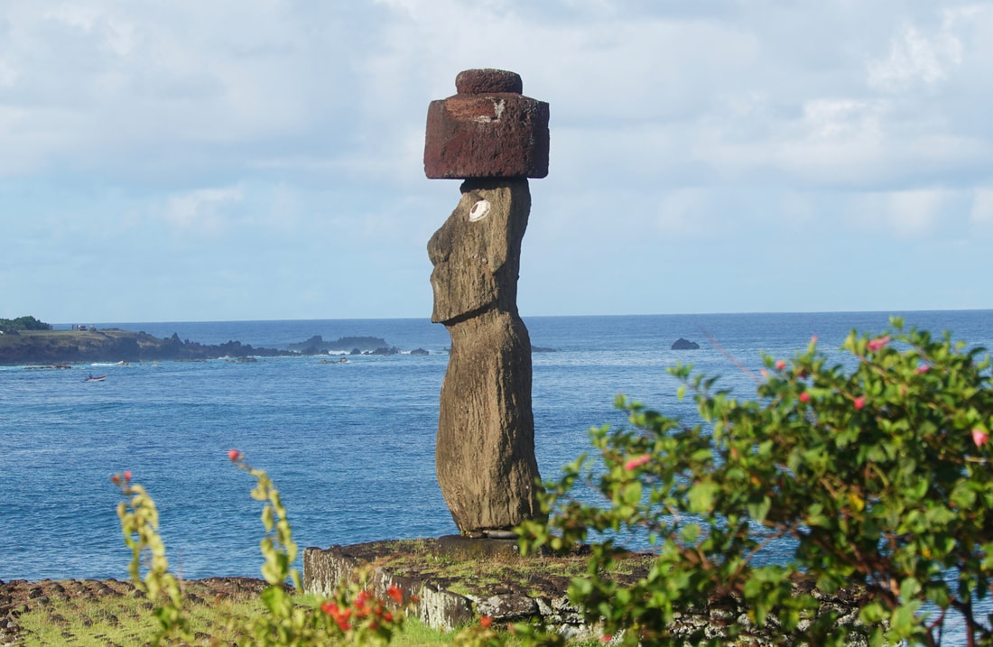
|
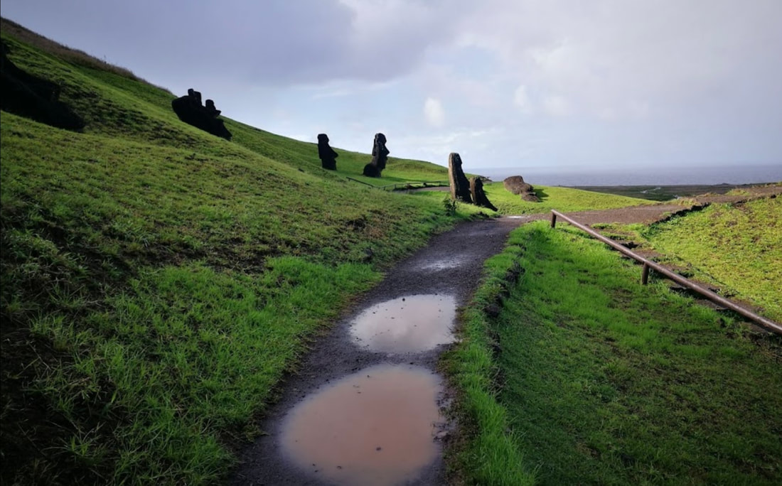
|
Easter island was more than we expected, not only in size, it’s culture, and it’s people. In short we had a great visit.
The biggest challenge to getting to the island were the swells. We say this because Easter Island does not have a port so to speak. Only transfer boats and fishing boats can tie up. Because of the swells, getting on the tender was a real challenge. The tender at its lowest point was two feet below the ships tender loading spot and its highest point was two to three feet above the loading spot. We were to step on the tender when the tender and loading spot we equal on the way up. You were “encouraged” by the crew on the ship and tender when and how to make that step.
Getting into the dock from the ship is so difficult it requires a docking pilot to get tenders in and out of the docking area.
Enough of the exciting stuff, now the dull stuff. Easter Island is a Chilean territory in Polynesia. Its native name is Rapa Nui. Easter Island (Spanish: Isla de Pascua, Rapa Nui: Rapa Nui) is one of the most isolated islands on Earth. Early settlers called the island "Te Pito O Te Henua" (The Navel of the World).
It lies far off in the Pacific Ocean, roughly halfway to Tahiti. As we all know, It’s fame is because of it’s nearly 900 monumental statues called moai, The moai are carved human figures with oversize heads, often resting on massive stone pedestals called ahus. Ahu Tongariki has the largest group of upright moai.
The first European visitors, the Dutch, named it Paaseiland ("Easter Island") in memory of their day of arrival. Its mixed population is predominantly of Polynesian descent; almost all live in the village of Hanga Roa on the sheltered west coast.
Ahu Tongariki is the largest ahu on Easter Island. Its moais were toppled during the island's civil wars, and in the twentieth century the ahu was swept inland by a tsunami. It has since been restored and has fifteen moai, including one that weighs eighty-six tons, the heaviest ever erected on the island.
Ahu Akivi is a particular sacred place as the moai, look out towards the Pacific Ocean. The site has seven moai, all of equal shape and size, and it is also known as a celestial observatory that was set up around the 16th century.
Orongo is a stone village and ceremonial center at the southwestern tip of Rapa Nui. It consists of a collection of low, sod-covered, windowless, round-walled buildings with even lower doors positioned on the high south-westerly tip of the large volcanic caldera called Rano Kau.
The Rano Raraku National Park is the place where the main moai quarry was and the place where you'll see them in all their glory and all stages of production. In fact, about half of the moai of Easter Island are located in this national park.They look inland towards the clan that created them as a sign of protection. Here in Rano Raraku, you'll see all shapes, expressions, and even some evolution of the carving craft between the early and latest Moais produced.
Abu Tahai is situated near the town of Hanga Roa, the ahu at Tahai sits near a canoe ramp made of rounded beach stones, and was restored by the American archaeologist William Mulloy. Tahai is thought to be among the earliest ahu structures on the island, dating back to AD 690.
According to oral tradition, Anakena served as the first settlement on the island. Anyway, Anakena is one of the best beaches on the island, and it is easily accessible.
All in all it was a great visit and we enjoyed it.
January 26, 2023
Sea Days
1/24/2023
Another Sea Day. Today we are about 800 miles from Peru and the swells are increasing.
Because of the swells and the fact that Easter Island is a tender port, the Captain has moved up our arrival to noon on Friday. Our excursion will be on Saturday Morning the Good Lord willing.
Last evening we had dinner at Earth and Ocean, wonderful food as always. After dinner, a couple came to our table and we invited them to sit and visit. She was from Taiwan and he was from the UK they were now living in south western Washington. We had a great one plus hour conversation with them.
1/25/2023
Today is another relaxing day. We had lunch again today with Canadian couple who are very enjoyable.
Between Peru and Easter island there are five sea days. Each day is the same yet different. They are the same in that they are quiet, relaxing, there is eating and time for reading and writing.
Last evening we had dinner with two sisters who traveled quite a bit. At the next table we’re the Signature representatives. Signature is a body made up of 1,400 travel agencies world wide. It just so happens that our TA is a member of this group.
Chile is still testing for Covid so this morning we all had Antigen tests prior to arriving at Easter Island. The swells are still with us so we can only hope a landing is possible.
This morning we sat with one of the guest performers from England. It was a wonderful two hours of discussions about her career.
This afternoon we sat with a woman from England and discussed everything thing from the English National Health Service to Peruvian Opels.
January 21&22 2023
Lima Peru, we’ll kind of
Well the Peruvian unrest has taken its toll on us, so we are not allowed to leave the ship either today or tomorrow. That being the case I will have to use the Internet to do the “walking” for us.
Callo is located in the constitutional province of Lima. El Callao is a seaside city on the pacific ocean and a vital trade route both into and out of Peru, in fact, it is the biggest seaport in all of Peru, thanks to it being one of the few natural harbors in Peru.
The urbanized area of the province is part of the Lima-Callao metropolitan area. The city also has a long naval history. It is not just a natural harbor, it was one of the Spanish towns that were vital to the colonial era.
As well as tradition, you can enjoy nature in Callao, particularly on the islands on Palomino and San Lorenzo.
The Chalaca province is the gateway to a world of experiences: learn more about the republican history of the city through its museums and fortresses, enjoy a quiet walk and rest on the shore of its beaches or spend a cultural afternoon visiting its galleries and exhibitions in the Callao Monumental neighborhood. As you can see, fun and pleasure are lived there.
This is a must-see in Callao. Constructed in 1833 and renovated in 1876, the temple is one of the oldest constructions in the port. It is also known as the Church of Saint Simon and Saint Judas of Callao, it was said to house the remains of both saints. Get inspired by its neoclassical style, based on Greco-Roman patterns. The temple has only one nave, numerous columns and arches, and a small dome above the high altar.
The independent Plaza is A beautiful place to to spend a quiet day relaxing and wandering around. One notable sight to see is the large ornamental bronze fountain with mythological themed figures in the middle of the Plaza.
The Real Felipe Fortress was built in 1747 and was designed by a french man named Luis Godín. This was one of the most important forts in Peru and played a key role in the colonization, as it was used for protection from pirates and other attackers. It served as a line of defense during the armed conflict with Spain during the battle of the 2nd May 1866.
Lima, the capital of Peru, lies on the country's arid Pacific coast. Though its colonial center is preserved, it's a bustling metropolis and one of South America’s largest cities. It's home to the Museo Larco collection of pre-Columbian art and the Museo de la Nación, tracing the history of Peru’s ancient civilizations. The Plaza de Armas and the 16th-century cathedral are the heart of old Lima Centro
January 19&20
At Sea
Well we left Manta at 10:00 PM. The Equatorial swell continued through the day so tenders were the mode of travel.
We spent the day on the back of the seventh deck in warm and breezy weather.
We spent part of our afternoon conversing with the captain. He is a very pleasant man with a great personality.
The evening was spent eating with two dancers from Ukraine and four other people. There was a couple from California, a commercial pilot from London, and a woman from Long Island New York. As usual we closed the dining room at 10:00 PM.
One of the things that makes Seabourn so special is their people. In the Colonnade the Maître d’Hotel Andres Markowski welcomes us by name every day at lunch time, seats us and makes a lunch suggestion. He checks on us several times as we eat. Finally as is our custom with him, he creates a dessert for each of us. He is an absolute delight and his kind acts make this cruise line special.
Late this afternoon we ran into a huge fog bank and the mournful fog horn can be heard on a regular basis. The fog cleared about 10:00 PM. It reminded us of some movies that portrayed the doldrums as without wind and foggy.
Today we scheduled excursions in Lima and Easter Island. We will be both in Lima and Easter Island for two days giving us the opportunity to look around and to take lots of pictures.
Our stop in Lima is set, however excursions are up in the air because of the unrest in the country. The Quest is in Lima today so the Captain will get first hand knowledge to day.
The Captain told us this AM that the port of Callo was closed for a while due to swells. It opened again so traffic in and out has started again. The excursion situation is up in the air at this point.
January 17&18, 2023
Manta Ecuador
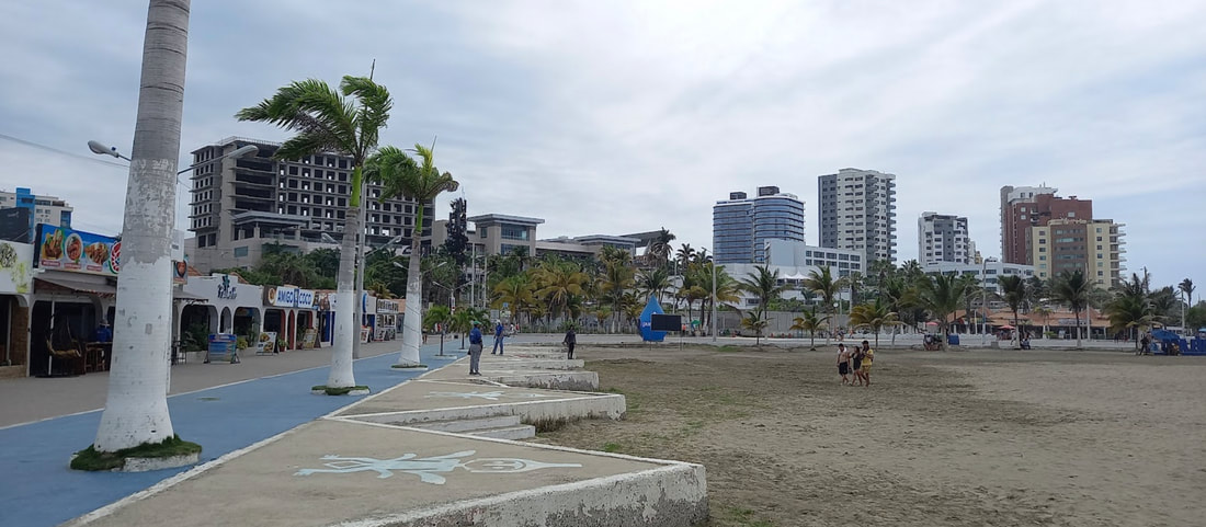
We arrived in Manta Ecuador at noon as expected. What wasn’t expected was a series of sea swells in the harbor.
Those swells made it difficult to put the gang plank down.
They finally were able to tie the ship down and put out the gang way. About an hour later there was a loud bang and a mooring alert sounded. Several hours later five mooring lines had failed and each line is rated at 82 tons.
The Captain just came on and said we were moving off shore as the swells were making it impossible to stay tied to the dock. If the swells diminish as forecast, we will try to come in again tomorrow.
The next morning the captain sent a tender ashore to see what it was like at the dock. He determined it still was not safe to tie up at the dock so tenders will be used all day.
The pilot said he had not seen this swell situation in the last seven years.
Now to the more mundane. Manta is a port city on Ecuador's central coast. It's known for its tuna-fishing industry.
Numerous indigenous cultures thrived in Ecuador for thousands of years before the Inca conquered the area. The Valdivia culture in the Pacific coast region is the earliest known Ecuadorian culture. Ancient Valdivian artifacts from as early as 3500 B.C have been found along the coast of the city of Santa Elena, capital of the Province of the same name.
The Archaeological Museum of Central Bank offers the opportunity to learn about these different cultures, among which is the Manteña and Jama Coaque, with their respective legends and a temple with these objects pre Hispanic cultures. You can see artifacts of five other cultures that existed in the region as Valdivia, Machalilla, Chorrera, Guangala and Bahia.
The town of Montecristi was formed during the first years of the Spanish conquest, most likely between 1536 and 1537, with settlers from Manta who left their village fleeing pirate attacks. Among the first settlers appears a man named "Criste", who would have built his house on top of the mountain, so it is believed that the place acquired the name of Montecriste, which later, for idiomatic ease, ended up being called Montecristi.
At the heart of Manta is the Malecón Escénico, a boardwalk of colorful huts containing shops, restaurants and bars on the Playa Murciélago beachfront. If you are there at the right time you can see residents repairing fishing boats or heading to sea to bring back tuna. The fresh catches are then served right off the boat in the restaurants in the area.
January 15, 2023
A day at sea
For those suffering from the chill of winter, it is 81 degrees out. Just to make you feel better, it is a cloudy and rainy day.
As boring as days at sea are to some, Dee and I like them. We catch up on our reading, what crap that is going on in the world, and do some writing. Some things however remain the same. The staff is outstanding and the food is delicious.
We are maskless, all of us which is great news. Some still wear them for their own personal reasons, but frankly we don’t know why.
Two evenings ago, we ate at the Colonnade as it was Thomas Keller rib night. The rib dinner was absolutely wonderful. Aside from the great food we had wonderful table mates.
Since we penned our last Sea day epistle, we have been to the TK Grill. Not only was the service spectacular the food was excellent as well. Last night it was Japanese night a the Colonnade. As has been our experience we have had wonderful table mates at our evening meals.
We went to two shows since we boarded, which is something we usually don’t do. One show featured a trio and the other a pianist and both were terrific.
The demographic is between 3 years of age to people like us, older than dirt. They’re is a great diversity of countries among the cruisers which is really great. For the most part we all have one thing in common, we are travelers.
What has been a very unusual experience for us is the contact with rude, snooty people. The first occasion was when Dee said, in jest, she thought she might wear jeans to formal night. The lady not seeing the humor in Dee’s comments, said, “well don’t sit near me”.
Then we were sharing a table with two other guests and one of the ships company. The woman next to me asked where we were from. I said Texas. She looked appalled. “I have a nephew who lives in Huston and I told him to get out of there because Texans are barbarians.”
I told her I must fit her definition as I was conservative and owned a gun. I left it that.
Well enough drivel for this post. We are off to Manta Ecuador and we will check back with you then.
January 14, 2023
The Panamá Canal & Panamá City
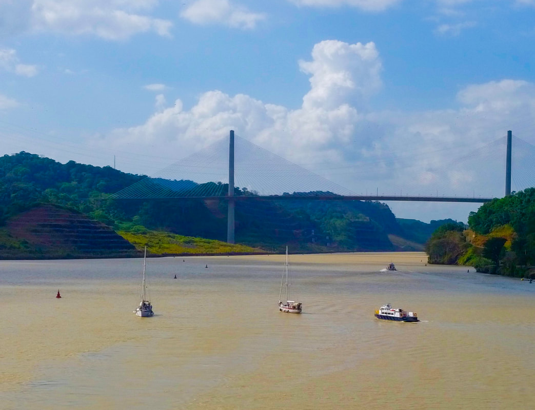
As we all know, that following the failure of a French construction team in the 1880s, the United States commenced building a canal across a 50-mile stretch of the Panama isthmus in 1904. The death toll due to disease was large to say the least. According to history.Com, there was “.. a massive public health campaign in the canal zone, undertaken by chief sanitary officer William Crawford Gorgas, who ordered the fumigation of homes, the drainage of pools of water and the attachment of screens to windows and gutters. To smother mosquito larvae, health officials sprayed crude oil mixed with kerosene in water sources and puddles. Thanks to those efforts, yellow fever cases on the isthmus were largely eradicated by the end of 1905. Although case numbers dropped, malaria proved more stubborn.”
Chief engineer John Stevens devised innovative techniques and spurred the crucial redesign from a sea-level to a lock canal. His successor, Lt. Col. George Washington Goethals, stepped up excavation efforts of a stubborn mountain range and oversaw the building of the dams and locks. Opened in 1914, oversight of the world-famous Panama Canal was transferred from the U.S. to Panama in 1999.
Bolstered by the addition of Madden Dam in 1935, the Panama Canal proved a vital component to expanding global trade routes in the 20th century. The transition to local oversight began with a 1977 treaty signed by U.S. President Jimmy Carter and Panama leader Omar Torrijos, with the Panama Canal Authority assuming full control on December 31, 1999.
The American Society of Civil Engineers recognized the canal as one of the seven wonders of the modern world in 1994. In 2020 about 14,000 ships transited the canal generating $2.6B in revenues.
At the Pacific terminus of the Panama Canal, Fuerte Amador is a manmade causeway jutting into the sea, constructed with material excavated from the Canal. Originally built as a fortification, today it is a park, the headquarters of the Smithsonian Institute of Tropical Research, and landing area for ships anchored off the Canal, with shops and restaurants.
Panama has a varied and unique history. The first human beings lived in Panama about 11,000 BC. By 2,500 BC they had learned to make pottery and later people from the region traded with others as far north as Mexico and as far south as Peru.
The first European to land in Panama was a Spaniard Rodrigo Galvan de Bastidas in 1501. The first Spanish settlement in Panama was made in 1510. Then on 25 September 1513, Vasco Nunez de Balboa became the first European to see the Pacific Ocean.
In 1519 Pedro Arias de Avila founded Panama City. The indigenous people were decimated by European diseases, to which they had no resistance. The survivors were enslaved. The Spanish introduced a kind of feudal system in which the indigenous people were forced to work on estates.
When Pizarro conquered the Incas in 1533 Panama became a transit point for gold on its way from Peru to Spain. The precious metal was taken overland by mule from the Pacific Coast to the Atlantic coast. The great riches in the area attracted the attention of the English. In 1572 Francis Drake raided Nombre de Dios. In 1671 a Welshman named Henry Morgan burned Panama City. It was rebuilt in a new location several kilometers away in 1673.
The Bio Museo is a museum focused on the natural history of Panama, whose isthmus was formed very recently in geologic time, with major impact on the ecology of the Western Hemisphere. Exhibits tell the story of Panama's rich biodiversity through engaging visuals, examining human presence throughout time and how the Atlantic and Pacific evolved differently.
Old Panama City was founded on August 15, 1519, by Spanish conquistador Pedro Arias de Ávila. The city of Panamá was the first European settlement along the Pacific. For 150 years it flourished as Spain exported Peruvian gold and silver to Europe via Panamá. In 1671, the privateer (pirate) Captain Henry Morgan sacked the city. It was relocated to the present-day Casco Viejo. Today much of Panamá Viejo lies buried under a poor residential neighborhood, though the ruins are a must-see.
The historic quarter of Panama City Viejo, is the southwestern tip of Panama City, overlooking the Pacific entrance to the canal. It's just three avenues wide and nobody uses addresses. It's a mix between Havana, New Orleans, Cuernavaca, Mexico and Miami's South Beach with Churches, Squares and Colonial Palaces.
A
The church of San José protects the famous Altar de Oro (Golden Altar), carved of wood & painted in gold flake, and is the sole relic salvaged after Privateer Henry Morgan sacked Panamá Viejo. According to local legend, when word came of Morgan's impending attack, a priest attempted to disguise the altar by painting it black, the baroque altar was later moved from the old city to the present site.
The Miraflores Locks Visitor Center is a space where you can live a unique Panama Canal experience. In one place you will find different activities to learn and fully enjoy the Panama Canal. The Exhibition halls are temporarily closed. The building has three levels for observing the Canal's operation, the passage of ships through the locks and how they move. It is the ideal place to take pictures and to hold memories of this engineering marvel.
January 13, 2023
Puerto Limon Costa Rica
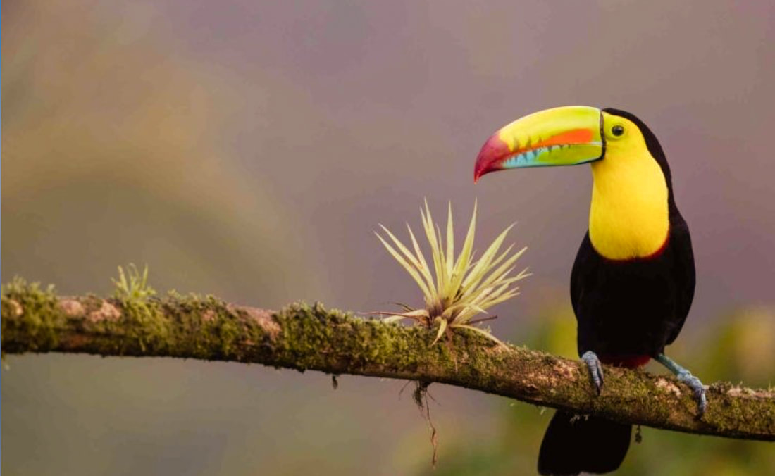
It is a short stay in Puerto Limón however it is a port with limited things to see. We say that not to be derogatory, but to reflect the fact we have been here before.
Puerto Limón, is a district, the capital city and main hub of Limón province, as well as of the Limón canton in Costa Rica and it is home of the Afro-Costa Rican community.
There is not a lot to say about this port. If you enjoy walking and local crafts, there is a local Craft market located at the end of the pier which sells local arts, crafts and souvenirs. Beyond this craft market the downtown area starts. There are numerous shops and restaurants in this area, but as Puerto Limon is a more of an industrial town so do not expect high-end shopping.
A day at the Vargas Park is definitely worth your attention. Huge palm trees and exotic plants surround the park. Visitors that walk along the park, have the chance to come in close contact with some of the city's indigenous wildlife.
The Sloth Sanctuary of Costa Rica is a privately owned animal rescue center located near the city of Cahuita and is worth a visit. The Sanctuary is dedicated to the rescue, rehabilitation, research, and release of injured or orphaned sloths.
`
January 12, 2023
San Andres Columbia
The island of San Andrés is located in the Caribbean Sea not far from Nicaragua. It is a small island of approximately ten square miles. What San Andrés Island lacks in size it makes up with its beautiful and pristine appearance. The island of San Andrés is officially part of Colombia but its old ties connect it with England. This makes the Island multicultural and bilingual the most common spoken languages are Spanish, English and Creole.
The Jardin Botanico de San Andres is a small botanical garden for plant, flower, and gardening lovers.
We are almost at the point of you see one beach you have seen them all but not quite. Spratt Bight Beach is a popular beach in the north of San Andres island. This is probably the best beach on the island! It's not rocky, unlike many of the beaches in San Andres.
All though Dee has considered pushing me over the side on occasion we are not snorkelers. Our across the hall neighbors told us of their snorkeling at Eco Parque West View. They said the waters were very clear for snorkeling & fish-feeding
. We heard on the News today that Columbia and Nicaragua claim ownership to the island and that the World Court ruled in favor of Nicaragua.